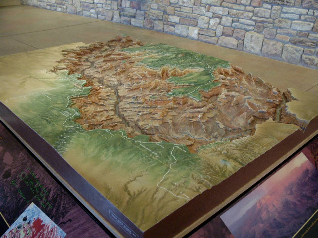
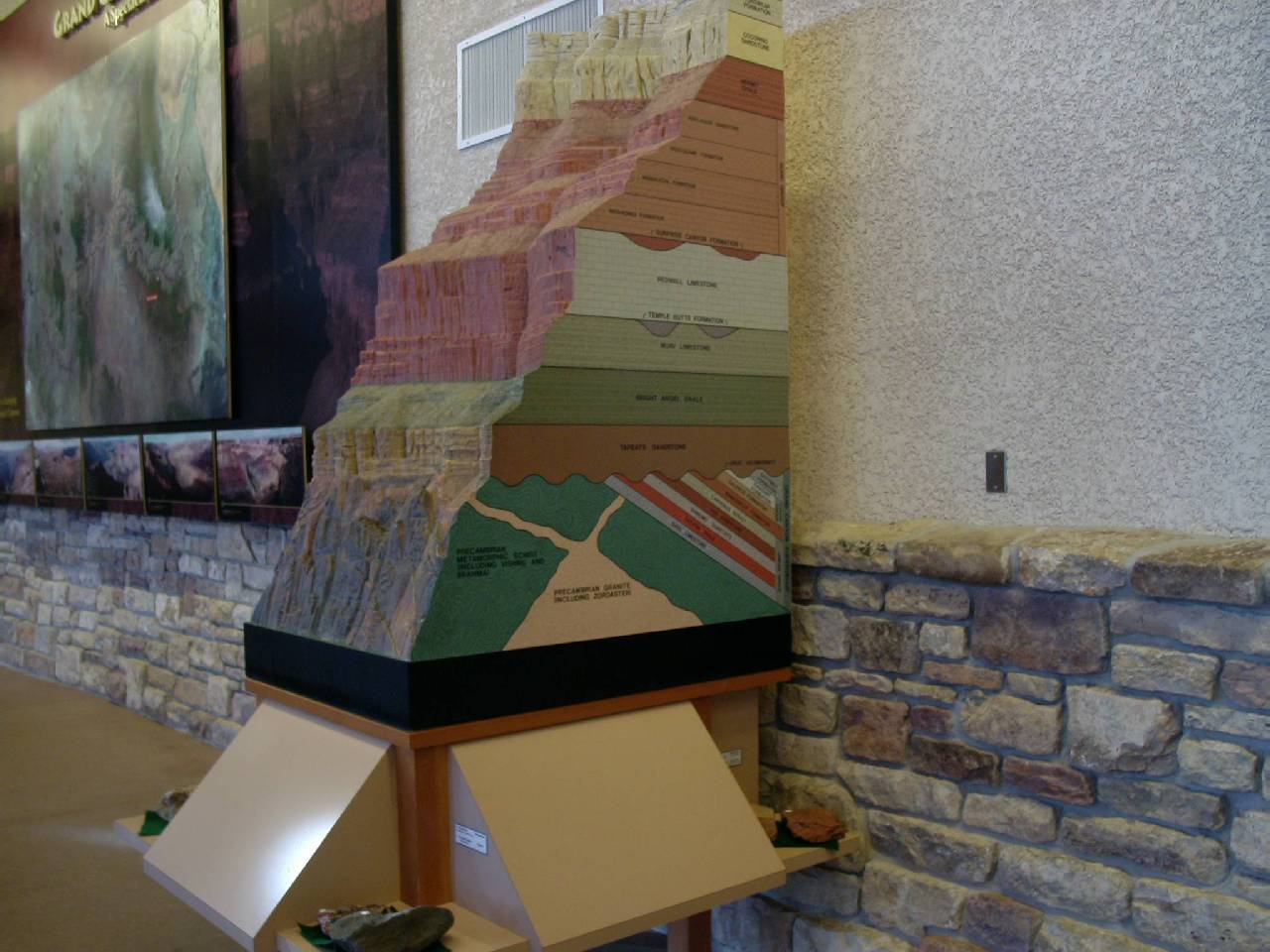
Grand Canyon 2003
South Kaibab and Bright Angel Trails
Travelog
Click on the pictures to view them full size
This hike at the Grand Canyon, down the South Kaibab Trail and then up
the Bright Angel, was a long time in the making. Originally I had wanted
to go in late May, shortly after the South
Kaibab hike (down and up the same trail), but summer came on schedule
and the extremely hot (105 degrees plus) weather made any day hike possibly
suicidal. To punctuate this cancellation, I fell on the trail at Squaw Peak
injuring my left ring finger and having my wedding ring cut off in urgent
care as a precaution. Was someone was trying to tell me this hike was a
bad idea? Training a bit here and there in the summer, I decided that mid-October
would be a good time to try again as the weather turns cooler at this time.
Ron, who always keeps himself in shape for some upcoming marathon (he's
completed 10 so far), wanted to join me again. We set a tentative date for
the third week in October, but the 199 mile Providian Relay came up on that
very weekend and we moved up the Canyon two weeks prior. Fate intervened
again as a training run at Squaw Peak produced another accident, this time
a hiker cut me off going up and my right knee hit a retaining wall. It hurt
so badly and was so bloody I knew instantly my canyon run was not to be
and in fact I worried that I couldn't even run in the upcoming relay. But
it healed quickly and the knee was good enough to run in the relay. So Ron
and I rescheduled for the very weekend after the relay because it was basically
the last weekend we were both available until the end of the year. This
time it was heavy rain that made us cancel. Instead, we ran in a half marathon
through a very light drizzle. The trails were so bad at the Grand Canyon
they were actually closed. You have to really start wondering, someone really
doesn't want us to do this hike!
SP_from_south.jpg) Even
though there was no possibility of a November or December trip, I was keeping
myself in relatively good shape by doing a lot of running. Well,
a lot of running by my standards. Maybe 20 miles a week. By the end of December
(and the end of the holidays), weekends were now available, but I hadn't
done any training at Squaw Peak. Ron was going to be at the Grand Canyon
over the Valentine's Day weekend with Nicole and the kids, so that was his
first choice! The only drawback was that we would be driving separately.
His plan was to drive to Williams, AZ, and take the Grand Canyon Train (which
amazingly, goes to the Grand Canyon!) In mid January I made my first visit
to Squaw Peak since last October with surprisingly encouraging results.
Three trips up were relatively easy. The following weekend was even better
Three trips up and taking the circumference trail turnoff on the way down.
There was no doubt that all the running over the winter was paying off.
I was satisfied that a hike was possible. Cindy was available that very
weekend and the prospect of staying overnight at the canyon was very appealing.
Everything was falling into place!
Even
though there was no possibility of a November or December trip, I was keeping
myself in relatively good shape by doing a lot of running. Well,
a lot of running by my standards. Maybe 20 miles a week. By the end of December
(and the end of the holidays), weekends were now available, but I hadn't
done any training at Squaw Peak. Ron was going to be at the Grand Canyon
over the Valentine's Day weekend with Nicole and the kids, so that was his
first choice! The only drawback was that we would be driving separately.
His plan was to drive to Williams, AZ, and take the Grand Canyon Train (which
amazingly, goes to the Grand Canyon!) In mid January I made my first visit
to Squaw Peak since last October with surprisingly encouraging results.
Three trips up were relatively easy. The following weekend was even better
Three trips up and taking the circumference trail turnoff on the way down.
There was no doubt that all the running over the winter was paying off.
I was satisfied that a hike was possible. Cindy was available that very
weekend and the prospect of staying overnight at the canyon was very appealing.
Everything was falling into place!
On the Sunday before the Sunday of the hike, I tested myself by doing a
full workout at Squaw Peak. Before my second
hike in the Canyon (the one that went so well), I did the summit trail
three full times and then on the fourth rather than complete it, I took
the 4.5 mile circumference trail turnoff. After doing the summit a couple
of times, the ups and downs of the circumference trail simulate the feeling
you'll have at the Grand Canyon (GC). I finished well under three hours
and though I was a bit tired, it was far from a debilitating tired (my definition
of exhaustion.) I was now very excited about the upcoming hike and very
satisfied with my preparation.
I began checking the weather reports daily and then hourly (or so it seemed).
The reports were mixed at best. There was midweek rain predicted for not
only the GC, but Phoenix as well. On Tuesday there was a bit of rain, and
real rain began on Wednesday; continuing for 36 hours straight! This is
very unusual for Phoenix where normally our rain comes down in buckets and
is over in 15 to 20 minutes. I really wanted to do some running, but I had
no desire to exercise in the rain. Heavy rain in Phoenix can often mean
even more in the high country to the north. At this time of year that means
snow and possibly a lot of it. This could spoil the hike by denying us a
passable route! (My consolidation was they weren't getting much snow in
Flagstaff which is at 7500 feet. They were getting a lot of snow at the
Arizona Snow Bowl which is just north of Flagstaff on the San Francisco
Peaks, almost 20 inches, enough to reopen the ski slopes!
By Friday the reports had partly cloudy skies and normal winter temperatures
predicted for Flagstaff and GC. This would be great for the hike if we could
make it through the snow. That is, if once again someone didn't want us
to go.
On the Tuesday before the GC weekend, Nova aired, "Mountain
of Ice," which chronicled a team of hikers who were climbing the
highest peak in Antarctica. This mini-expedition required a lot of preparation
and planning if they were going to succeed. Lack of either could be deadly.
They compared their adventure with the early Antarctica explorers in 1911
who were the first to make it to the South Pole. There were two teams (one
from Norway headed by Roald Amundsen and the other from England headed by
Robert Scott) that ended up heading out in what turned out to be a race
to be the first to the pole.
Amundsen, the Norwegian, loved exploration and adventure for it's own
sake (and the snow!) and had spent his lifetime preparing for this moment.
He learned how to use dogs from the Eskimos and learned how to cross-country
ski, skills that would be critical for a long trip in the snow and bitter
cold. Robert Scott, on the other hand, had done very poorly in terms of
both planning and preparation. It seemed he was there simply for the glory
of being the first to the South Pole. The first time Scott wore skis were
in Antarctica and because he didn't research, he didn't use the correct
bindings so quickly concluded they were useless. Instead of dogs, Scott
brought ponies which were ill suited to the snow and cold and mechanical
sleds (very advanced for 1911), but they broke down quickly in the cold.
The Amundsen trip, in the words of Amundsen himself, "Went like
a dream." In many ways Scott was expecting an ordeal and he got it.
The going was very tough and without any help to pull the sleds, the men
had to do it themselves (man hauling) without the help of skies. When Scott's
team finally reached the South Pole, they were already near exhaustion and
had to face the torturous trip back. They arrived at the Pole to bitter
disappointment when they found a tent with a Norwegian flag waving in the
wind. Amundsen had not only gotten there first, he beat them by over 30
days! This story would almost be comical if it weren't for the fate that
awaited the Scott team. They would not make it back - the entire team died
on the return trip. Their entire story is well known, however, because of
the photographs and the detailed log that Scott wrote during the journey.
Writing about their modern adventure in Antarctica, Jon
Krakauer described his view of adventure:
"There is a quote I think about all the time when I'm climbing or
on expeditions. It's by the great polar explorer Vilhjalmur Stefanson: "Adventure
is a sign of incompetence." Stefanson was a guy who bragged that he
never had adventures. He said that if you have an adventure, you're doing
something wrong, that if you really plan things out in the vein of Amundsen,
you don't have adventures. (Now, having said this, Stefanson relates sort
of proudly how he almost got ambushed by a polar bear. Stefanson had plenty
of adventures!)"
"We're deliberately hoping we have some adventures, but not too
much adventure. We'll be miserable at times, and we'll wonder what the hell
we're doing here. But we know what we're doing here. We came looking for
this sort of thing. I like that quote because it speaks to the sense of
absurdity of this whole business. That sense of absurdity has been there
from the beginning of polar exploration. People have always gone to the
poles for a sense of adventure. They wanted to go out and get scared and
get miserable and enjoy themselves in a way you can't really understand
unless you do this stuff, and like to do this stuff. That's what Stefanson
was speaking to."
"I think the motivations for doing something like this are many,
and they're hard to comprehend. There is a certain perversity, at least
other people would regard it as such. But for me it's a wonderful thing,
for all kinds of reasons. It's the joy of physical effort. The joy of feeling
confident in a harsh place."
This is a lesson that should be well learned if you're trying to find
a little adventure. A little adventure is okay, but it must not turn into
an ordeal. Hiking to the river and back at the GC is not to be taken lightly.
It requires preparation or you will have an ordeal.
Me and Cindy were able to book a room at the Yavapai Lodge which is within
the Grand Canyon National Park, even though it was on short notice. Good
luck in the summer where the rooms need to be reserved months in advance.
Rain or no rain, snow or no snow, Cindy now had her heart set on going so
as long as we could get there, we were there! It was cloudy as we left Phoenix
and amazingly it cleared up quite a bit on the drive north. This is just
the opposite of any other time we've driven north. As we approached Flagstaff,
having risen to over 7000 feet elevation, there was a conspicuous absence
of snow. A few patches could be spotted her and there, but it looked like
it hadn't snowed in at least a month. Just 15 miles north of Flagstaff on
the San Francisco Peaks they'd received over 18 inches of snow!
P80477.jpg) We had a scheduled stop in Flagstaff for lunch and
I chose a hamburgers at BunHuggers which is right on their main strip. The
last time I'd visited this restaurant was after Ron and I had completed
our canyon hike in May. We got gas and headed north out of town, passing
a fairly large anti-war demonstration, a reminder of world events. We passed
the snow covered San Francisco Peaks which were simply a beautiful sight.
Many of the cars sharing the road with us turned off at the Arizona Snow
Bowl, one of the two main ski areas in this state. I should mention that
elk warning signs were out in force. In all there were 60 miles of elk signs
and not a single elk!
We had a scheduled stop in Flagstaff for lunch and
I chose a hamburgers at BunHuggers which is right on their main strip. The
last time I'd visited this restaurant was after Ron and I had completed
our canyon hike in May. We got gas and headed north out of town, passing
a fairly large anti-war demonstration, a reminder of world events. We passed
the snow covered San Francisco Peaks which were simply a beautiful sight.
Many of the cars sharing the road with us turned off at the Arizona Snow
Bowl, one of the two main ski areas in this state. I should mention that
elk warning signs were out in force. In all there were 60 miles of elk signs
and not a single elk!
P80362.jpg)
P80363.jpg) The 75 MPH speed limit makes a huge difference to
travel time. I recall a minimum of 4 and a half hours to get to the canyon
years earlier. We were at the gate of the south entrance 4 hours from the
start of our journey, and this time with a lunch stop. I missed a turn that
would get us quickly to the Yavapai Lodge that drove us right by the rim
so we got our first look into the colorful canyon early. The Yavapai Lodge
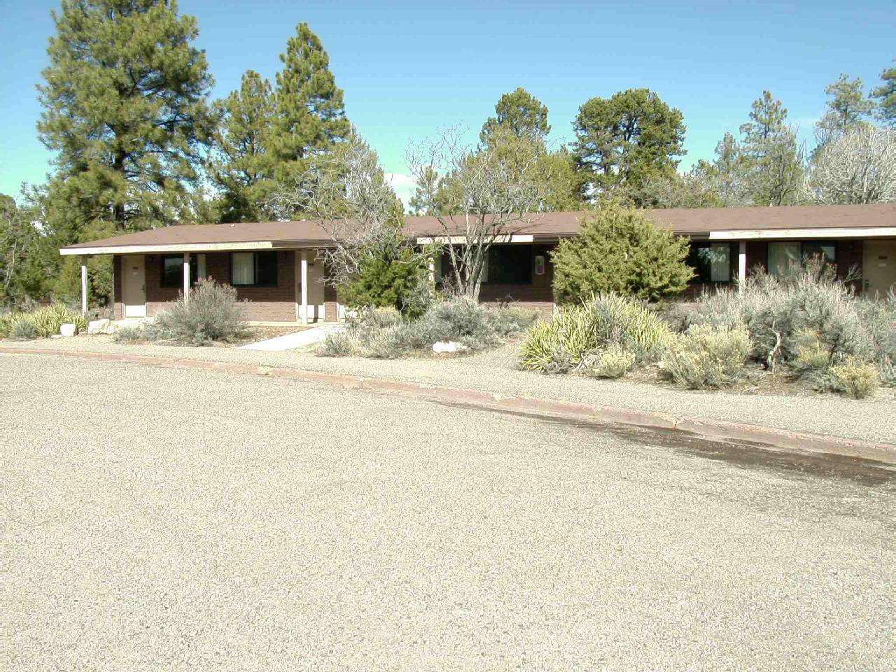
is not a single building. It is actually a series of small one-level buildings.
After check in, you then get back your car and drive to your room. The small
buildings reminded me a classic Motel 6, but they were all nestled within
the ponderosa pine trees that are everywhere on the south rim. The room
was pretty basic but comfortable.
The 75 MPH speed limit makes a huge difference to
travel time. I recall a minimum of 4 and a half hours to get to the canyon
years earlier. We were at the gate of the south entrance 4 hours from the
start of our journey, and this time with a lunch stop. I missed a turn that
would get us quickly to the Yavapai Lodge that drove us right by the rim
so we got our first look into the colorful canyon early. The Yavapai Lodge
is not a single building. It is actually a series of small one-level buildings.
After check in, you then get back your car and drive to your room. The small
buildings reminded me a classic Motel 6, but they were all nestled within
the ponderosa pine trees that are everywhere on the south rim. The room
was pretty basic but comfortable.
P80364.jpg)
P80369.jpg)
P80370.jpg)
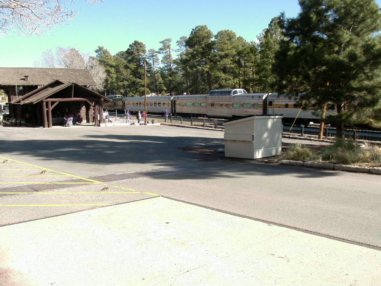
We drove back to the parking lot of the lodge lobby where there is a
gift shop and cafeteria to catch one of the buses. Being after 2:00, I wanted
to hit Yaki Point first, before the view was obstructed by the late afternoon
shadows. Yaki Point lies just beyond the South Kaibab trail head and offers
the best view from the rim of that trail. Unfortunately we caught the wrong
bus and we ended up going in the opposite direction toward the main Grand
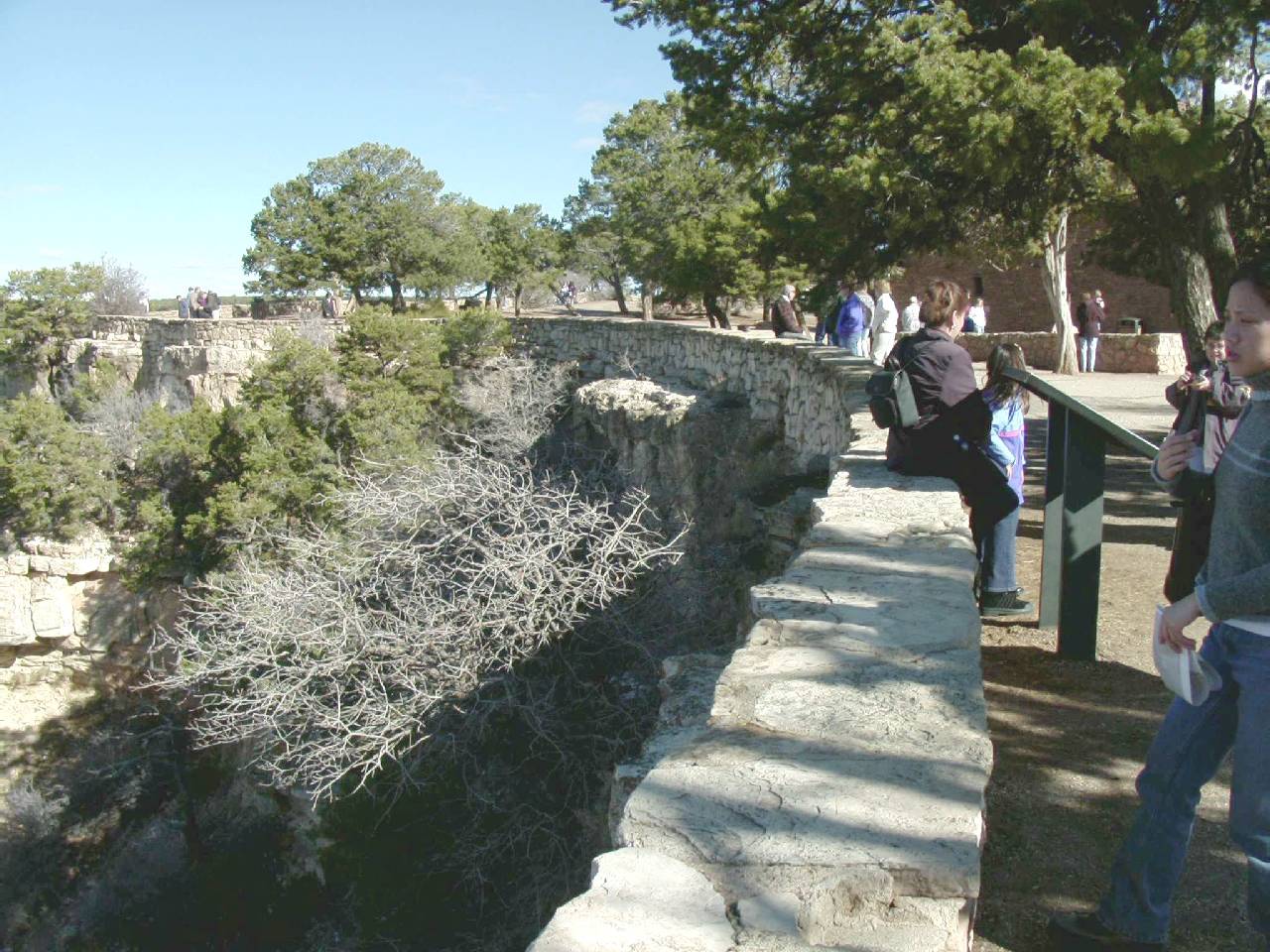
Canyon Village. We got off at Yavapai Point where there were quite a few
visitors stopped for the view. This point lies almost exactly between the
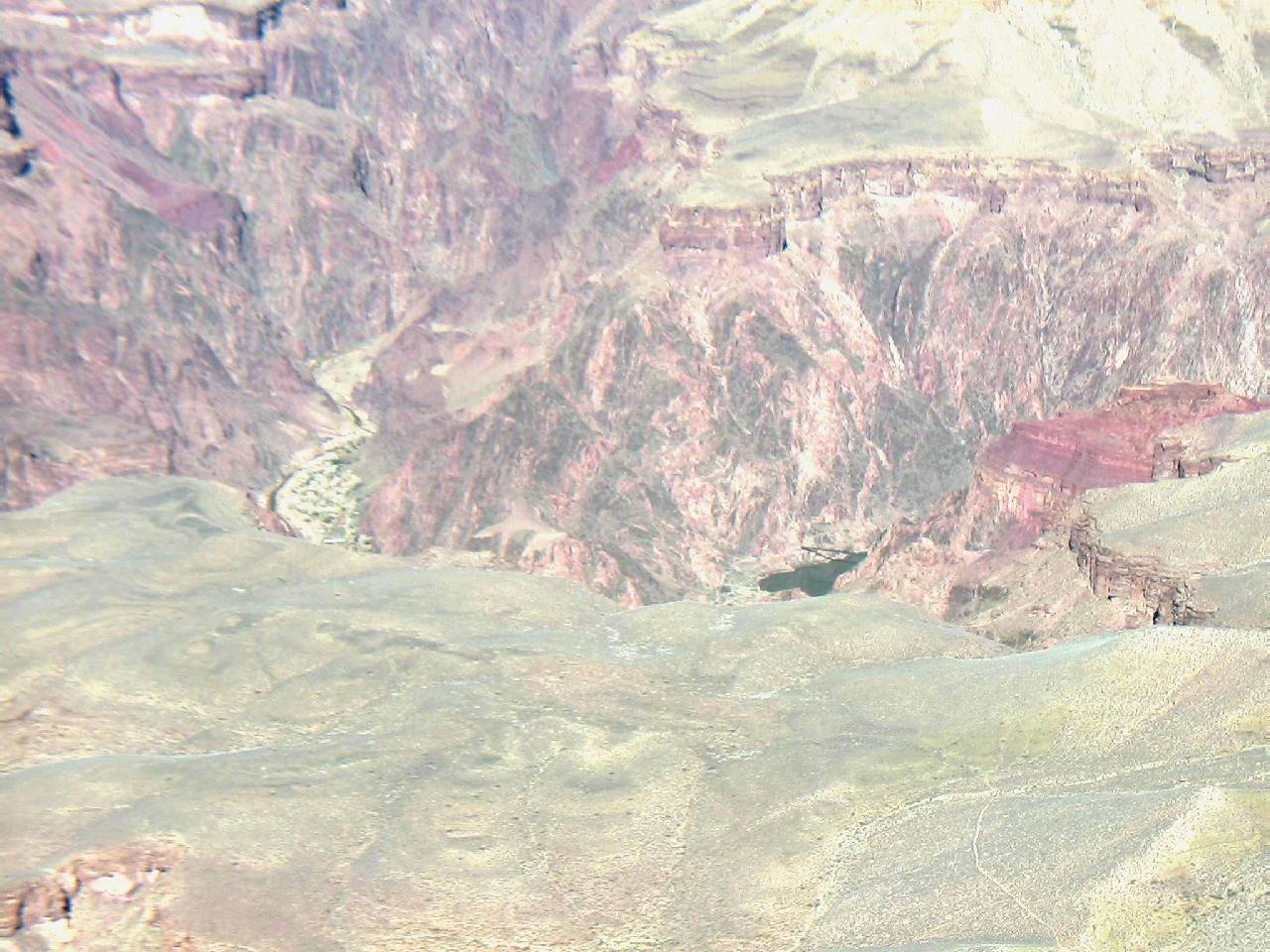
South Kaibab and Bright Angel trails. Because the Colorado River lies within
the inner gorge, from many outlooks it's completely invisible. From this
spot you can see two tiny sections of the river, but one of them shows the
Kaibab bridge! You could also actually see Phantom Ranch at the bottom of
the canyon. I was happy we had remembered to bring along the binoculars.
P80371.jpg)
P80375.jpg)
P80376.jpg)
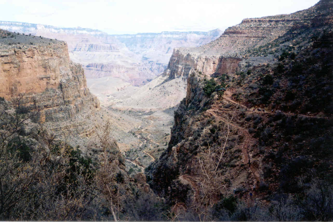
Being in the center of the trails and seeing small sections of it here
and there, the enormity of the following days hike was very apparent. For
a few moments I actually thought this was a really dumb idea. I suppose
if I had never done it before I would be oblivious and wouldn't be bothered.
But I have done it before and knew how great the task. I was comforted by
the thought that I was really well prepared.
P80378.jpg)
P80380.jpg)
P80381.jpg)
P80383.jpg)
P80385.jpg)
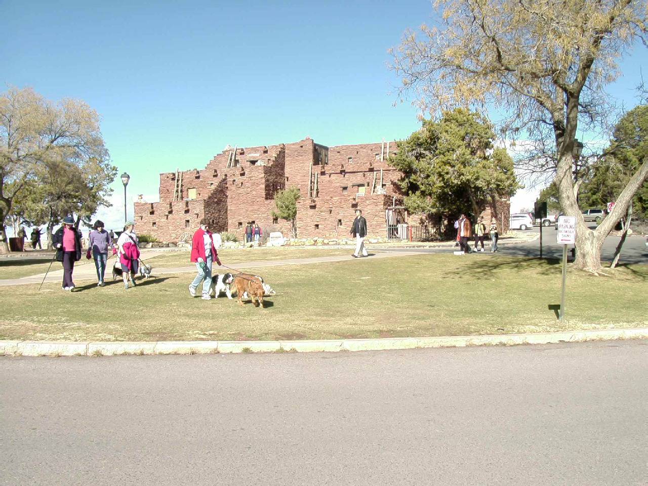
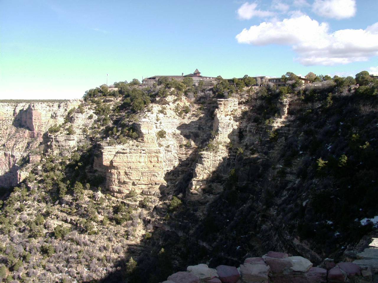
Back on the bus we headed west toward the village. The next logical stop
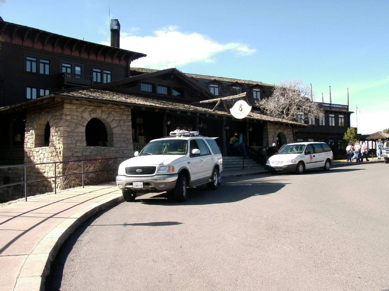
was at the famous El Tovar Lodge which sits very near the rim. If you want
room reservations, you need to do so months in advance in the winter and
a year or more for summer accommodations. There is a very good restaurant
there which requires reservations, but a quick glance at the menu showed
no "Cindy Friendly" food. We learned later that Ron and Nicole
had reservations that very night.
P80386.jpg)
P80425.jpg)
P80387.jpg)
P80388.jpg)
P80389.jpg)
P80393.jpg)
P80394.jpg)
P80396.jpg)
P80398.jpg)
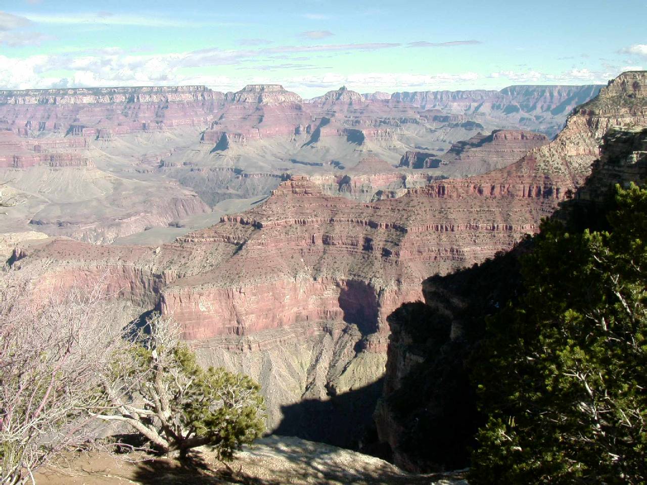
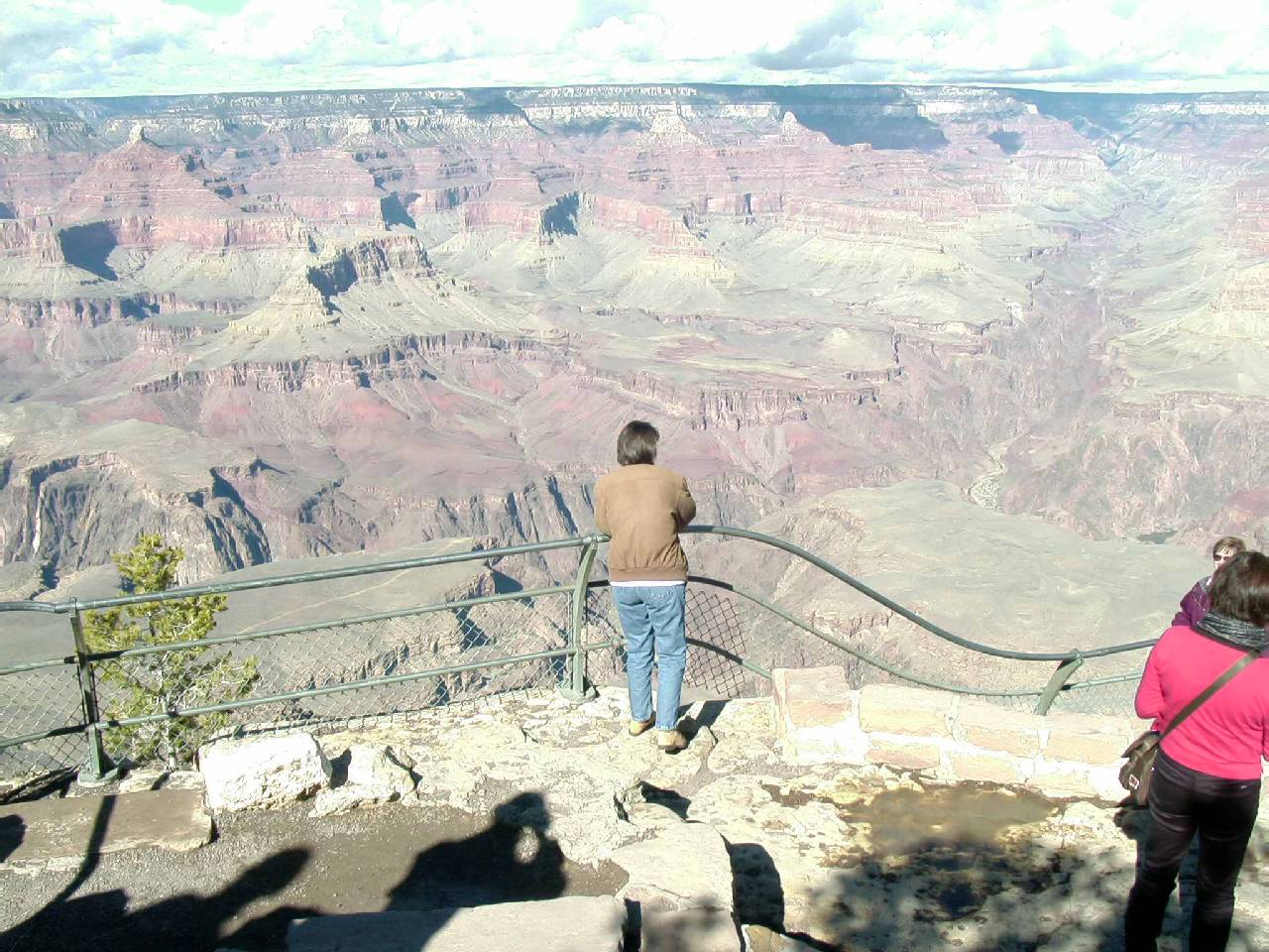
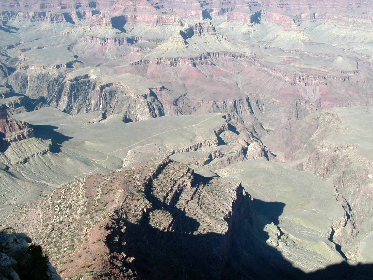
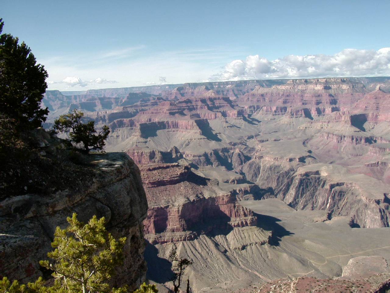
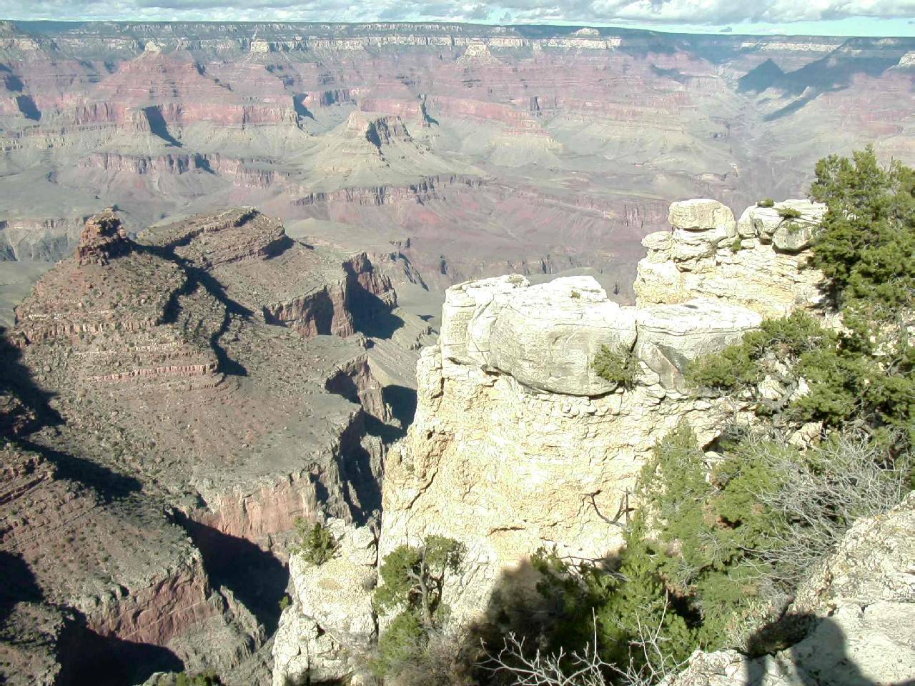
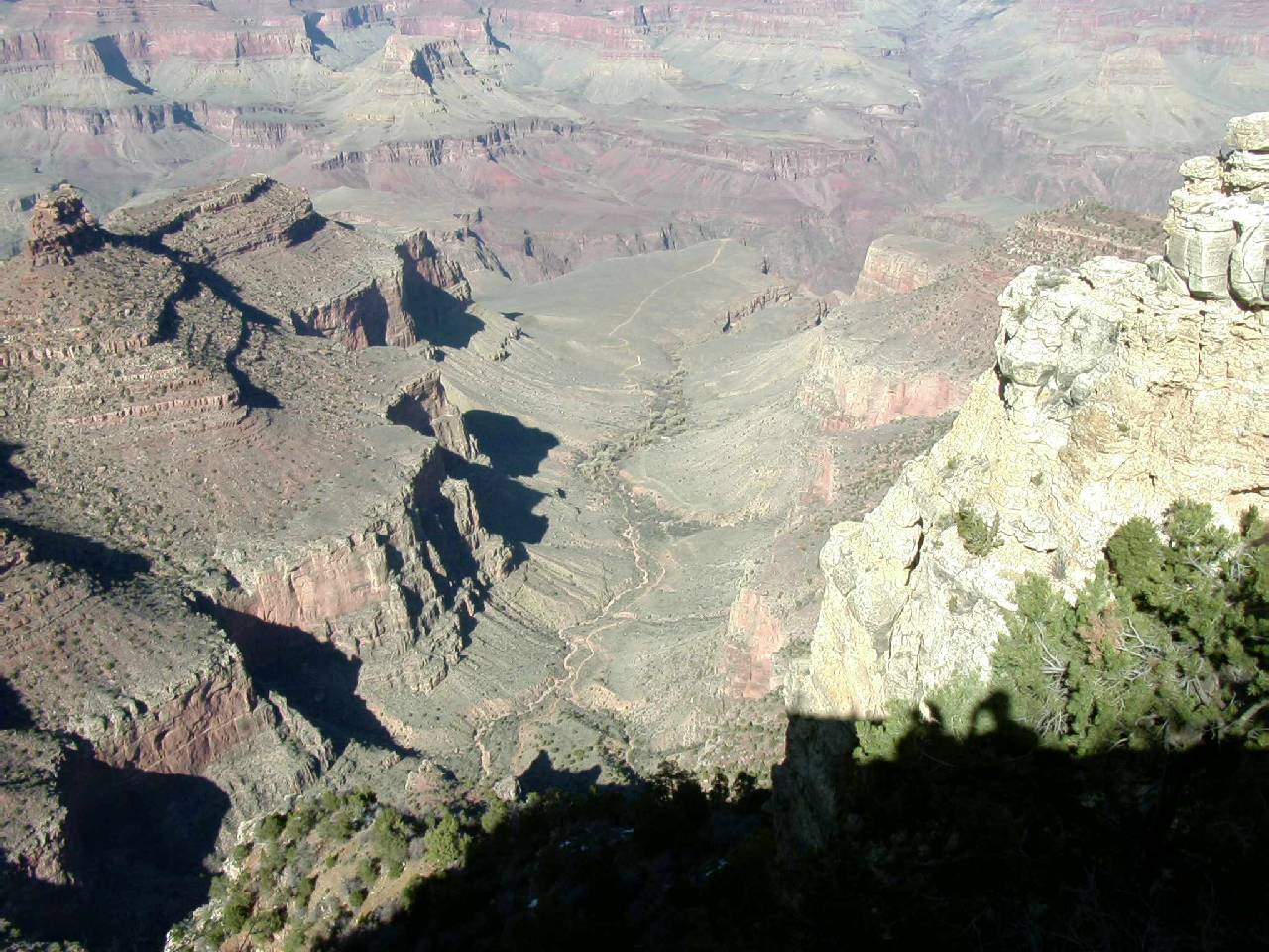
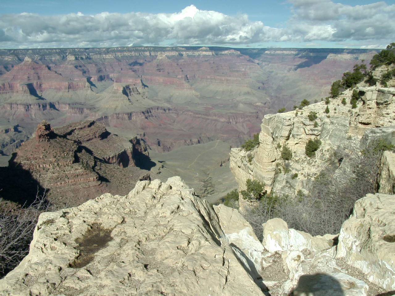
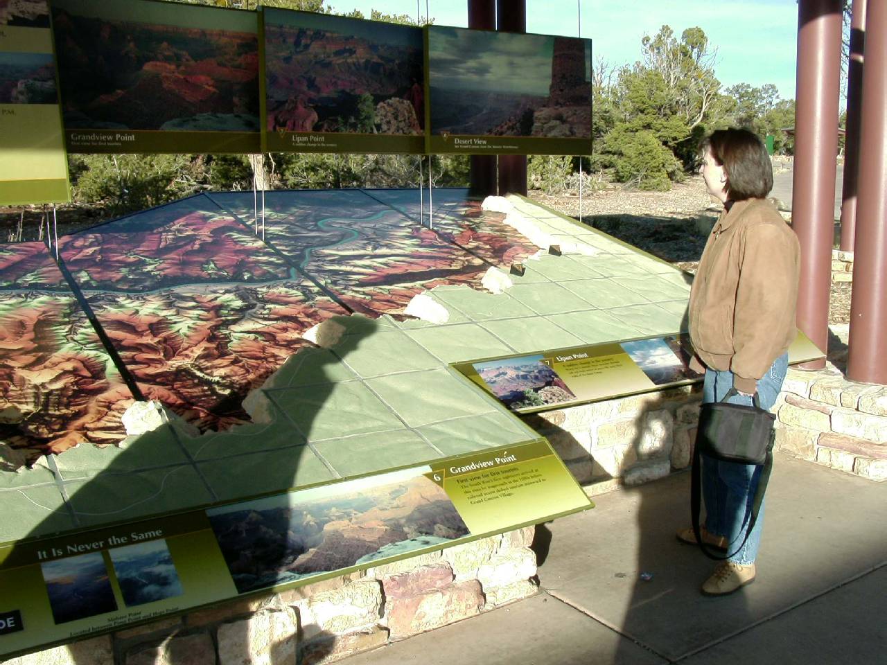
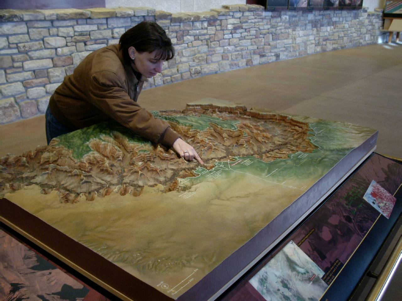
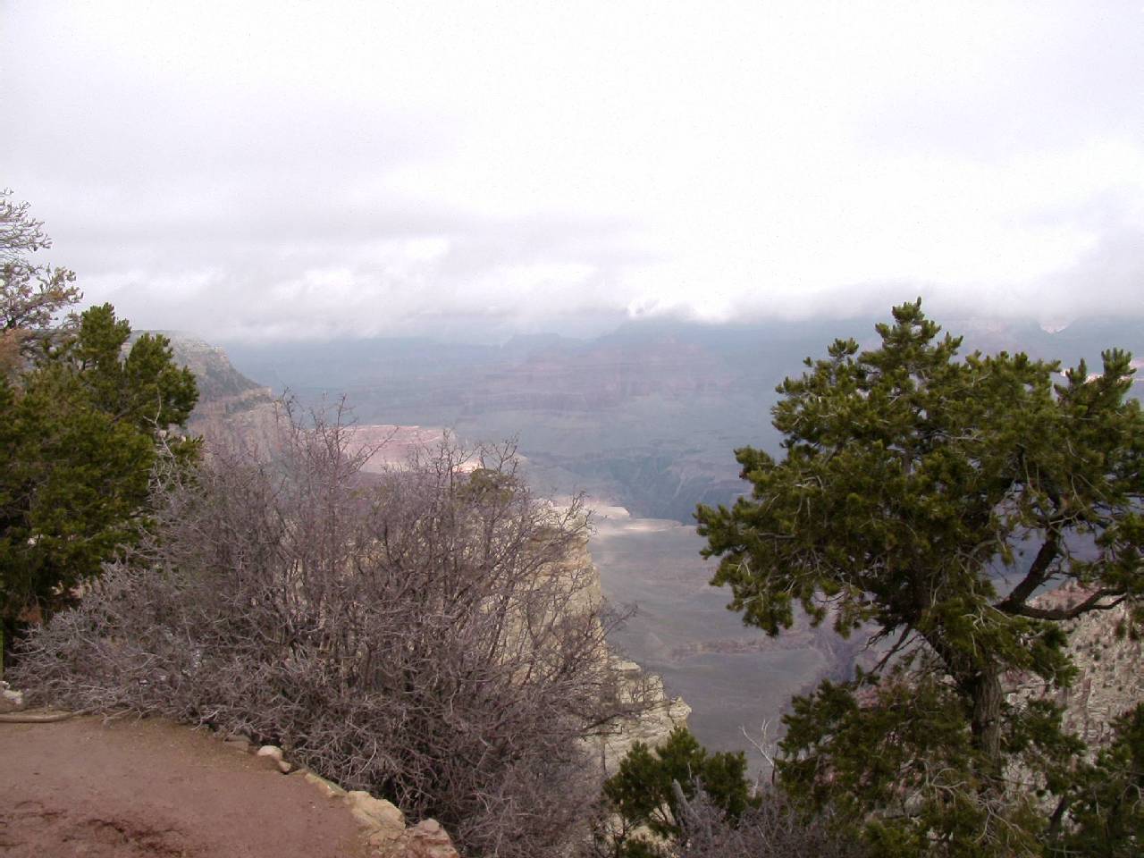
The skies were only partly cloudy so all the overlooks were simply stunning.
This was making me feel very good about our prospects for the following
day. I decided that I would take my 35mm camera as I did the last time and
got enough film to shoot 200 pictures.
P80399.jpg)
P80402.jpg)
P80405.jpg)
P80407.jpg)
P80409.jpg)
P80410.jpg)
P80413.jpg)
P80416.jpg)
P80424.jpg)
P80421.jpg)
P80419.jpg)
P80417.jpg)
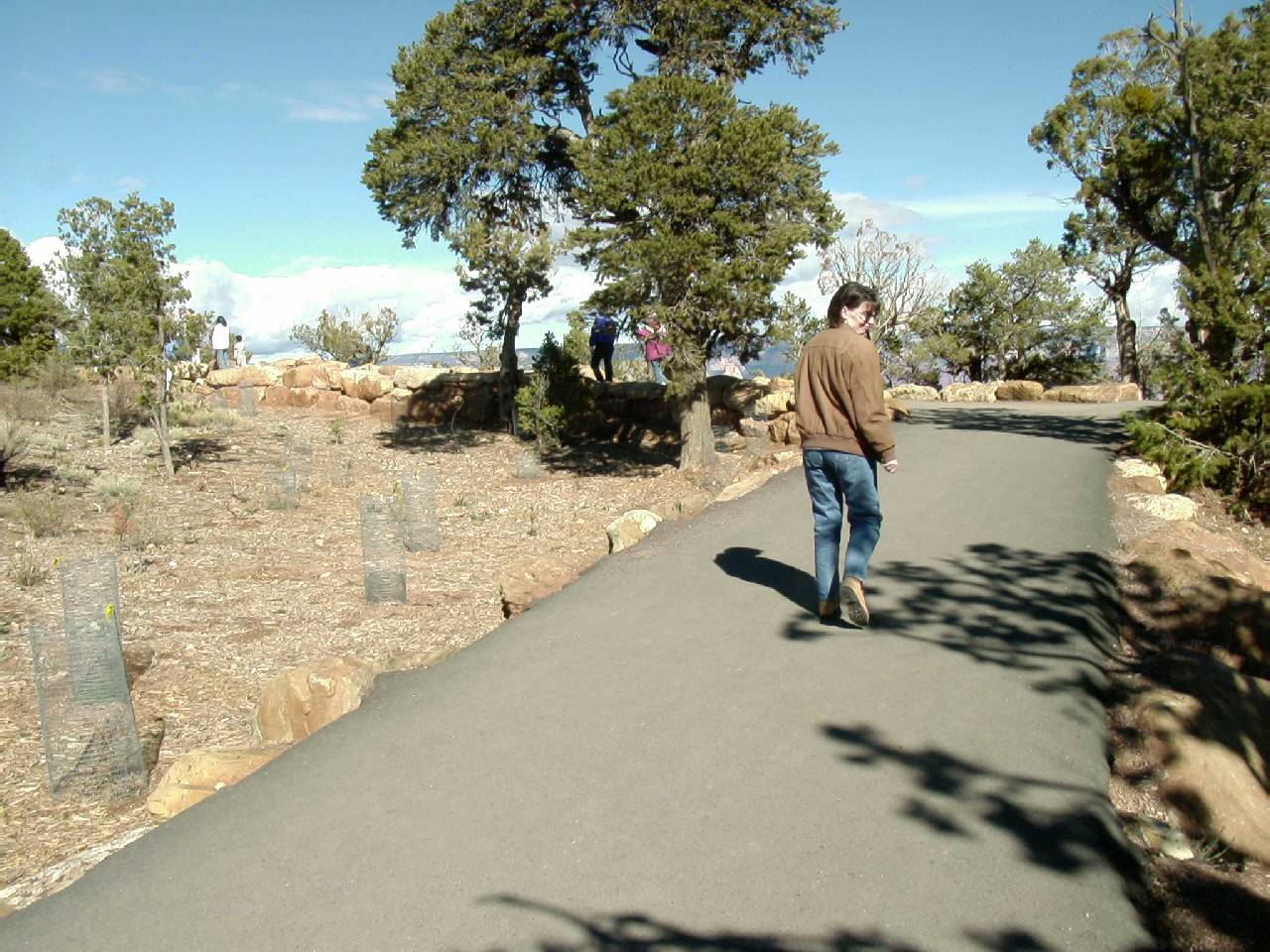
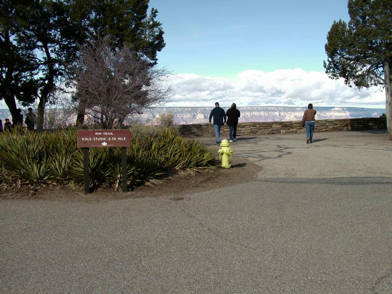
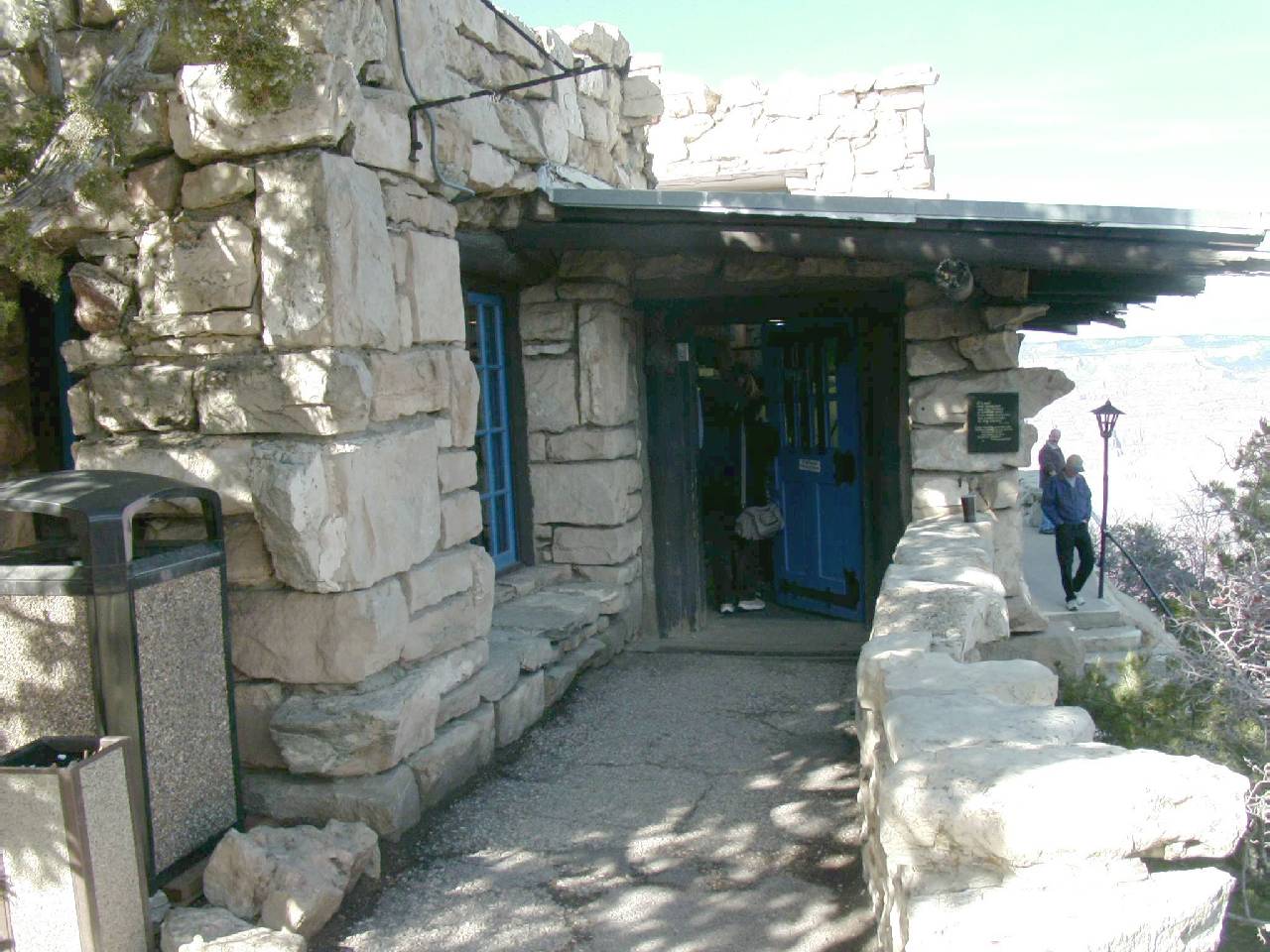
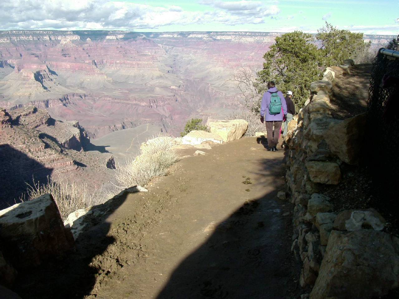
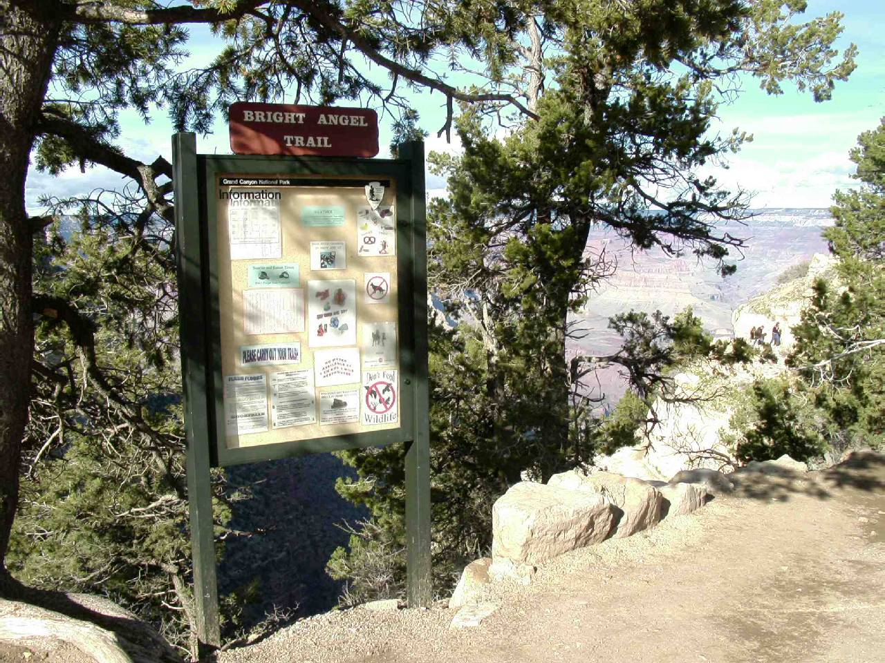
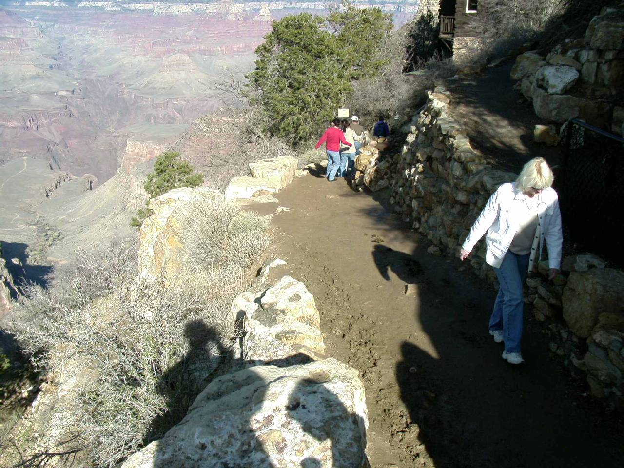
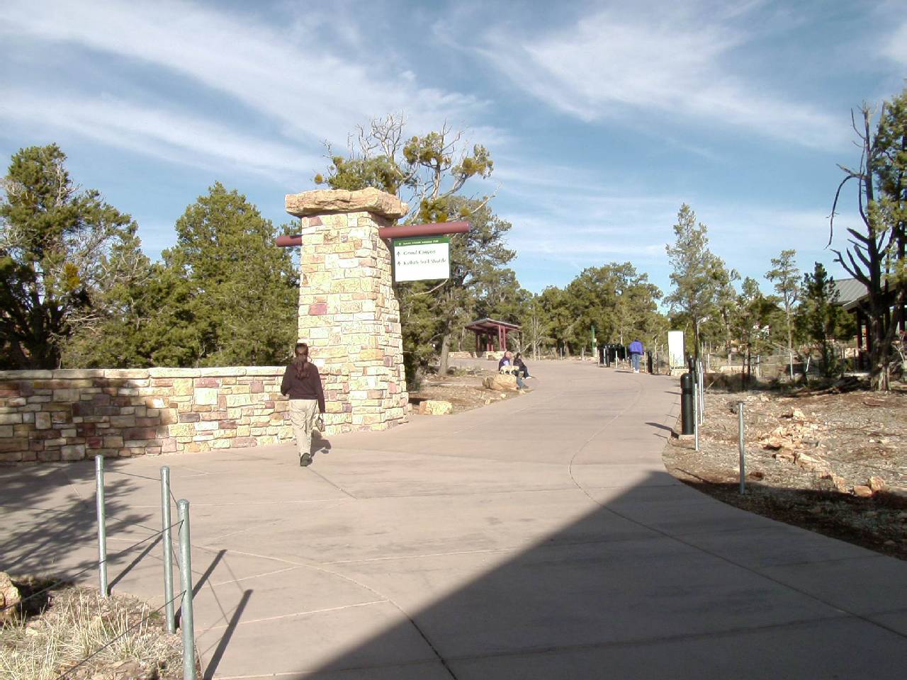
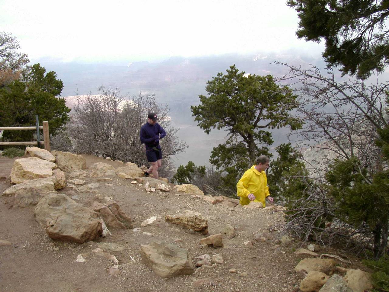
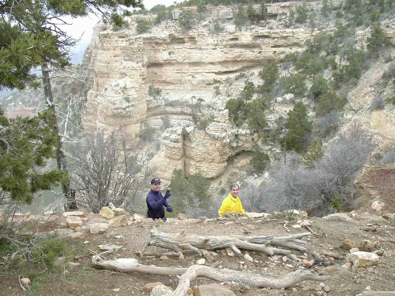
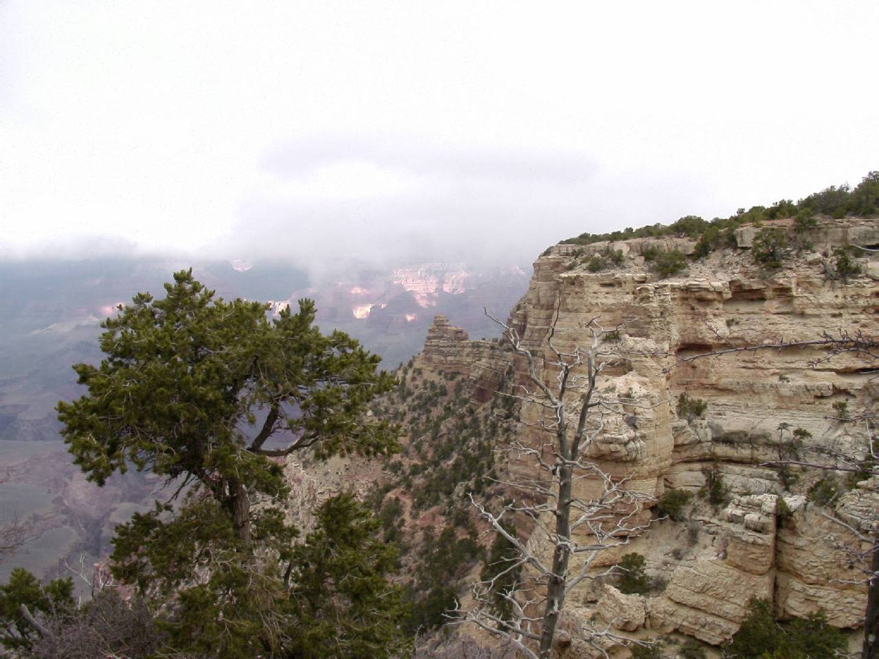
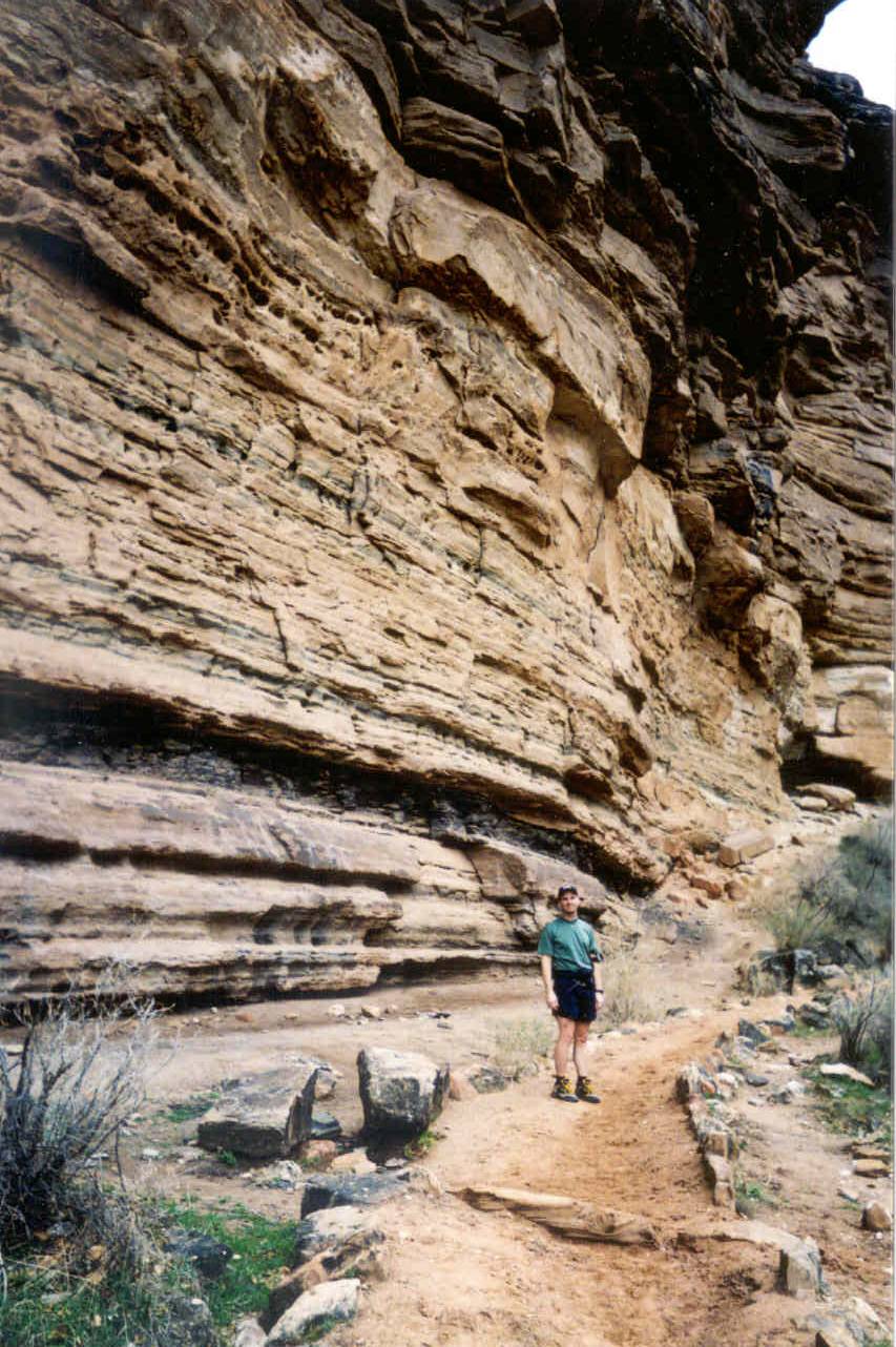
A little over a quarter of a mile from the El Tovar is the top of the
Bright Angel Trail. The top of the Kaibab and Bright Angel trails are for
me genuinely happy places. There is great excitement (and some anxiety)
when you begin your hike, and great relief and joy when you return. I couldn't
help but think what I'd be feeling like at this very spot the next day.
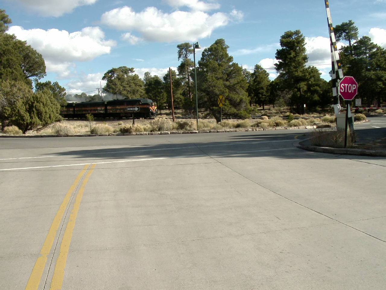
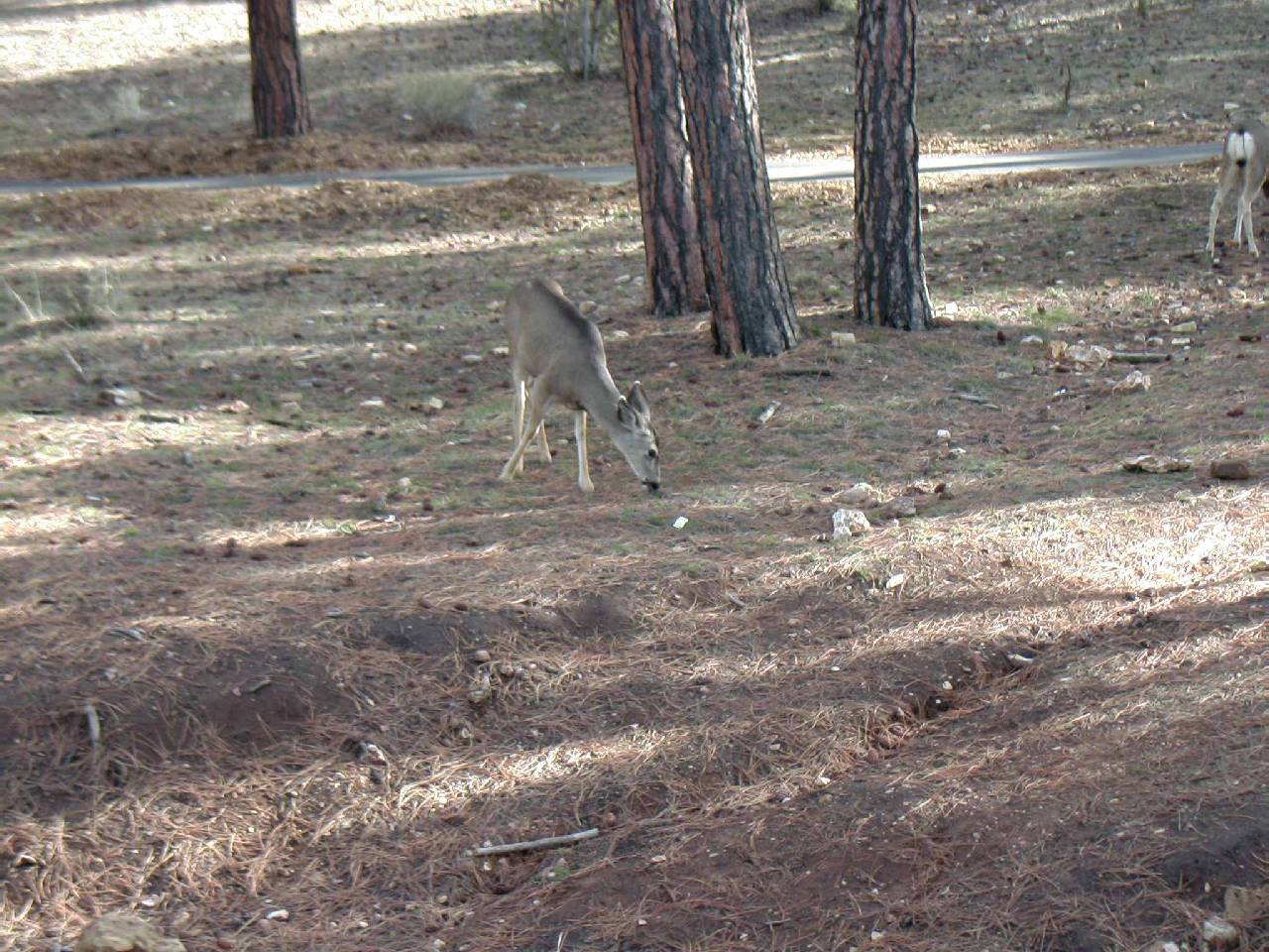
P80428.jpg) Back on
the bus we headed to the vistors center where we caught a bus to take us
to the South Kaibab trail head and to Yaki Point. The sight of deer is common
within the park and we spotted at least a dozen during the visit. We briefly
looked around at the displays but the full tour would wait until the ride
back. I was hoping to see part of the South Kaibab Trail before it was engulfed
in shadows. The bus first stops in the parking lot of the trail, and it
was quite a contrast to what we saw last May. The parking lot was now full
whereas it was completely empty that May morning. At Yaki Point I noticed
the same thing. There were a lot of cars. Apparently you didn't have
to take the bus, but it was very convenient, so why not?
Back on
the bus we headed to the vistors center where we caught a bus to take us
to the South Kaibab trail head and to Yaki Point. The sight of deer is common
within the park and we spotted at least a dozen during the visit. We briefly
looked around at the displays but the full tour would wait until the ride
back. I was hoping to see part of the South Kaibab Trail before it was engulfed
in shadows. The bus first stops in the parking lot of the trail, and it
was quite a contrast to what we saw last May. The parking lot was now full
whereas it was completely empty that May morning. At Yaki Point I noticed
the same thing. There were a lot of cars. Apparently you didn't have
to take the bus, but it was very convenient, so why not?
P80435.jpg)
P80441.jpg) We got to the overlook too
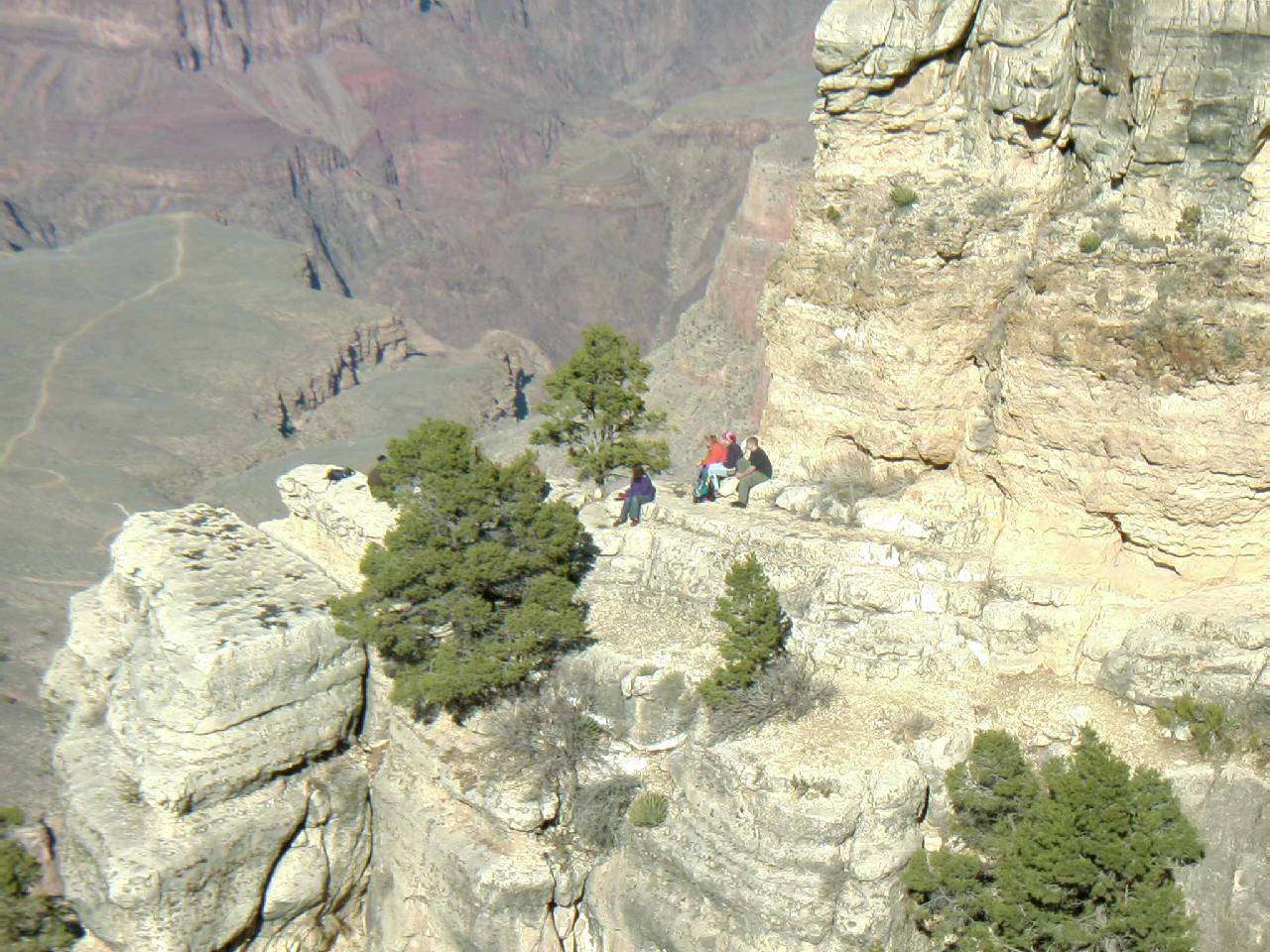
late for a great view of the trail. Too much of it was no in the shadows.
As we admired the view there were three kids (yeah, I call them kids, they
were probably in their early 20's) from England going over the railing which
is not uncommon to stand closer to the edge and generally joking around.
(See picture at the left.) They had completed a day hike down and up the
South Kaibab Trail and were pretty tired. They managed to do it in 9 hours.
To me this was impressive (and a little bit naive) to try a hike without
prior preparation.
We got to the overlook too
late for a great view of the trail. Too much of it was no in the shadows.
As we admired the view there were three kids (yeah, I call them kids, they
were probably in their early 20's) from England going over the railing which
is not uncommon to stand closer to the edge and generally joking around.
(See picture at the left.) They had completed a day hike down and up the
South Kaibab Trail and were pretty tired. They managed to do it in 9 hours.
To me this was impressive (and a little bit naive) to try a hike without
prior preparation.
P80431.jpg)
P80432.jpg)
P80433.jpg)
P80434.jpg)
P80450.jpg)
P80444.jpg)
P80443.jpg)
P80448.jpg)
P80449.jpg)
P80446.jpg)
Cindy was not keen on eating at the cafeteria for dinner. She preferred
a sit down restaurant. Near the El Tovar we found the Arizona Room which
offered Cindy Friendly food. I had a steak and she had chicken. It was a
nice spot with a view of the canyon until darkness fell.
Back to our room, there was only one detail left. I had attempted to
call Ron's cell several times and it quickly went to messaging. After the
third time this happened I knew there was a service area problem. We thought
we would run into him at one of the overlooks. I was anxious to know if
he'd made it. Within minutes, Ron called from the Maswik Lodge, to say he
was there and to say his cell phone wasn't working. We were on for the following
morning and I got to bed by 8:15. But the weather reports were now suddenly
turning. Instead of mostly clear to partly cloudy, the prediction was cloudy.
The following morning before sunrise the weather channel was indicating
cloudy conditions with a cloudy forecast. I decided if these were the conditions
I would not bring the camera that would add a lot of extra weight. Instead
I would pick up a disposable camera in the gift shop.
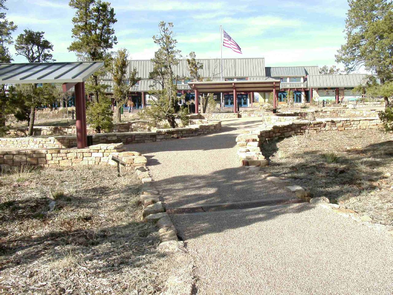
Our plan was to meet in the cafeteria at the Yavapai the following morning.
Cindy would join us where me and Ron planned on scarfing down a very large
breakfast to fuel our bodies and see us off on the bus. I wished that she
would be coming along to the top of the trail to take a few pictures, but
studying was on her mind and she'd planned on using all the hours of our
hike.
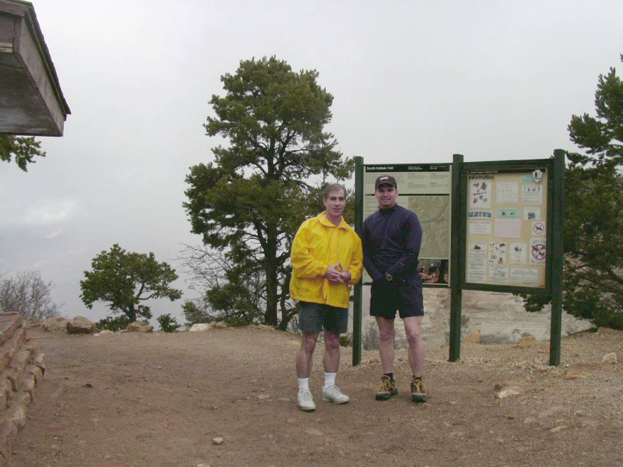
It was finally time to get to the trail. 9:00 was our target time and
it was now 8:40. I made a quick stop at the gift shop which is right next
to the bus stop to pick up a disposable camera. The first bus was not the
right one - disappointing because now I wished to get started. It was a
little chilly, but I didn't think it was too bad. I was trying to decide
if I'd bring my yellow windbreaker or leave it behind. Ron and Cindy were
absolutely freezing so we all went back inside the gift shop to keep warm
and wait for the second bus. As we waited for the bus, it suddenly occurred
to me how ridiculous it was to be waiting for a bus. I chuckled and announced,
"What are we doing?" We have a car and Cindy can drive us directly
to the trailhead! Mentally me and Ron were still thinking of summer where
the bus is your only option unless you want to walk all the way there and
back.
P80451.jpg)
P80460.jpg) The parking lot was mostly full with maybe two parking
spaces available. There was a group of six milling in the lot and given
the time of morning and how fresh they appeared, you figured they about
to head down the trail. They were outfitted for an overnight stay with full
backpacks and climbing sticks. Our start was delayed slightly as the group
asked me to take a group picture with several of their cameras. We walked
up to the short path to the trail head and Cindy took a couple of pictures.
I decided to wear the parka because if I took it off it would not be a lot
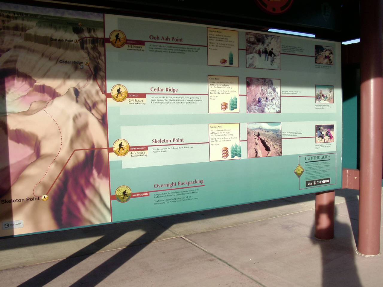
of extra weight to lug around. On closer inspection of the information sign
that we posed next to, she noticed the warning about no attempting a day
hike to the river and back in one day!
The parking lot was mostly full with maybe two parking
spaces available. There was a group of six milling in the lot and given
the time of morning and how fresh they appeared, you figured they about
to head down the trail. They were outfitted for an overnight stay with full
backpacks and climbing sticks. Our start was delayed slightly as the group
asked me to take a group picture with several of their cameras. We walked
up to the short path to the trail head and Cindy took a couple of pictures.
I decided to wear the parka because if I took it off it would not be a lot
of extra weight to lug around. On closer inspection of the information sign
that we posed next to, she noticed the warning about no attempting a day
hike to the river and back in one day!
P80452.jpg)
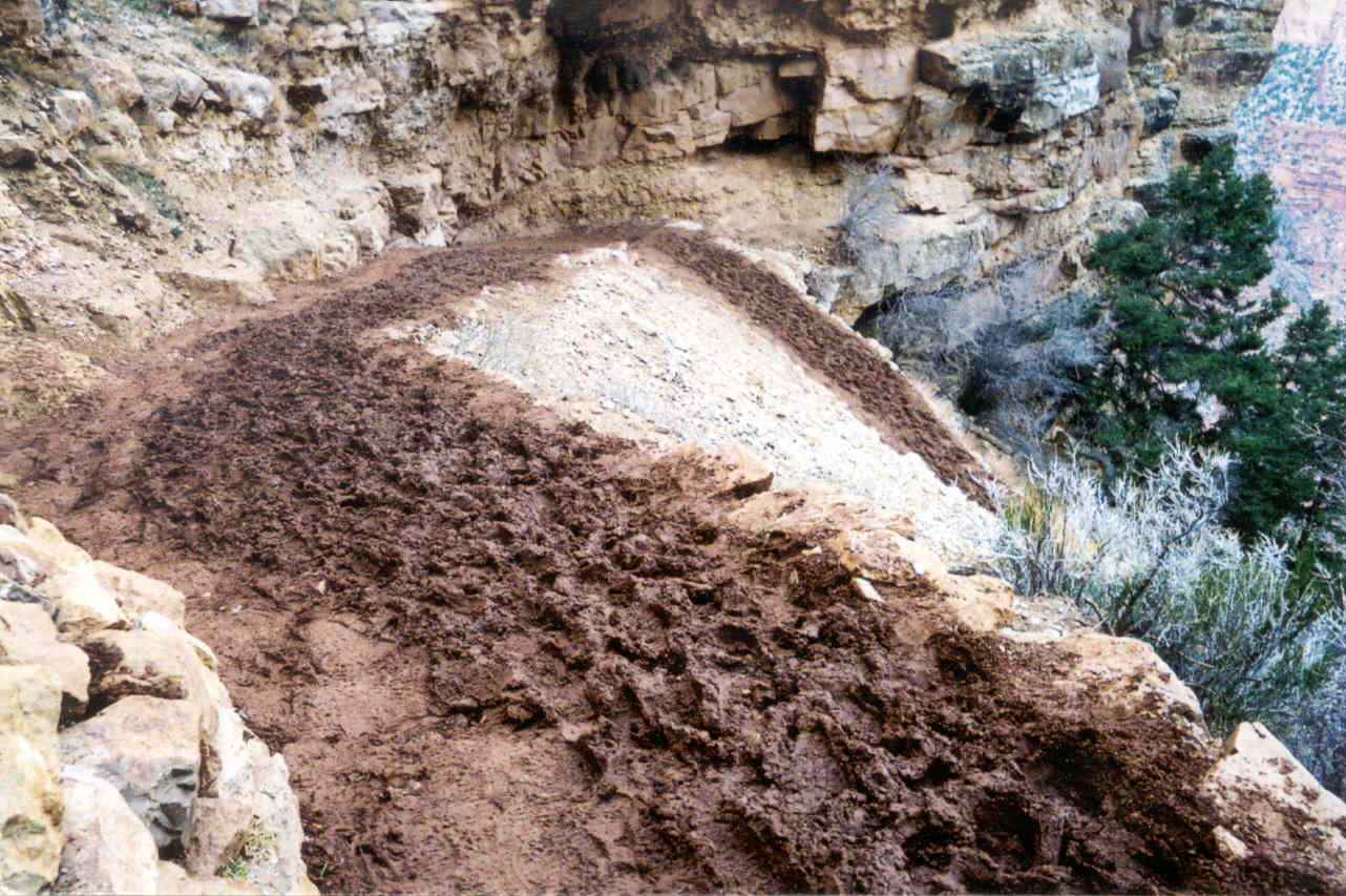
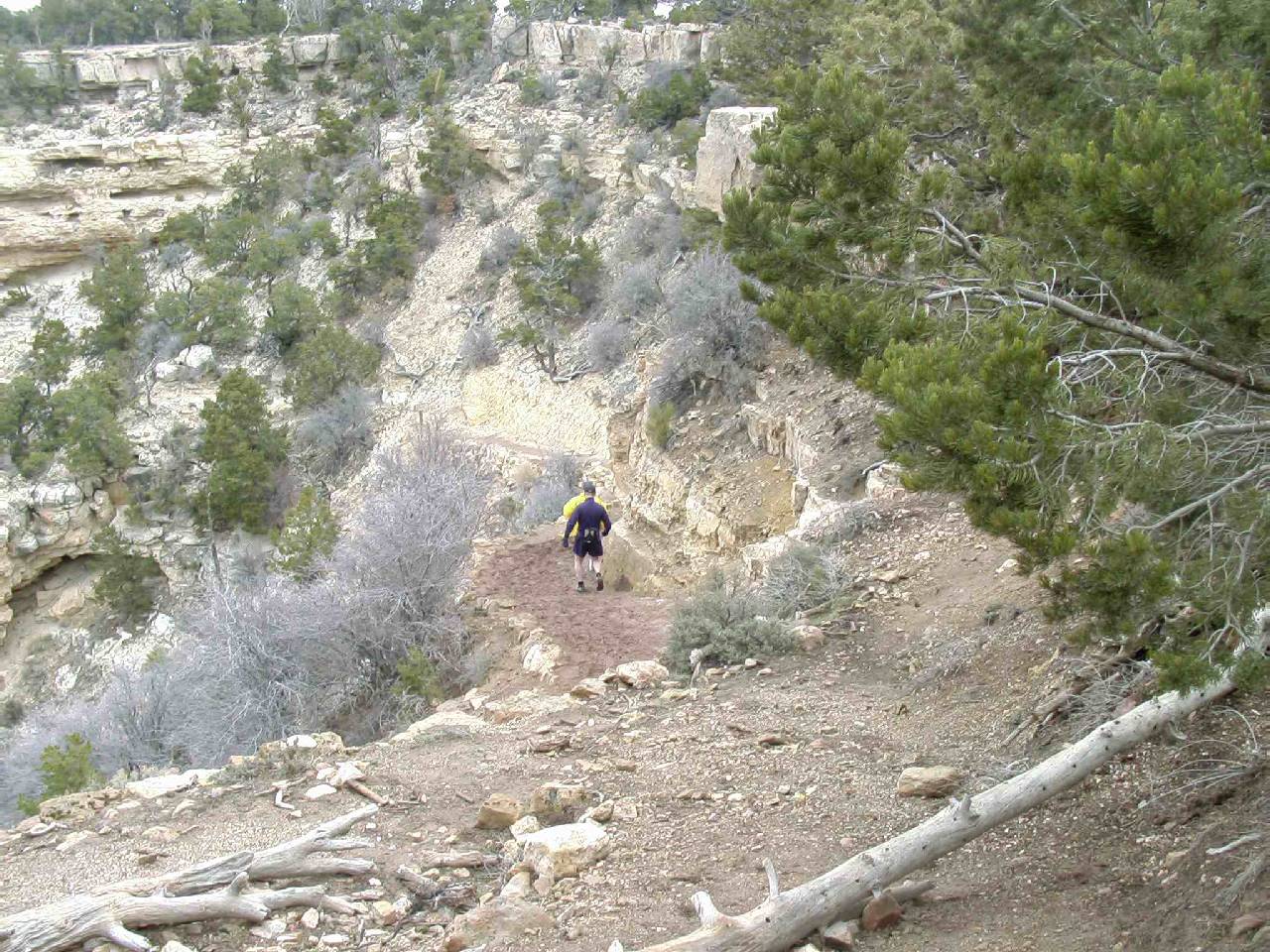
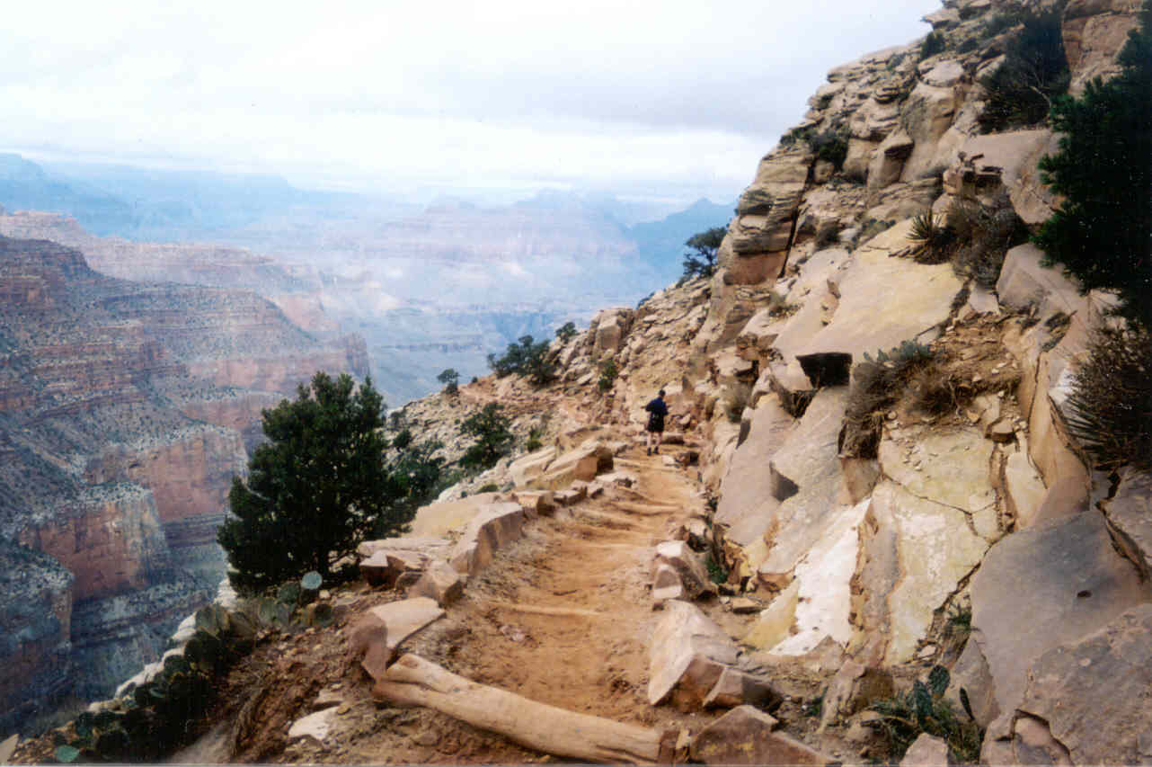
gc2003_01.jpg) The top of the trail looked very muddy, but it was
a frozen muddy! Very quickly, however, it turned into genuine mud with a
lot of standing water which often pooled in the middle of the concave trail.
This section of the trail is shielded from the sun most of the day so this
was hardly a surprise. Me and Ron would switch running from one side of
the trail to the other avoiding the water and mud, sometimes walking or
running over the rocks that line both sides of the trail. My concern was
not safety as much as the thought of the added weight the mud would add!
I figured as soon as we emerged from the side canyon where the South Kaibab
Trail begins, the trail would dry out. This turned out to be wishful thinking
because the water and mud continued. After your quick initial descent from
the limestone layer (and thus fairly hard limestone trail), you hit the
softer coconino sandstone and then the red hermit shale. In order to keep
the trail from washing away, they have laid enumerable 6-inch wide logs
across the width of the trail. These would often form nice pool areas for
the water and mud. Ron called our navigation of these sections "log
hopping." It may sound funny, but you really have to pay attention
because a slip could end the hike in an instant.
The top of the trail looked very muddy, but it was
a frozen muddy! Very quickly, however, it turned into genuine mud with a
lot of standing water which often pooled in the middle of the concave trail.
This section of the trail is shielded from the sun most of the day so this
was hardly a surprise. Me and Ron would switch running from one side of
the trail to the other avoiding the water and mud, sometimes walking or
running over the rocks that line both sides of the trail. My concern was
not safety as much as the thought of the added weight the mud would add!
I figured as soon as we emerged from the side canyon where the South Kaibab
Trail begins, the trail would dry out. This turned out to be wishful thinking
because the water and mud continued. After your quick initial descent from
the limestone layer (and thus fairly hard limestone trail), you hit the
softer coconino sandstone and then the red hermit shale. In order to keep
the trail from washing away, they have laid enumerable 6-inch wide logs
across the width of the trail. These would often form nice pool areas for
the water and mud. Ron called our navigation of these sections "log
hopping." It may sound funny, but you really have to pay attention
because a slip could end the hike in an instant.
P80453.jpg)
P80454.jpg)
P80455.jpg)
P80456.jpg)
P80458.jpg)
P80457.jpg)
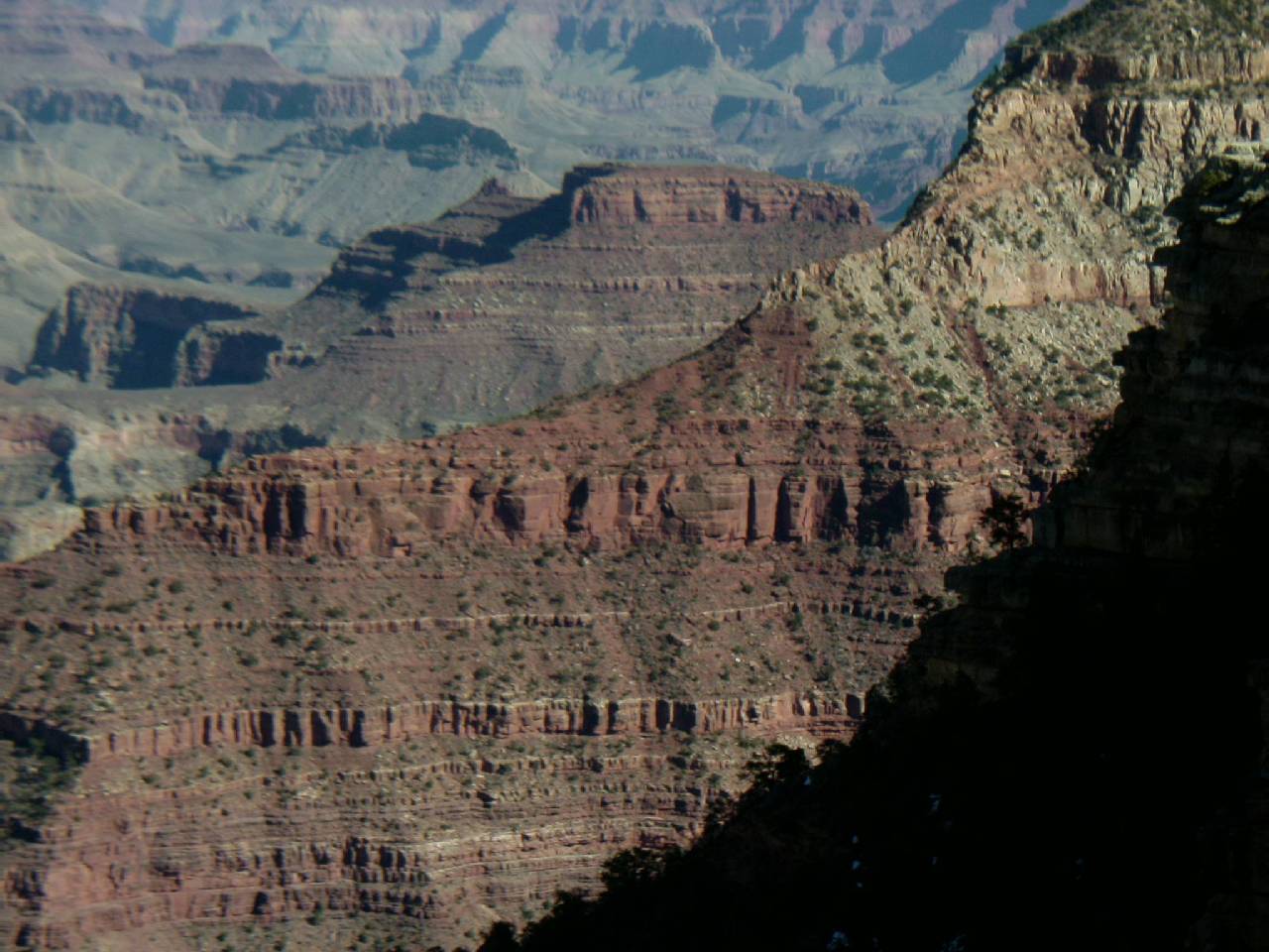
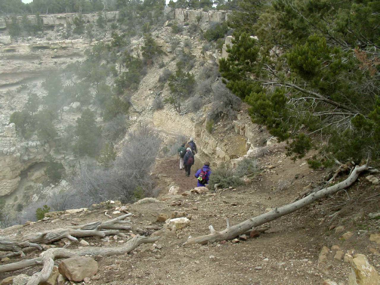
Though the overcast sky dulled the colors of the canyon, the visibility
was good, but we weren't doing too much sightseeing. We were keeping a very
good pace which feels like eight minutes per mile, but my experience has
shown it to be actually about 10. Our only pause at this section of the
trail was at the Ooh-Ah Point which Ron remembered me taking his picture
at this very spot last year. I took the short break as an opportunity to
remove my yellow parka because I was already feeling warm. I didn't need
to take it along. I placed it in my fanny pack which held my Gatorade bottle
and disposable camera. My thoughts often were on the familiarity of the
trail. There were very few spots I could not remember. The trail now seemed
like an old friend. We arrived at Cedar Ridge (1.5 miles from the trail
head) in only 16 minutes so with the brief stop, we were nearly at that
10 minute per mile that I estimated. Along with the lack of sun there was
a conspicuous lack of hikers. We would pass about four hikers coming up
and maybe eight going down.
gc2003_02.jpg) After a bathroom break at
the Rest House at Cedar Ridge (a consequence of drinking a lot of fluids
that morning), we were back jogging down and avoiding the trail that was
still surprisingly muddy in places, even though we were now in the wide
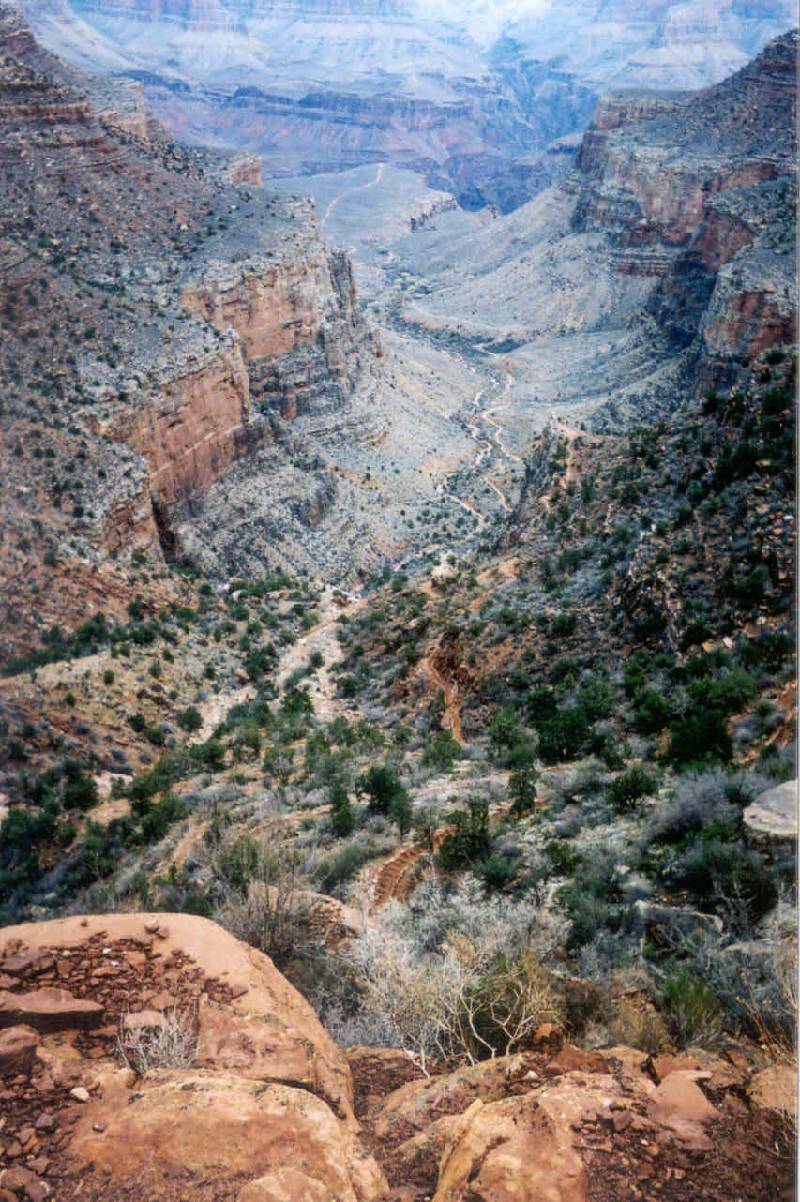
open expanse. We briefly stopped at the top of the long switchbacks because
... well ... you just have to! It is such a wonderful view with the switchbacks
in the foreground and the rest of the canyon in the background.
After a bathroom break at
the Rest House at Cedar Ridge (a consequence of drinking a lot of fluids
that morning), we were back jogging down and avoiding the trail that was
still surprisingly muddy in places, even though we were now in the wide
open expanse. We briefly stopped at the top of the long switchbacks because
... well ... you just have to! It is such a wonderful view with the switchbacks
in the foreground and the rest of the canyon in the background.
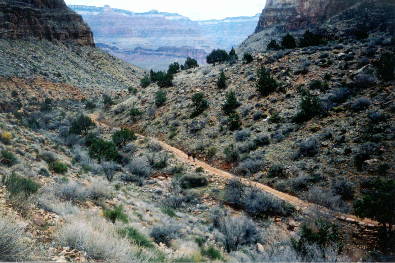
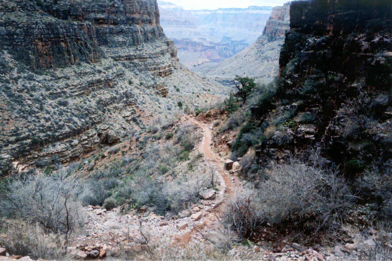
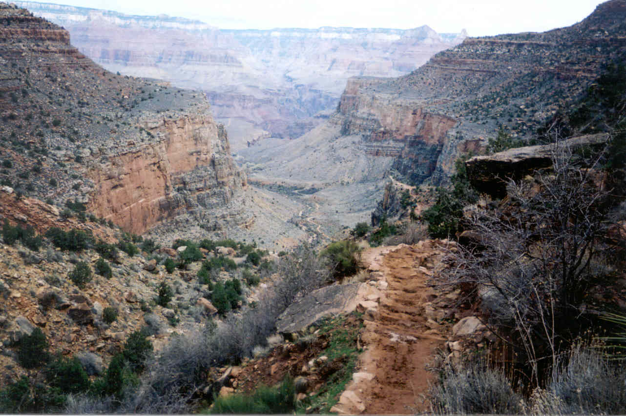
After the long switchbacks the trail became mostly dry. The trail straightens
and heads directly to the abyss of the inner gorge. Our only stops were
a brief one to view the bottom and a two minute one to let a mule train
pass. In 01:08:30, we were in the tunnel leading out to the Kaibab Bridge.
This beat my time nearly 10 years earlier by a minute and a half.
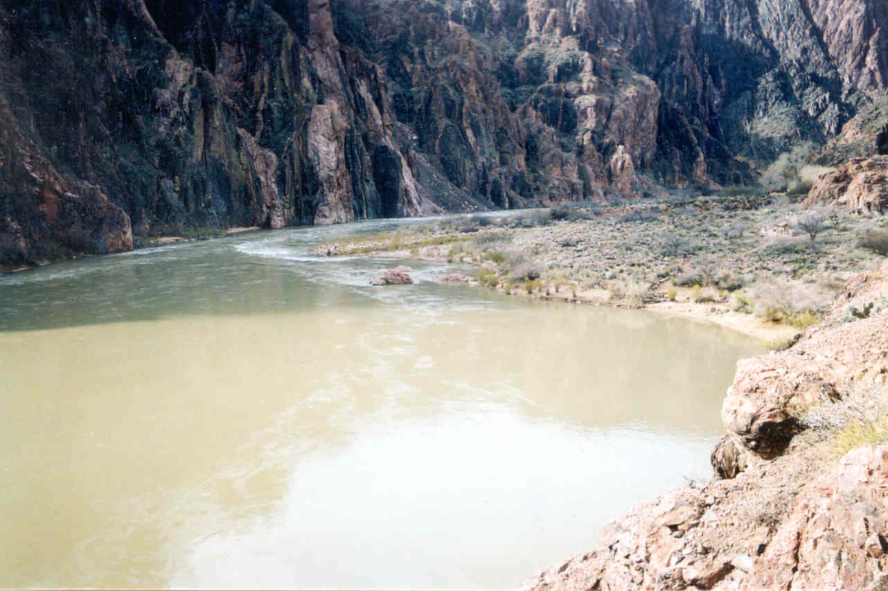
gc2003_03.jpg) The river was muddy but not as bad as I'd imagined,
but it was flowing much heavier than last May. The first thing you notice
coming out of the tunnel and onto the bridge is the roar of the flowing
water which seems to fill the gorge. Ron immediately pointed out that the
beach was missing! This beach was our stopping point the last time where
Ron went for a swim. It wasn't actually missing, we knew right where it
was, but it was now under water. After passing the sign that warned of no
swimming, (we would obey it this time ;) we were now on unfamiliar trail.
I experienced a brief burst of excitement as everything I was seeing was
new. This was tempered by the thought of the upcoming difficulty we might
experience.
The river was muddy but not as bad as I'd imagined,
but it was flowing much heavier than last May. The first thing you notice
coming out of the tunnel and onto the bridge is the roar of the flowing
water which seems to fill the gorge. Ron immediately pointed out that the
beach was missing! This beach was our stopping point the last time where
Ron went for a swim. It wasn't actually missing, we knew right where it
was, but it was now under water. After passing the sign that warned of no
swimming, (we would obey it this time ;) we were now on unfamiliar trail.
I experienced a brief burst of excitement as everything I was seeing was
new. This was tempered by the thought of the upcoming difficulty we might
experience.
gc2003_04.jpg)
gc2003_05.jpg) Less than 100 feet from
our stopping point last May there was a fresh water station, complete with
a well crank! With the high temperatures of that hike, it would have been
nice to refill my water bottle. I didn't pass up the opportunity and I refilled
my bottle so now it was a mix of water and gatorade. Very quickly the trail
split, one path leading to the nearby Phantom Ranch, the other leading over
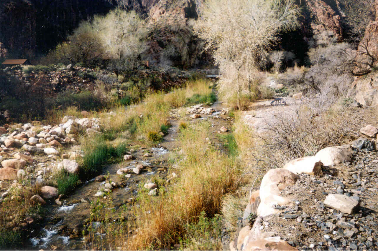
a short bridge crossing the Bright Angel Creek with it's beautifully clear
running water. The area was not exactly new; I had seen this area from the
trail (almost looking straight down) and from the Kaibab Bridge. But the
look did not match my mental image. There were trees! A water supply will
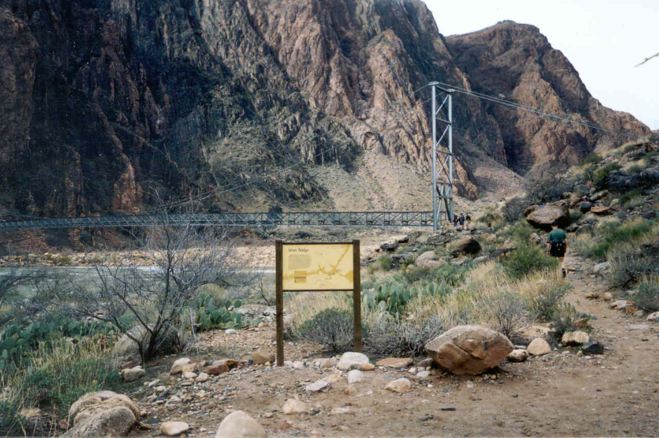
do that. We passed the helipad and the picnic ground and onto Silver Bridge
to cross back over the Colorado River. Like the Kaibab Bridge, it is said
to be "one mule wide." It could also easily be described as "one
hiker wide" since we got behind two hikers that were walking with full
backpacks very slowly (actually painfully slow as far as we were concerned)
across this span. We figured the hikers were together, but as the bridge
ended, one headed left back to the South Kaibab Trail while the other just
stood there and made no expression or response when I said, "Hi!"
Ron didn't say anything to him thinking the guy looked to him like he was
just plain unhappy. I joked, "Unhappy? That's not good. There's a lot
of unhappiness left to go. He shouldn't be wasting all of it here at the
bottom!"
Less than 100 feet from
our stopping point last May there was a fresh water station, complete with
a well crank! With the high temperatures of that hike, it would have been
nice to refill my water bottle. I didn't pass up the opportunity and I refilled
my bottle so now it was a mix of water and gatorade. Very quickly the trail
split, one path leading to the nearby Phantom Ranch, the other leading over
a short bridge crossing the Bright Angel Creek with it's beautifully clear
running water. The area was not exactly new; I had seen this area from the
trail (almost looking straight down) and from the Kaibab Bridge. But the
look did not match my mental image. There were trees! A water supply will
do that. We passed the helipad and the picnic ground and onto Silver Bridge
to cross back over the Colorado River. Like the Kaibab Bridge, it is said
to be "one mule wide." It could also easily be described as "one
hiker wide" since we got behind two hikers that were walking with full
backpacks very slowly (actually painfully slow as far as we were concerned)
across this span. We figured the hikers were together, but as the bridge
ended, one headed left back to the South Kaibab Trail while the other just
stood there and made no expression or response when I said, "Hi!"
Ron didn't say anything to him thinking the guy looked to him like he was
just plain unhappy. I joked, "Unhappy? That's not good. There's a lot
of unhappiness left to go. He shouldn't be wasting all of it here at the
bottom!"
gc2003_06.jpg)
gc2003_07.jpg)
gc2003_08.jpg)
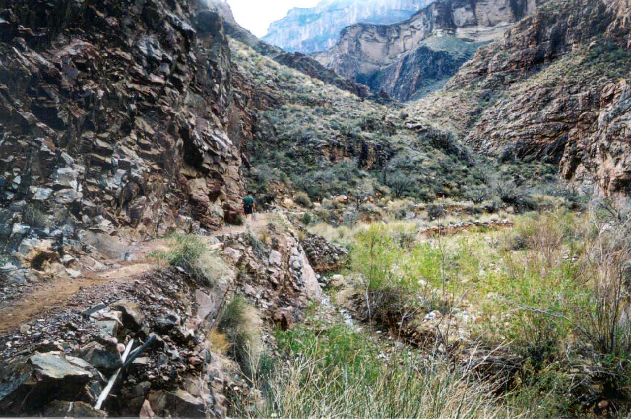
This part of the trail is technically the River Trail, but nearly everyone
(including myself) think of it was part of the Bright Angel. In comparison
to the rest of the trails this one is flat, but it does go up and down along
the path. We did our fast walk when the trail ascended and ran whenever
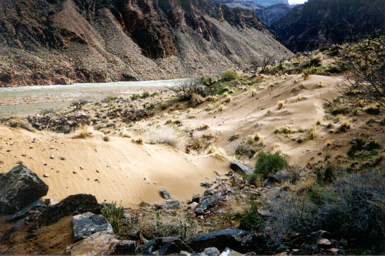
the trail descended. A surprise on this River Trail was the sand! Sand?
You'd think there was water near by. ;) For a good portion of this trail
we were walking on pure sand, obviously deposited from long past floods
from the river. This was a moment I was very happy I had the disposable
camera to snap a picture.
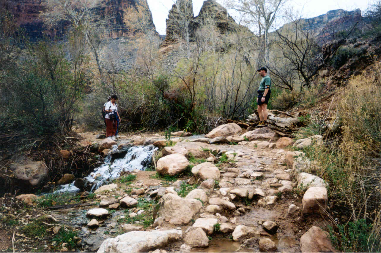
gc2003_09.jpg) The River Trail ends as it hits Pipe Creek. This
is the actual start of the Bright Angel Trail . There is a rest house here
and another chance to get fresh water. The creek was much smaller than the
Bright Angel Creek, but it was also very clean and it's noise was music
to my ears. The trail would basically follow this stream and cross it several
times during our ascent.
The River Trail ends as it hits Pipe Creek. This
is the actual start of the Bright Angel Trail . There is a rest house here
and another chance to get fresh water. The creek was much smaller than the
Bright Angel Creek, but it was also very clean and it's noise was music
to my ears. The trail would basically follow this stream and cross it several
times during our ascent.
I'd seen no photographs and I was very surprised by the look and feel
of this section of the trail. In my imagination I'd pictured the lower part
of the South Kaibab, but with a little more vegetation. The presence of
any amount of water always makes a huge difference in the foliage. But this
turned out to be a clean flowing creek! Dirty water would indicate
the water came from very recent rains. What did not surprise me was this
lower section offered almost no view of the overall canyon and my first
thought was it didn't belong within the GC. The beauty of the Bright Angel
is the local scenery. The walls are right there! The creek divided (from
our viewpoint going up) and the trail followed a new very small stream that
reminded me of a spring. It was now fairly quiet on the trail. We were still
encountering very few hikers, most of them in full backpacks heading down.
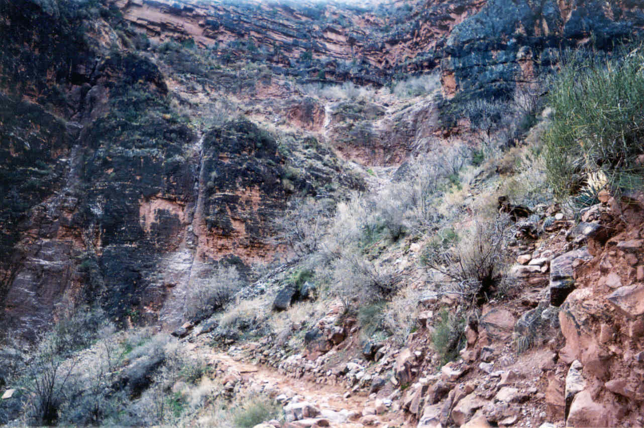
As the trail diverged from even this trickle of water, most of the vegetation
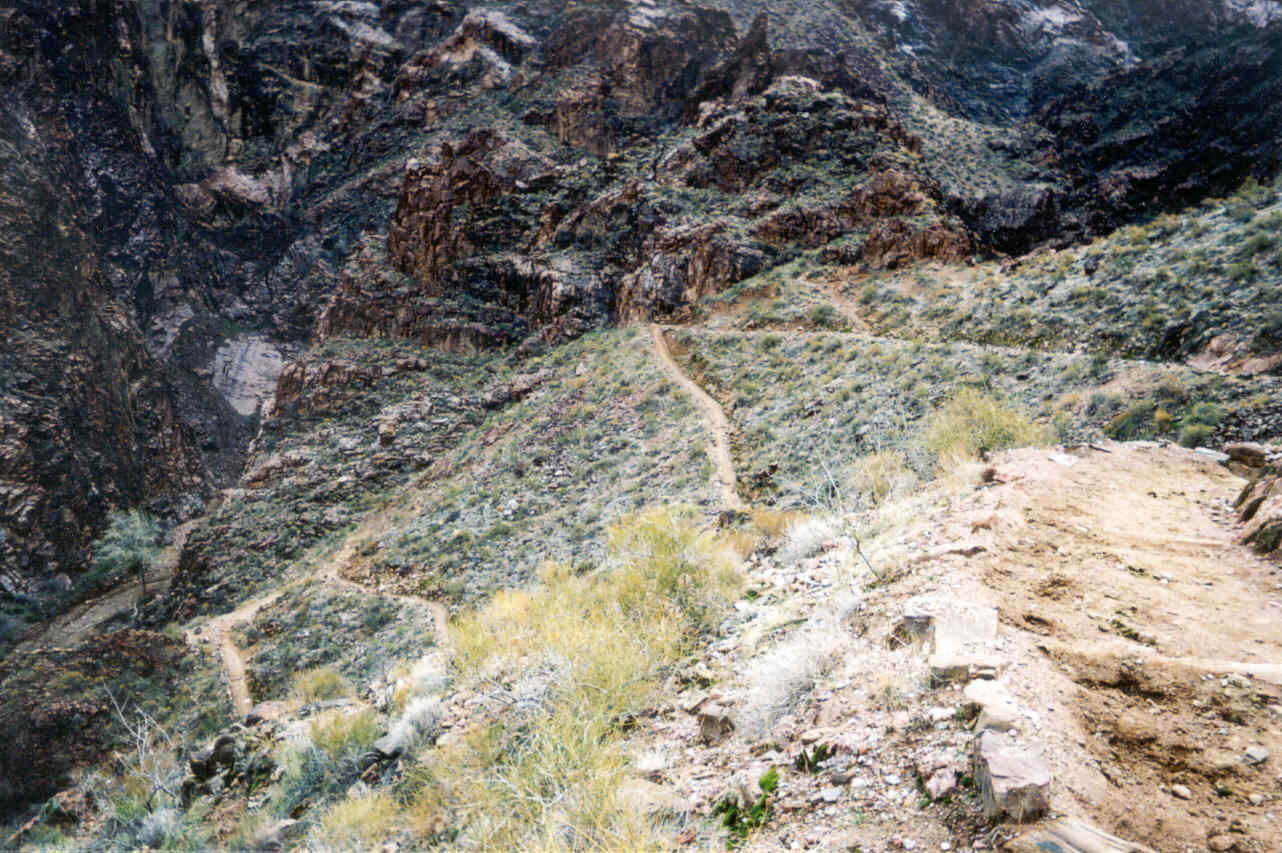
vanished. The trail got steeper at this point in a series of switchbacks
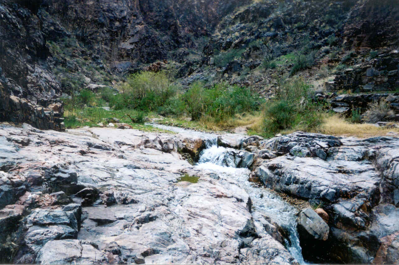
I learned later they call the Devil's Corkscrew. Half a mile later, however,
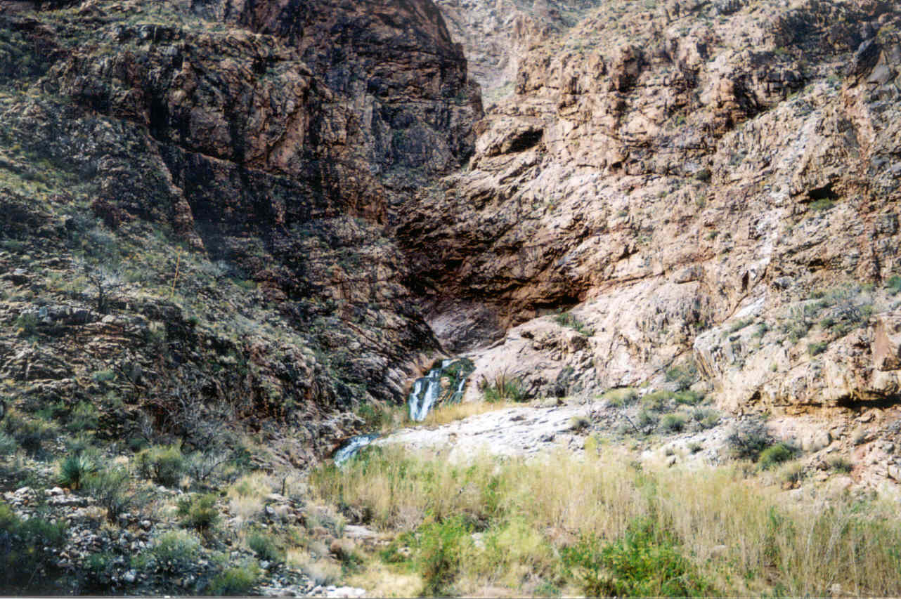
the silence very abruptly ended by the roaring sound of a nearby waterfall.
I could not see it, but that sound was unmistakable. Within a minute the
trail joined back up with Garden Creek with the sight of a beautiful little
(but loud) waterfall.
gc2003_10.jpg)
gc2003_11.jpg)
gc2003_12.jpg)
gc2003_13.jpg)
gc2003_15.jpg) I assumed the lower portion
to be a steeper grade (like the South Kaibab) and then leveling out for
a long section which runs through Indian Garden. We could clearly see this
section the day before from the top of the Bright Angel Trail. But the grade
was very moderate and as we emerged from the inner gorge there seemed to
be no change whatsoever. At this point the trail opened up and much of the
South Rim was suddenly visible. It looked a long way up! The trail was now
fairly straight and was lined with trees that would give very welcome shade
under a hot sun. Right then, however, it was neither sunny nor hot, though
it looked like it might be clearing up. I knew Indian Garden had to be close.
I assumed the lower portion
to be a steeper grade (like the South Kaibab) and then leveling out for
a long section which runs through Indian Garden. We could clearly see this
section the day before from the top of the Bright Angel Trail. But the grade
was very moderate and as we emerged from the inner gorge there seemed to
be no change whatsoever. At this point the trail opened up and much of the
South Rim was suddenly visible. It looked a long way up! The trail was now
fairly straight and was lined with trees that would give very welcome shade
under a hot sun. Right then, however, it was neither sunny nor hot, though
it looked like it might be clearing up. I knew Indian Garden had to be close.
gc2003_14.jpg)
gc2003_16.jpg)
gc2003_17.jpg) Indian Garden is truly an oasis.
There is Garden Creek, shade trees, lots of other vegetation, and a natural
spring to provide drinking water. Looking through binoculars from the rim
the day before, there appeared to be three large buildings and at least
a dozen smaller ones. I was sure they must be small cabins, but they turned
out to be ramadas with picnic benches underneath. During the summer I think
this would be a wonderful place for a picnic! Before Indian Garden there
were only a trickle of hikers, all of them decked out in full gear for an
overnight stay at the bottom. That all changed at this spot. Suddenly there
were hikers everywhere, and many appeared to be day hikers. There was also
a group taking the mule trip, all mounted up and ready to move. This gave
a moment of anxiety for Ron who did not wish to be behind another mule train.
He had no thoughts of stopping or even taking even a short look around,
so continued without pause. Being some 30 feet behind, when I spotted the
mules the wrangler (who leads the train) turned them in my direction indicating
they were on their way down! A few minutes later Ron turned around and said
we have to stay ahead of the mules. I was happy to tell him they
were heading down. Unfortunately I had no opportunity to get any pictures.
Indian Garden is truly an oasis.
There is Garden Creek, shade trees, lots of other vegetation, and a natural
spring to provide drinking water. Looking through binoculars from the rim
the day before, there appeared to be three large buildings and at least
a dozen smaller ones. I was sure they must be small cabins, but they turned
out to be ramadas with picnic benches underneath. During the summer I think
this would be a wonderful place for a picnic! Before Indian Garden there
were only a trickle of hikers, all of them decked out in full gear for an
overnight stay at the bottom. That all changed at this spot. Suddenly there
were hikers everywhere, and many appeared to be day hikers. There was also
a group taking the mule trip, all mounted up and ready to move. This gave
a moment of anxiety for Ron who did not wish to be behind another mule train.
He had no thoughts of stopping or even taking even a short look around,
so continued without pause. Being some 30 feet behind, when I spotted the
mules the wrangler (who leads the train) turned them in my direction indicating
they were on their way down! A few minutes later Ron turned around and said
we have to stay ahead of the mules. I was happy to tell him they
were heading down. Unfortunately I had no opportunity to get any pictures.
gc2003_18.jpg)
gc2003_19.jpg)
gc2003_20.jpg)
Since our last hike, Ron had purchased a sophisticated monitor designed
for a running and hiking that attaches to his upper arm. It has a timer,
an altimeter, and comes with a strap that goes around your chest to monitor
your heart beat. Best of all it has enough memory to record all this information
for many hours. Another neat feature is a selectable checkpoint. At any
point in your journey, press a button and it will record a marker at that
instant. If you were running in a race, you might record when you were passing
mileage markers. On the trail you indicate landmarks. Later when the data
is plotted, you can see your altitude and time at that exact moment. (See
the graph at the bottom.) Ron missed marking a checkpoint at Cedar Ridge
(the first real landmark on the trail), but it turn out we didn't need it.
Since we took nearly a two minute bathroom break at the rest house, the
graph shows what looks like a two minute level stretch in an otherwise continuous
descent.
My watch has an altimeter, but it stopped working last year. Instead
I was able to ask (and sometimes annoy) Ron for the reading which would
give me an idea of how far we had to go. Ron's answers would often annoy
me because they were seemed low: 2200, 2800, 3200, 3500, ... Annoying because
I knew the trail head was about 6850 feet; we had a long way to go!
After Indian Garden the trail was still basically straight heading right
toward the steep canyon cliffs that rise 2500-3000 feet above us if Ron's
readings were at all accurate. The cliffs and their height were certainly
intimidating. I joked that if I didn't know better, I would turn back immediately
thinking there's no way any walkable trail could exist that could
navigate up these walls. And yet we knew it had to be there (all
these people didn't jump!), yet there were no signs of trail even 300 feet
ahead of us.
gc2003_21.jpg)
gc2003_22.jpg)
gc2003_23.jpg)
When we passed Indian Garden my watch read 2:32. Not only were we making
good time, but it now seemed that 5 hours or even 4 and a half were very
pessimistic estimates. I was starting to imagine completing the route in
under 4 hours which would be 30 minutes faster than any time I'd heard.
At 2:54 into the hike the relatively straight trail ended and a long series
of switchbacks now lay before us. The steepest part of the Bright Angel
Trail was at hand. 10 minutes later we hit another known landmark: the 3
mile rest house. During the summer months you can get drinking water here
and at the one and a half mile rest house. The rest room facilities are
available all year round. As the name indicates, it is 3 miles from the
rim, giving us an exact measure of the distance left to sanity. That was
the good news. The bad news was I was starting to tire significantly which
meant a lot of insanity left to go. I was still moving well enough, but
it was an increasing effort and Ron who was 50 feet ahead was starting to
put more distance between us. But even worse I was beginning to think that
4 hours was our of reach.
gc2003_24.jpg)
gc2003_25.jpg)
To add insult to injury the trail (which doesn't ever get a lot of sun)
was becoming very muddy again. There were patches here and there on the
way up, but easy to navigate without getting your shoes muddy. Now avoiding
them would take a bit of energy. Switchback after switchback I knew we were
a lot higher by looking back at where we were, but the rim still looked
insurmountably high. I was tempted to slow a bit because as the minutes
were ticking away I was beginning to realize that 4 hours might be just
out of reach, but I wanted to keep Ron in sight, trying not to let him get
too far ahead. My thoughts went back to last May when I was totally drained
and I held him up. With time ticking away on my watch (my glances at it
became ever more frequent) I decided I would tell Ron at the one and a half
mile rest house he should not let me slow him down because I really thought
at that point I was slowing him. I was tired, but I was otherwise fine,
and in a perverse way still enjoying myself. There was no concern that I'd
have to stop and rest - I could continue and at worst I would just slow
down. I swear the toughest part was avoiding the very muddy center of the
trail.
gc2003_26.jpg)
gc2003_27.jpg) Ron seemed to take me up on my offer as he was getting
so far ahead he was disappearing now and then (or was I simply going slower?)
I was comforted by the thought the end couldn't be much further away. But
my glances at my watch, now averaging every other minute, were not comforting.
3:30 turned into 3:45 and the top was still a long way up. 4 hours was not
to be unless the trail head was a lot closer than it looked. Wishful
thinking. One really nice thought was Ron surely had a good shot at 4 hours.
He had now vanished from view so we could be easily 4 or 5 minutes ahead.
Ron seemed to take me up on my offer as he was getting
so far ahead he was disappearing now and then (or was I simply going slower?)
I was comforted by the thought the end couldn't be much further away. But
my glances at my watch, now averaging every other minute, were not comforting.
3:30 turned into 3:45 and the top was still a long way up. 4 hours was not
to be unless the trail head was a lot closer than it looked. Wishful
thinking. One really nice thought was Ron surely had a good shot at 4 hours.
He had now vanished from view so we could be easily 4 or 5 minutes ahead.
As I came up to the four hour mark I was somewhat demoralized. I knew
I would fall short - there was still too much trail ahead. I suppose I should
have been happy to be so far ahead of any time I thought even possible before
the hike, but I'd spent the last 2 hours building this goal in my mind.
From this point on I didn't even bother avoiding the mud, choosing to walk
right through it.
With only a little way to go, I came upon a very heartening sight: Ron
was stopped on the trail with Nicole taking out a snack. I gave a Homer
Simpson, "Woo! Hoo!" I thought he had completed the climb and
had come back down waiting for me. I asked, "What time did you get?"
hoping that he had broken 4 hours. But he gave me a puzzled expression as
he looked down at his watch saying, "It's 4:04." 4:04? That was
the time that was showing on my watch! It turned out that is as far
as Ron got. At 4 hours Ron who was incredibly tired himself (he was finding
it difficult to move at all - a feeling he's had at the end of several marathons)
also felt demoralized when he didn't reach the elusive goal so he stopped
there at the 4:02 mark. He was only two minutes ahead of me and he said
later that I was never out of his view. Nicole had a video recorder going
and as I past them I looked into the camera saying, "I'm absolutely,
totally, spent!" But that wasn't quite true. It was true only a moment
before I spotted Ron and Nicole. Now suddenly I felt a burst of energy knowing
I was virtually finished! A few more switchbacks and I reached the top at
4:11:30 according to my watch. I was now feeling quite good.
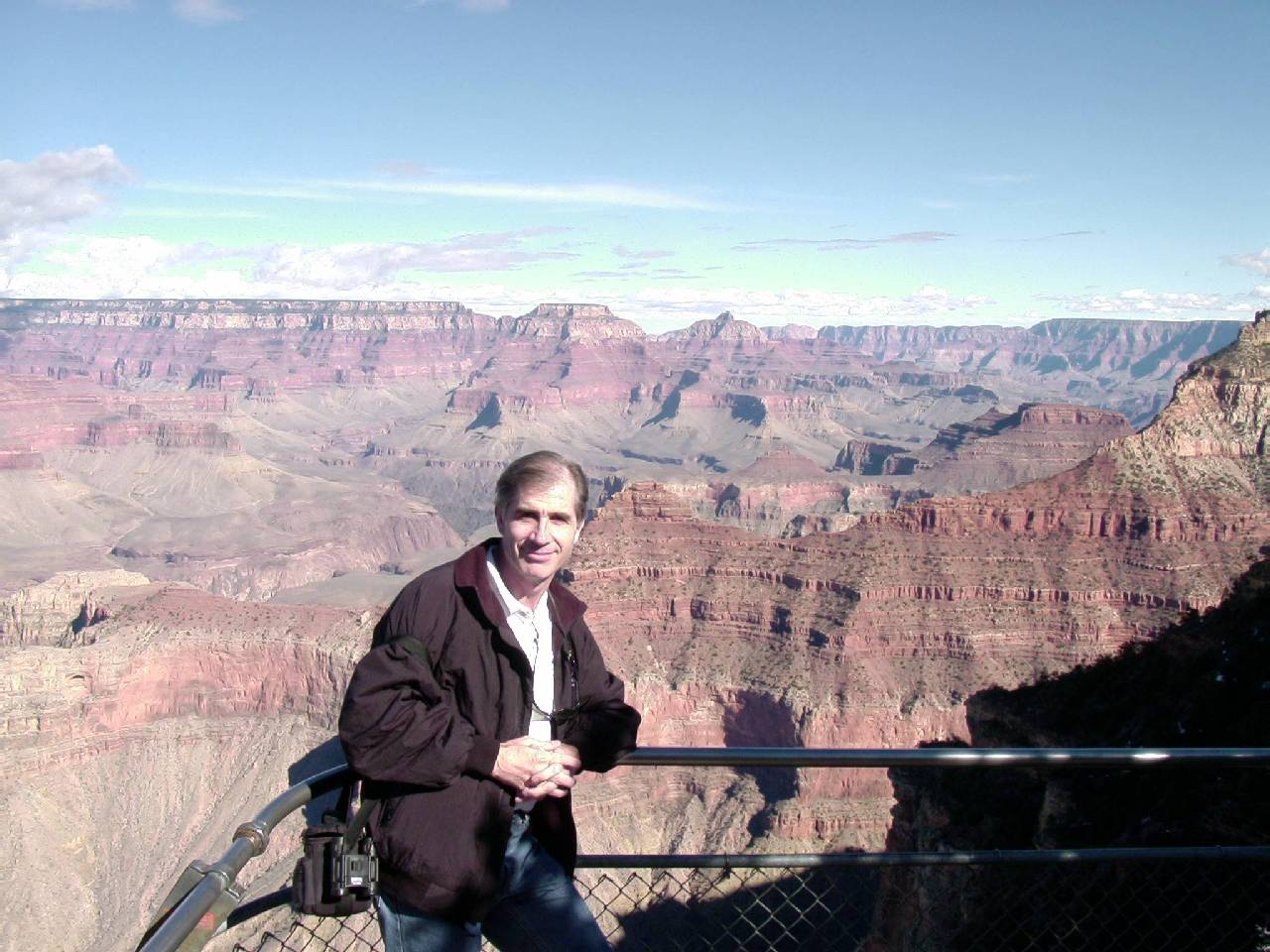
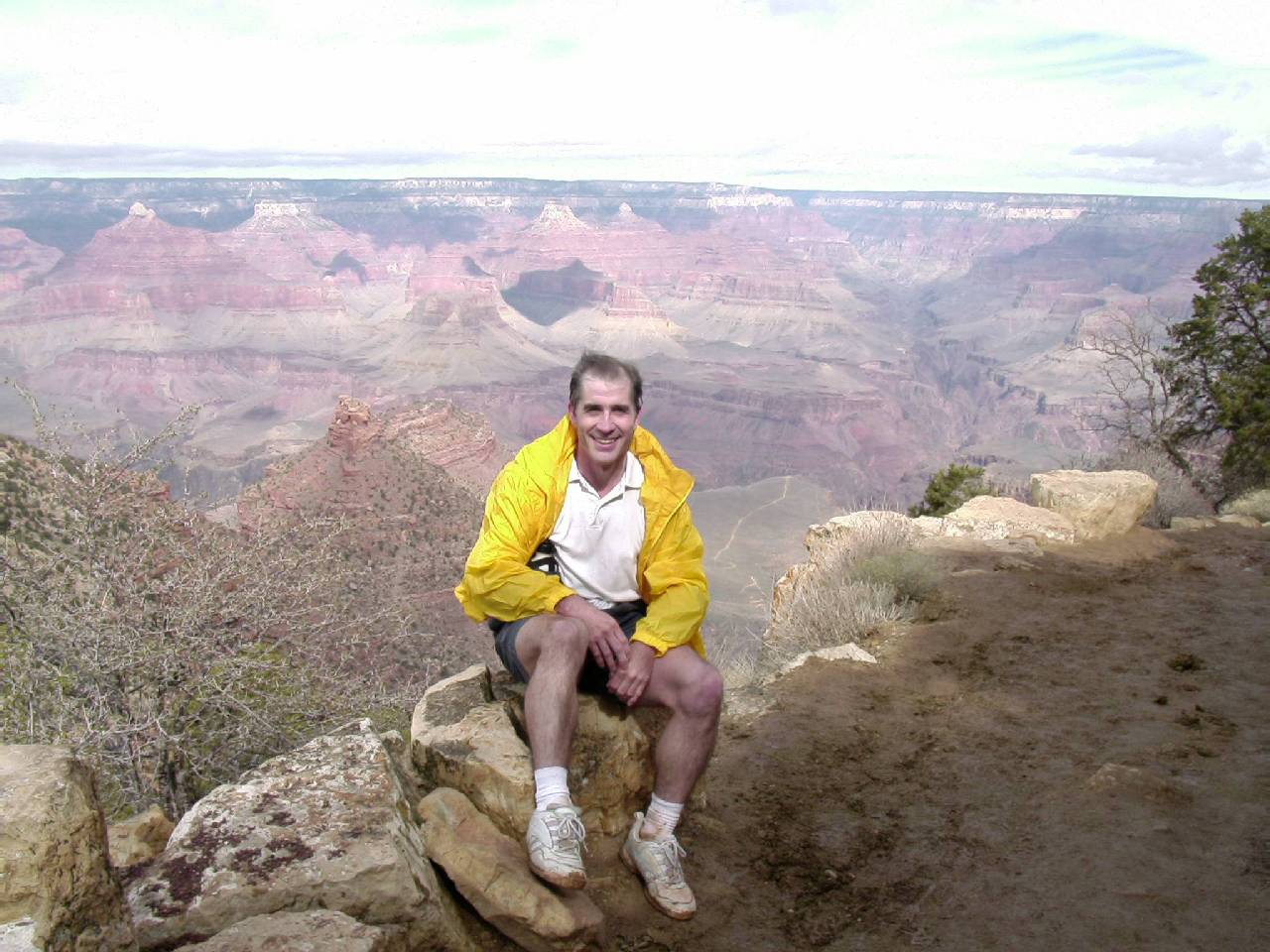
P80461.jpg) Now
it was time to see the bright side. I was thinking how good it was to have
done so much better than I could have imagined. I sat down on one of the
many rocks that line the trail to wait for Ron and Nicole who would surely
arrive in only a few minutes. Sitting there in the wind and no longer exercising,
I was feeling a real chill so I took out my parka to use as a wind breaker.
Suddenly there was Cindy, coming down toward me! What amazing timing and
now we would not have to worry about finding each other. She immediately
asked, "How long have you been there?" She was surprised by my
answer of, "Maybe a minute?" She said I looked like I'd been there
for half an hour and not like someone who had just completed this
long hike. Cindy took this great photo of me on that very rock with the
canyon in the background.
Now
it was time to see the bright side. I was thinking how good it was to have
done so much better than I could have imagined. I sat down on one of the
many rocks that line the trail to wait for Ron and Nicole who would surely
arrive in only a few minutes. Sitting there in the wind and no longer exercising,
I was feeling a real chill so I took out my parka to use as a wind breaker.
Suddenly there was Cindy, coming down toward me! What amazing timing and
now we would not have to worry about finding each other. She immediately
asked, "How long have you been there?" She was surprised by my
answer of, "Maybe a minute?" She said I looked like I'd been there
for half an hour and not like someone who had just completed this
long hike. Cindy took this great photo of me on that very rock with the
canyon in the background.
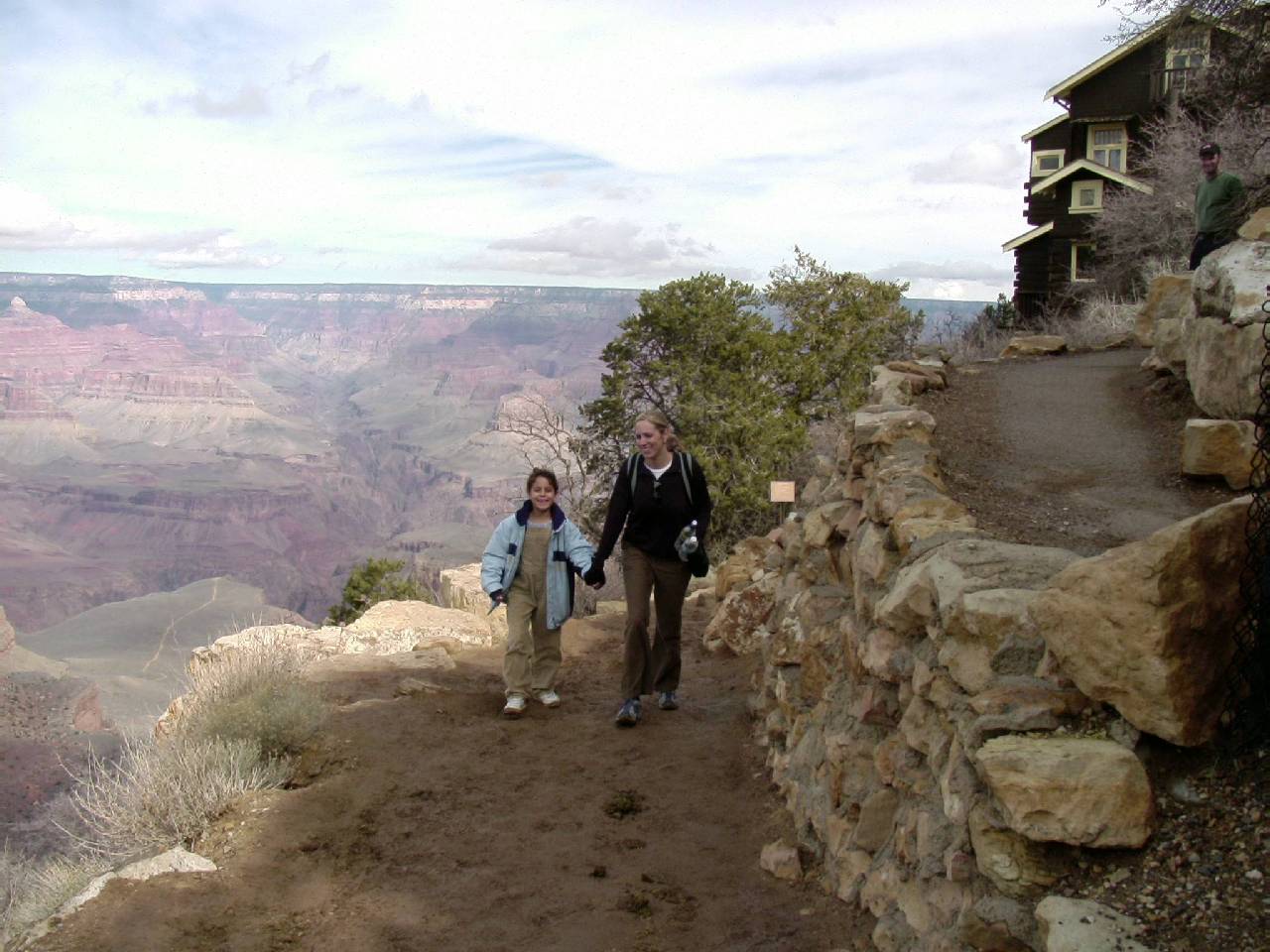
P80462.jpg) After another
two minutes Ron arrived and our adventure was over. I felt great, although
a flight of stairs on the way to the car were a quick reminder that my legs
had taken a beating. This was my fourth day hike to the bottom of the canyon,
and my second best. Walking to the car there was no question of whether
I would do it again. It was a simply a question of when.
After another
two minutes Ron arrived and our adventure was over. I felt great, although
a flight of stairs on the way to the car were a quick reminder that my legs
had taken a beating. This was my fourth day hike to the bottom of the canyon,
and my second best. Walking to the car there was no question of whether
I would do it again. It was a simply a question of when.
Ron's viewpoint is different from mine. His attitude is, "Been there,
done that." He has no interest in doing it again unless it's a new
trail - which means the North Kaibab Trail. For myself, I love nearly every
step (there are some exceptions – especially those near the end) of
the hike. As I grow older I must treasure these opportunities. It takes
a lot of preparation to make this otherwise potentially deadly hike into
a safe adventure. You just can't decide to go one day you're going to do
it right then and there. You have to decide months in advance and then go
through a rigorous training regiment. If you don't you might just end up
having an ordeal and not a nice little adventure!
The Graphical View of the Hike
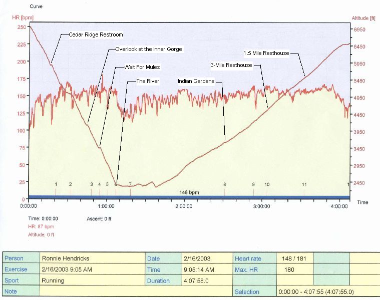
The jagged line indicates Ron's heart rate for the 4+ hour "adventure."
The checkpoints:
1) Just after Cedar Ridge at the first switchback on the face of O'Neill
Butte. The straight line just before this point shows our stop at Cedar
Ridge.
2) Start of the Long Switchbacks section.
3) The Great Curve.
4) Wait for a mules.
5) Overlook of the river area between Kaibab Bridge and Silver Bridge.
6) Into the tunnel and onto the Kaibab Bridge.
7) Over Silver Bridge.
8) Indian Garden.
9) Start of the switchbacks and the steep climb section of the Bright
Angel Trail.
10) 3-mile resthouse.
11) 1 and a half mile resthouse.
12) Finished!
It was not surprising to me that the descending line was essentially
straight, indicating a constant level of descent. What was very surprising
was the ascending line was also fairly straight! I am very certain we were
slowing down as we got to the steeper section of the trail, but apparently
our rate of descent was still a constant. Finally, you can see from the
slopes that our rate of descent was a little better than twice the ascent.