Grand Canyon 2002
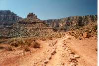
South Kaibab Trail
Click on the pictures to view it full size
It has been over eight years since my
last visit to the canyon. I have done the canyon twice and both those
hikes were down and up the South
Kaibab Trail in only a few hours. This hike would follow those same
footsteps, but different in two respects. First, I would have a companion
joining me. This was Ron who is an active marathon runner so I was confident
he would have the endurance. But second, I was now eight years older.
Our plan was to be at the top of the Kaibab trail head on early Sunday
morning at either 6:00, 7:00, or 8:00 depending on the weather forecast.
8:00 would be the best time from the photography point of view and 6:00
would be the best from the viewpoint of temperature. Two days before the
trip the weather report looked moderate so 7:00 was a good compromise.
The problem with such an early start means leaving Phoenix approximately
five hours earlier. Leaving at 2:00AM meant not getting a lot of sleep.
I thought I could get in a couple of naps, but this proved almost impossible.
I kept thinking of the pending hike and whether I had all the necessary
preparations. I finally got to sleep at 10:30 and awoke with my alarm at
1:00. Ron arrived at the house at 1:40, 20 minutes early, but I was ready
set to go and anxious to get going. He transferred his gear to my car while
I said goodbye to Cindy. We were on our way with the road mostly to ourselves.
We used to figure four and a half hours for travel (if you didn't stop),
but since that time the speed limit has gone from 55 to 75. We arrived in
Flagstaff at 3:50 where we planned to eat a big breakfast. It turned out
we were too early for most of the usual breakfast restaurants like Village
Inn and Perkins. Luckily there was a Denny's which is open 24 hours, and
fortunately we were able to get a table because the place was packed! Our
guess was the crowd was mostly students from nearby Northern Arizona University
which is only walking distance away. While we were briefly waiting for a
table, a more elder man (Mexican/Indian) with shaggy hair and unclean clothes
walks right by us (almost as if he went out of his way to get close to us)
saying, "I'm going to the bathroom," in a tone slightly more audible
than a mumble. Me and Ron just looked at each other both thinking, "We
are at Denny's and it is four o'clock in the morning." Twenty minutes
later well after we had started our meal he finally emerged from the restroom.
Me and Ron may have looked equally odd both wearing shorts with the temperature
at 35 degrees.
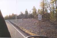
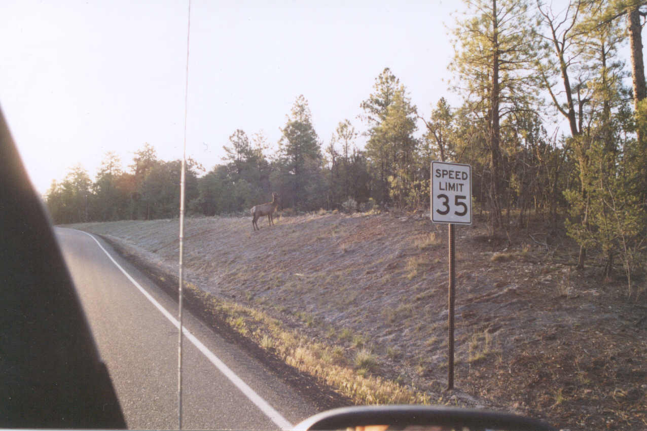
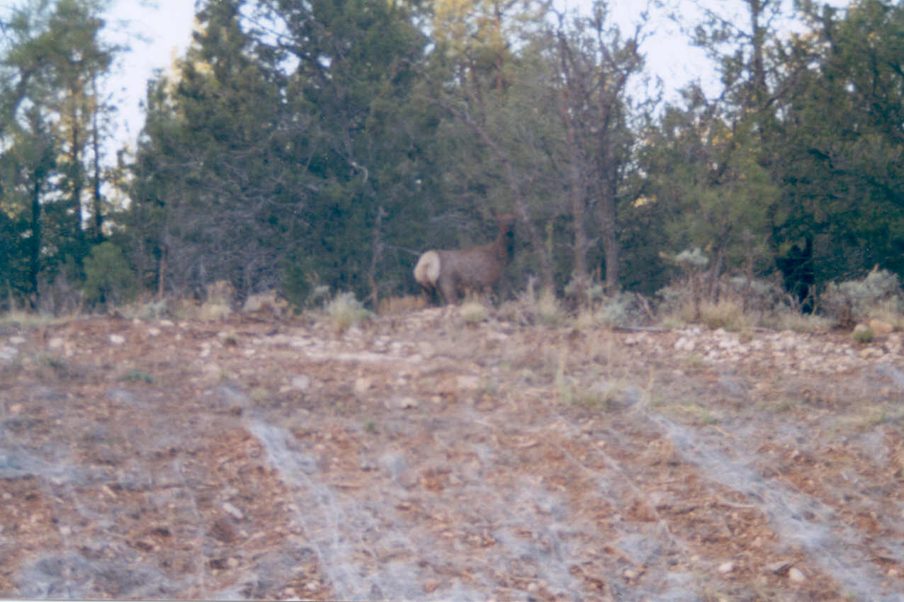
 Before
hitting Flagstaff there were signs warning of Elk. The first sign said Watch
for Elk, 25 miles. The next, 20 miles, then 15 miles, and so forth. But
before the 10 mile mark there was a temporary light sign (the kind they
usually use to warn drivers of construction ahead) warning about the elk.
With this sign I took the warnings very seriously, but we made it to Flagstaff
without seeing a single one. I joked to Ron that this was all false advertising.
"I was promised 25 miles of elk and there weren't any!" It was
too early in the morning so the Flagstaff Chamber of Commerce was probably
not open so we couldn't drop in the file a complaint. ;) But outside of
Flagstaff heading north to the canyon things were bit more serious. Every
half mile it seemed there were one or two elk along the side of the road
or crossing! Ron was driving at this point and he drove with considerable
care as it was only twilight at this point without great visibility. Interestingly,
there were no signs on the road warning about the elk!
Before
hitting Flagstaff there were signs warning of Elk. The first sign said Watch
for Elk, 25 miles. The next, 20 miles, then 15 miles, and so forth. But
before the 10 mile mark there was a temporary light sign (the kind they
usually use to warn drivers of construction ahead) warning about the elk.
With this sign I took the warnings very seriously, but we made it to Flagstaff
without seeing a single one. I joked to Ron that this was all false advertising.
"I was promised 25 miles of elk and there weren't any!" It was
too early in the morning so the Flagstaff Chamber of Commerce was probably
not open so we couldn't drop in the file a complaint. ;) But outside of
Flagstaff heading north to the canyon things were bit more serious. Every
half mile it seemed there were one or two elk along the side of the road
or crossing! Ron was driving at this point and he drove with considerable
care as it was only twilight at this point without great visibility. Interestingly,
there were no signs on the road warning about the elk!
The sun rose at 5:33 by my watch and by 6:00 we hit the village of Tusayan
which is just outside the south entrance to the Grand Canyon. There are
a couple of restaurants there, but it used to be there was only the McDonalds.
I am not kidding: they used to charge two dollars for a hamburger! We didn't
need to stop to find out what they were charging for an Egg McMuffin.
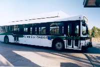
We faced another change since I last visited. They no longer allow cars
on the roads to the lookouts since the traffic got too great. There is a
nice parking lot at the South Kaibab trail head, but only employees may
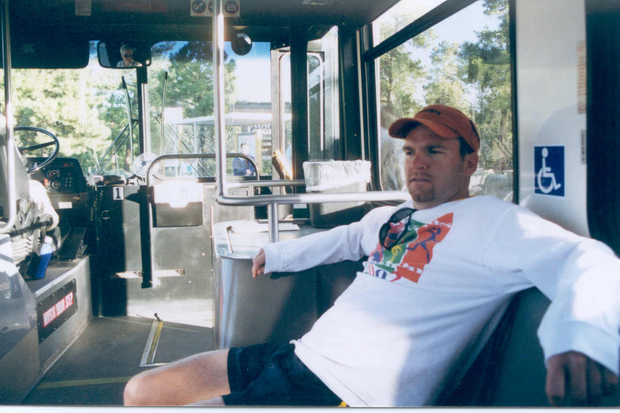
now park. You now must use one of the inner parking lots and take a shuttle
bus. It turns out this is a very good system, but it caused me some anxiety
since I knew we would have to transfer buses to get to the trail head and
this would invariably add time. I had investigated and printed bus routes
and their stops on the internet so we knew where there would be good spots
to park.
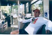
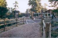
 With all our gear for the hike
prepared, we were ready for the next bus. We had surprising difficulty finding
a restroom, however, because everything was closed being so early in the
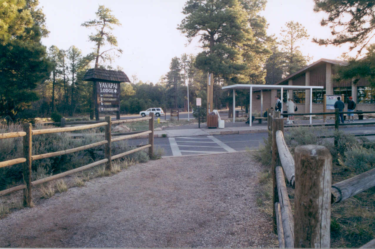
morning. We eventually we found one in the Yavapai Lodge. This is not a
huge concern because there are two restrooms on the trail. To get to the
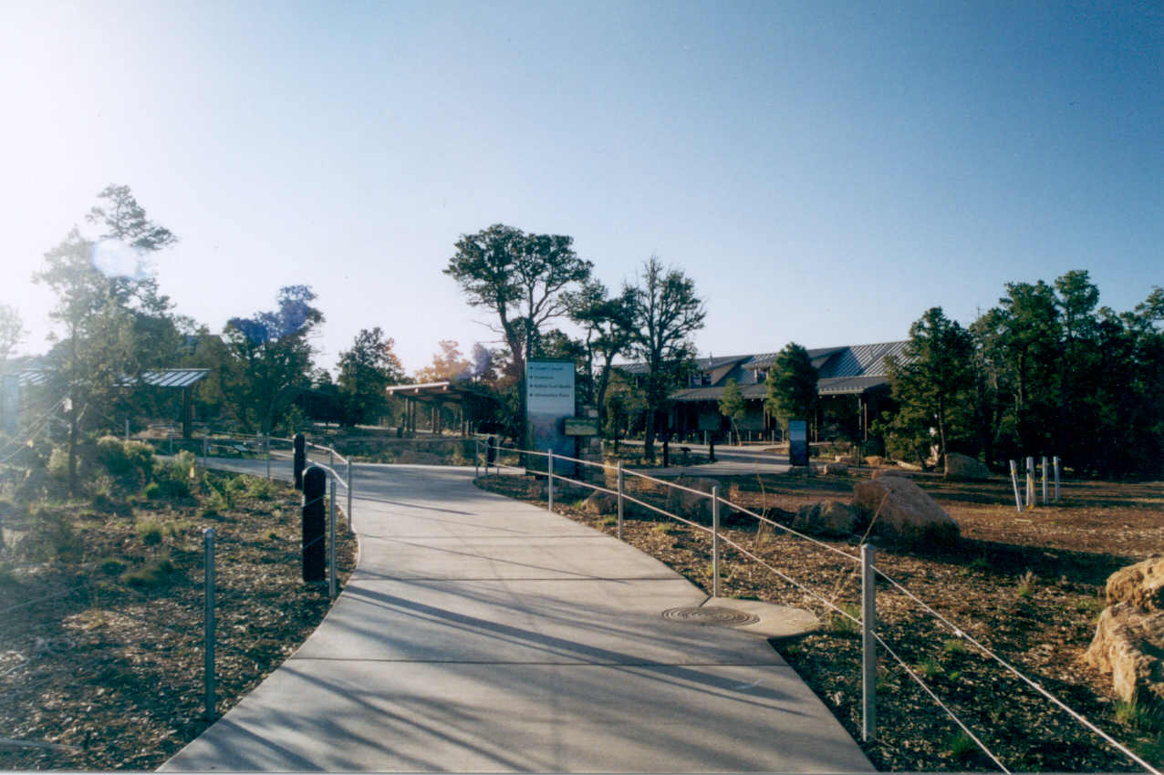
Kaibab trail head, you first take a bus to the visitors center which you
had to walk across to pick up the next bus. The visitors center, of course,
was not open due to the earliness of the hour!
With all our gear for the hike
prepared, we were ready for the next bus. We had surprising difficulty finding
a restroom, however, because everything was closed being so early in the
morning. We eventually we found one in the Yavapai Lodge. This is not a
huge concern because there are two restrooms on the trail. To get to the
Kaibab trail head, you first take a bus to the visitors center which you
had to walk across to pick up the next bus. The visitors center, of course,
was not open due to the earliness of the hour!

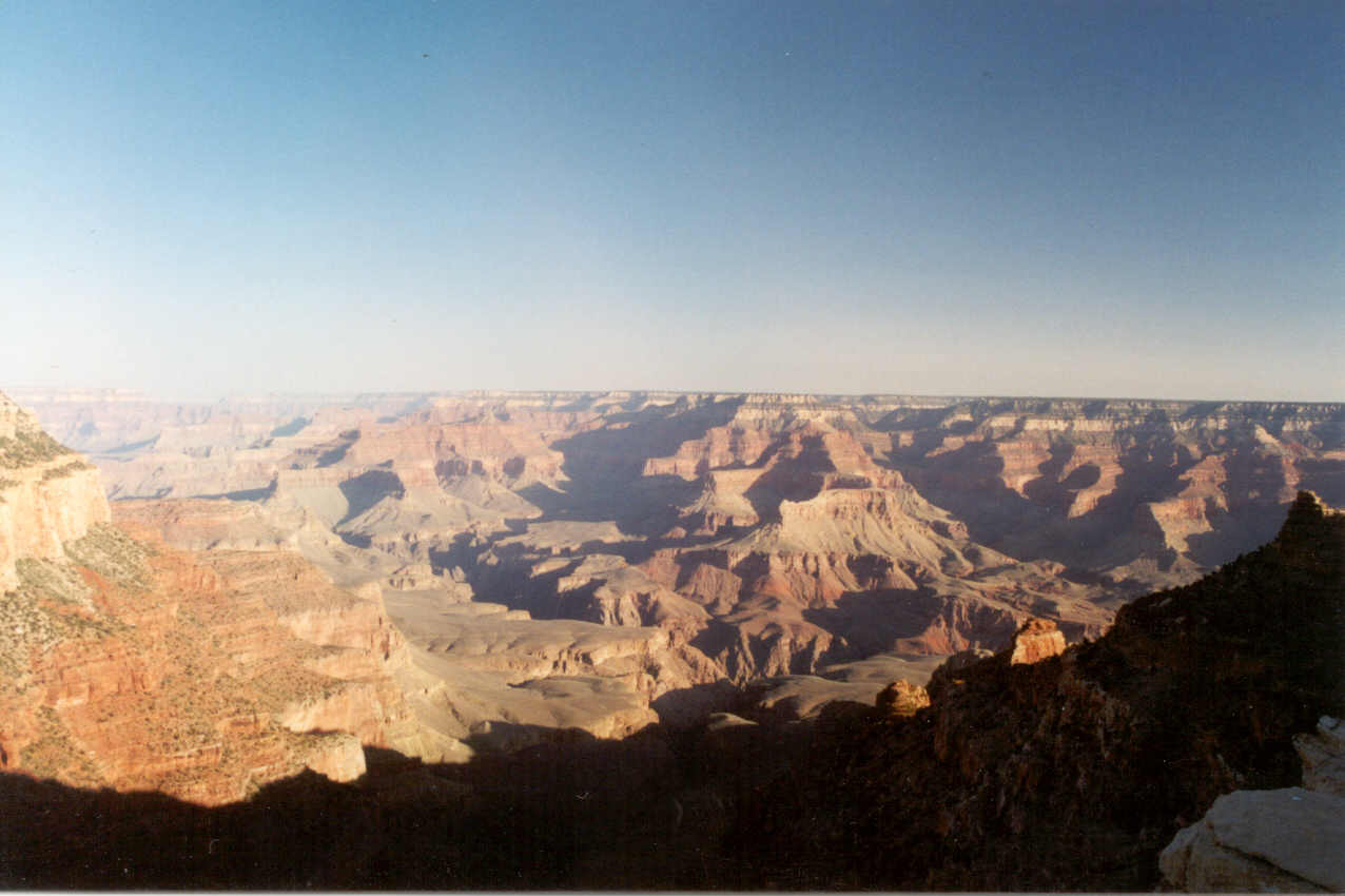
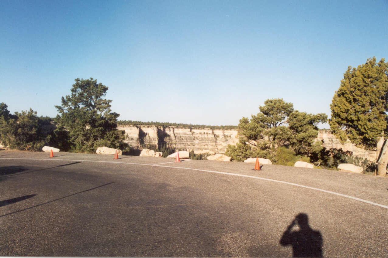
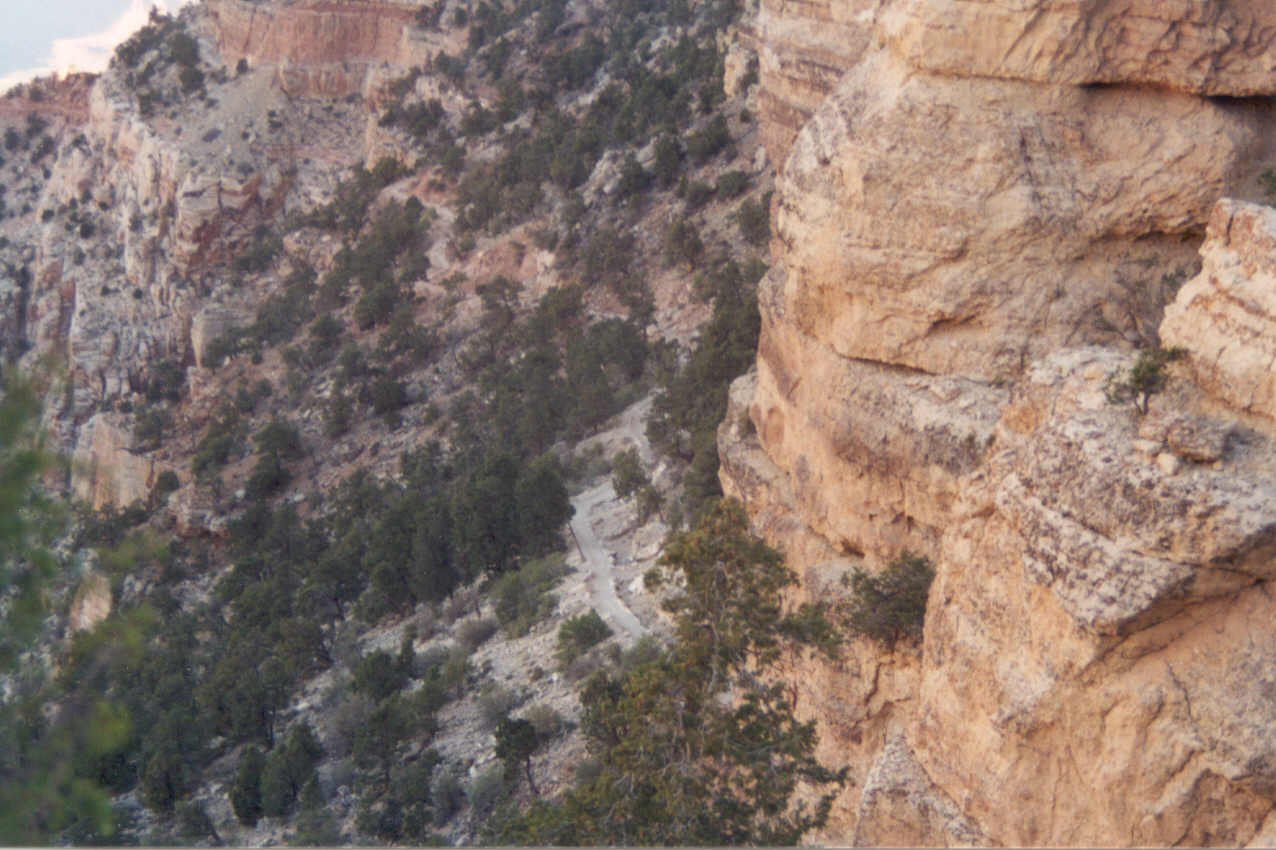
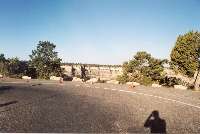
 It did not occur to me that the
road to the trail would go very near the rim before the turnoff. Suddenly
I could see this beautiful view of the canyon and I did not expect the sight.
This removed any fear of bad visibility we'd have on our hike. At 6:45 we
pulled into a deserted Kaibab Trail parking lot. There were a total of four
of us on the bus, and only me and Ron were getting off to do a hike. Both
bus drivers were very friendly and the last one gave her seal of approval
wishing us well on our hike and adding that she thought the Kaibab Trail
was the best in the canyon.
It did not occur to me that the
road to the trail would go very near the rim before the turnoff. Suddenly
I could see this beautiful view of the canyon and I did not expect the sight.
This removed any fear of bad visibility we'd have on our hike. At 6:45 we
pulled into a deserted Kaibab Trail parking lot. There were a total of four
of us on the bus, and only me and Ron were getting off to do a hike. Both
bus drivers were very friendly and the last one gave her seal of approval
wishing us well on our hike and adding that she thought the Kaibab Trail
was the best in the canyon.

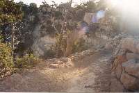
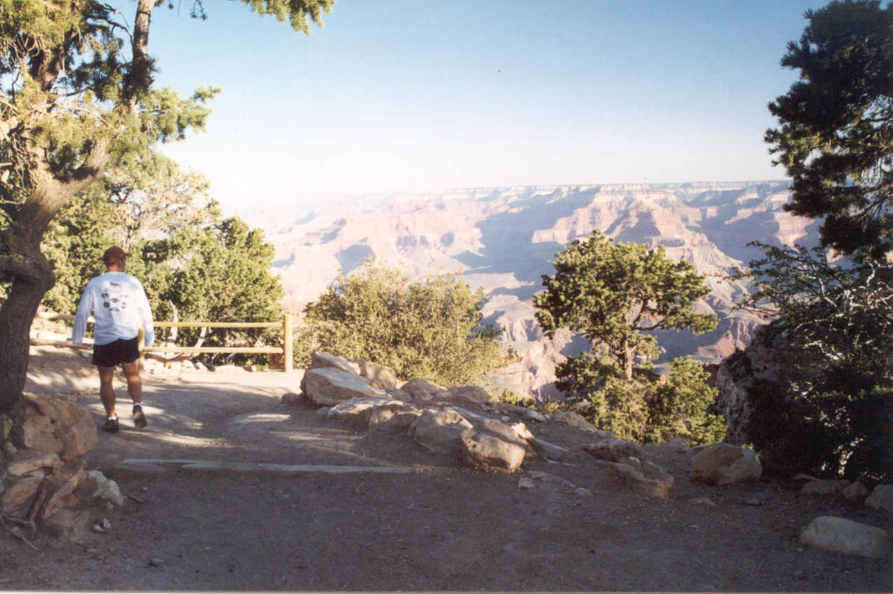
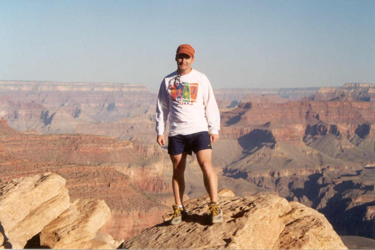
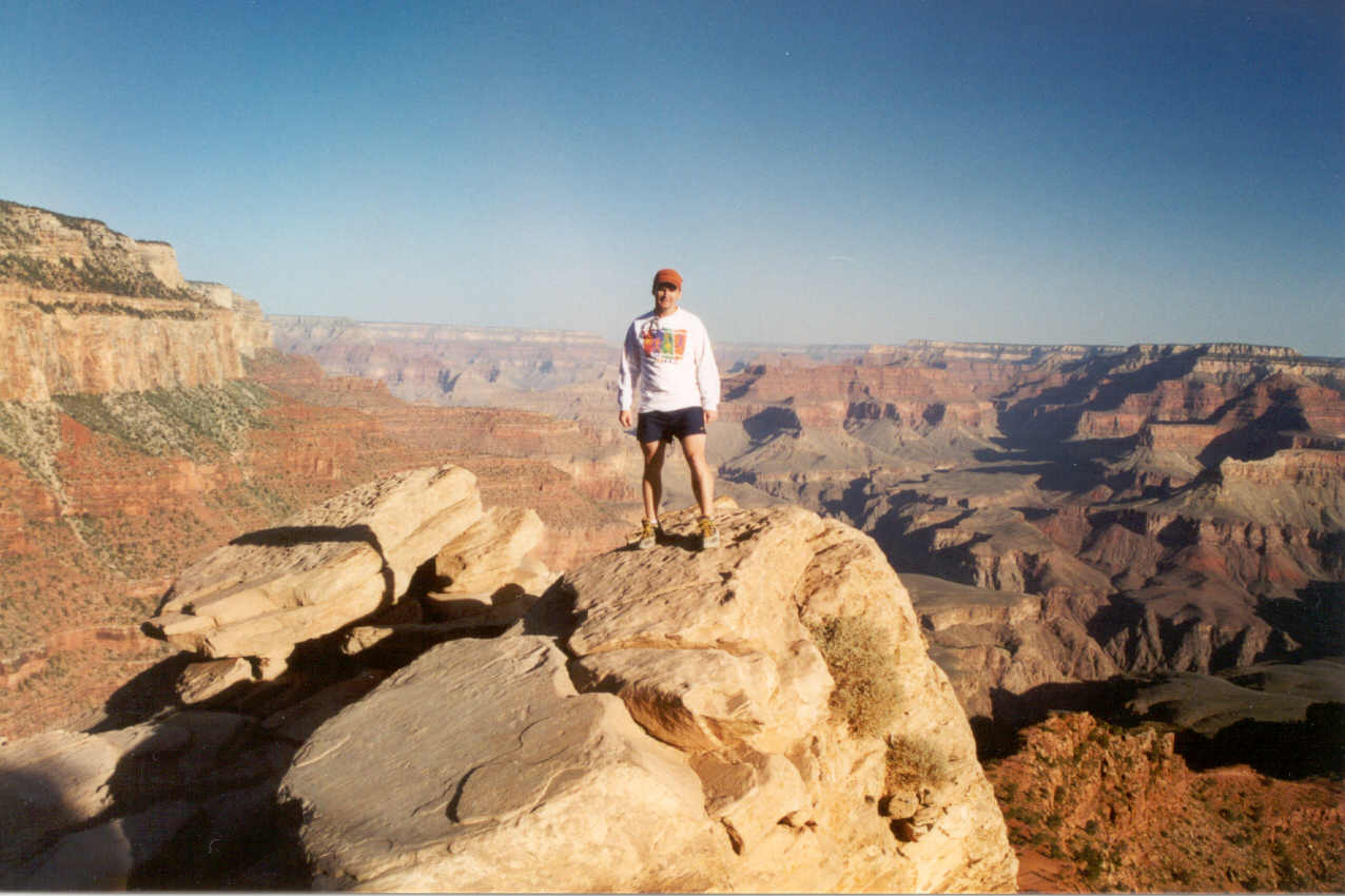
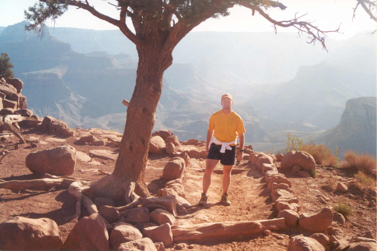
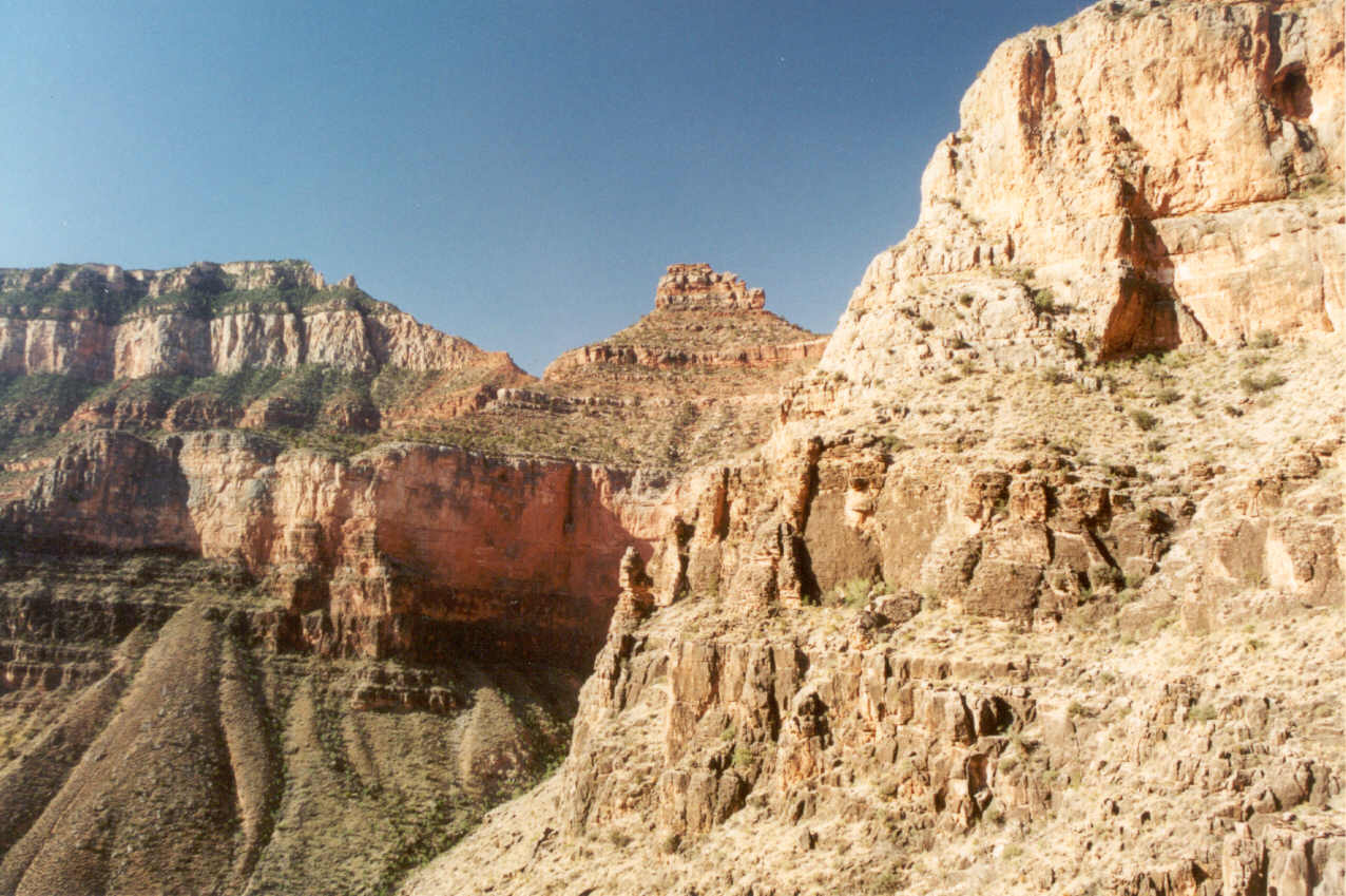
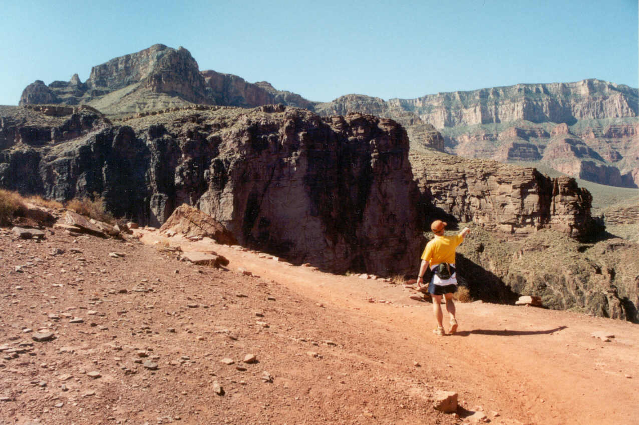
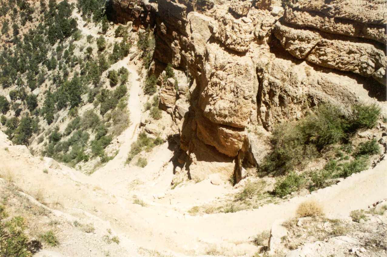
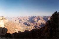
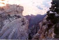
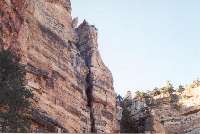
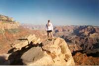
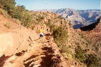
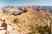
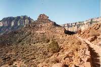
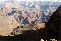
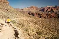
It is hard to describe the excitement me and Ron felt at this moment.
At the end of the parking lot there is an overlook into the canyon which
has been called "The World's Largest Hole," and felt pure awe
in the task before us. From this point we could see some of the trail and
we spotted a couple of hikers well below. The actual trail head starts up
about 150 feet from the parking lot. I really didn't want to start. I wanted
the moment to last. It didn't occur to me at that moment that it felt much
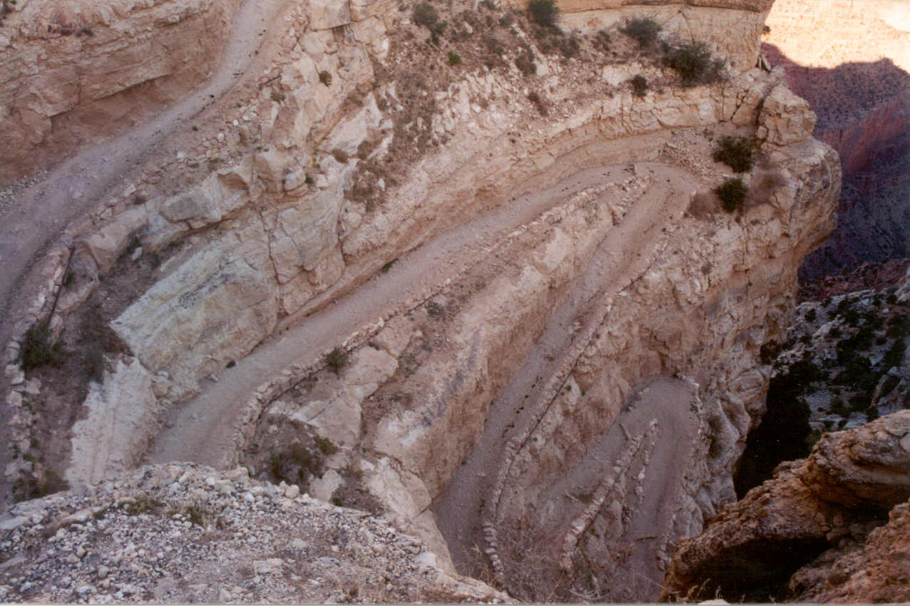
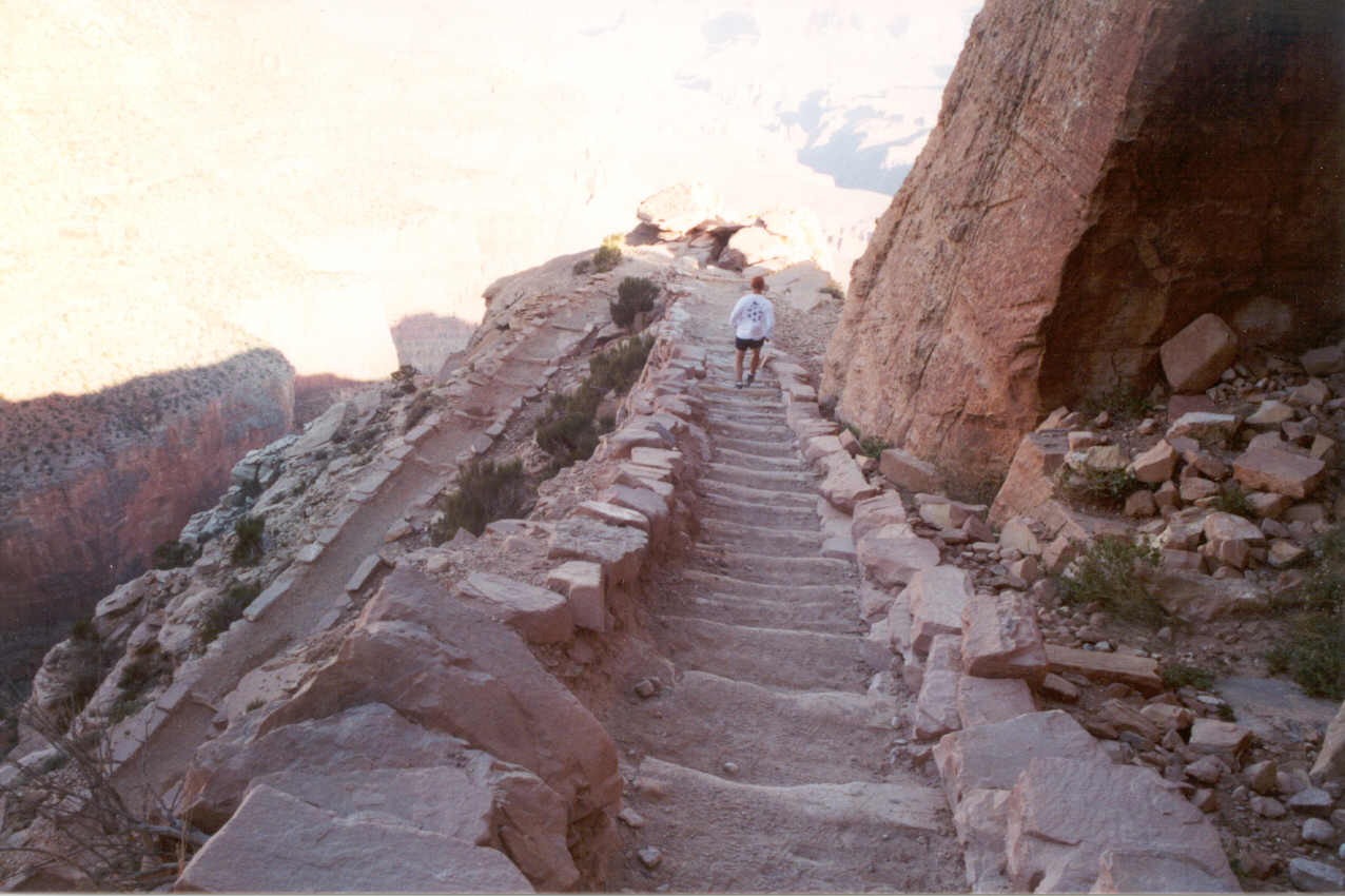
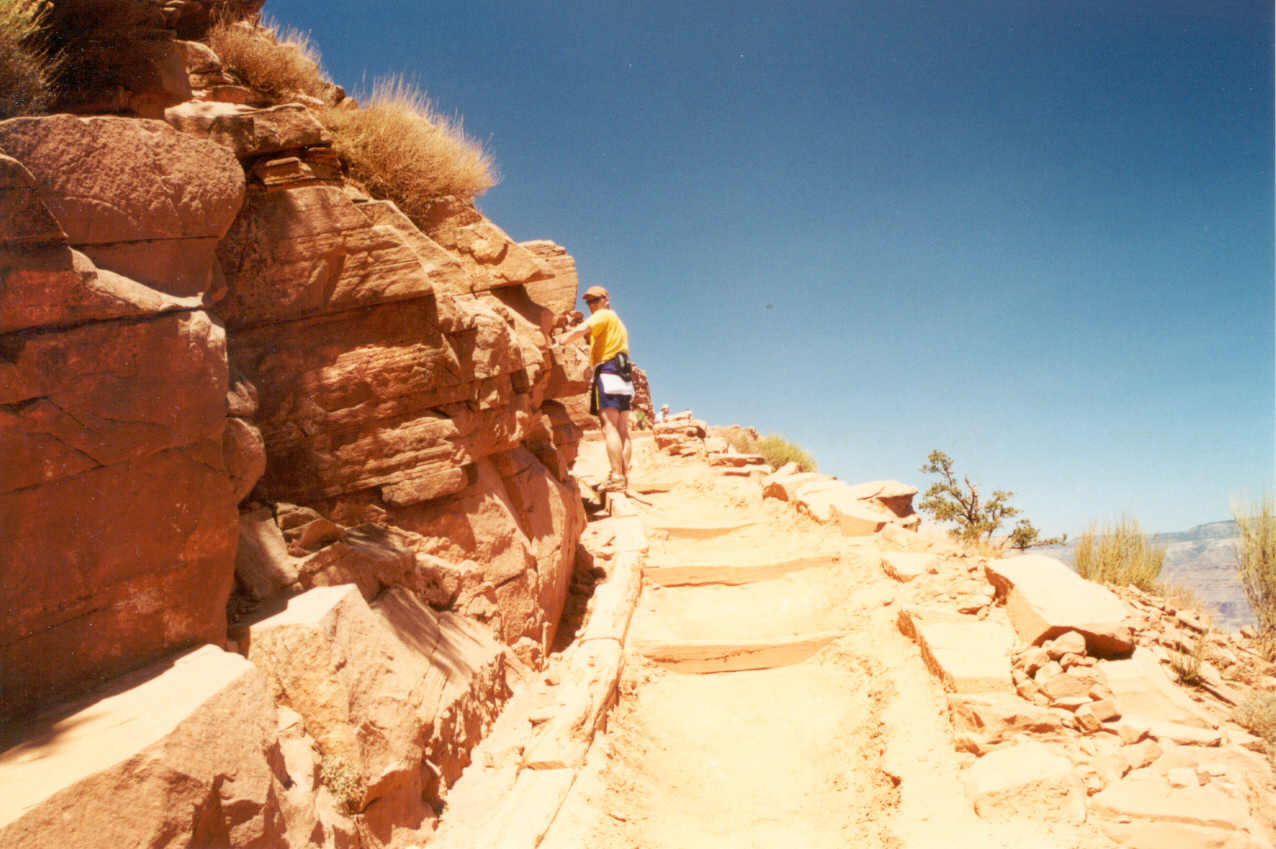
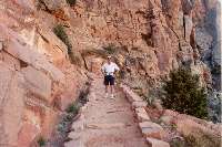
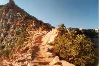
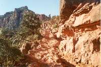
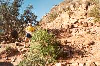
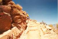
warmer than I expected. My watch read 6:55 and we started down the limestone
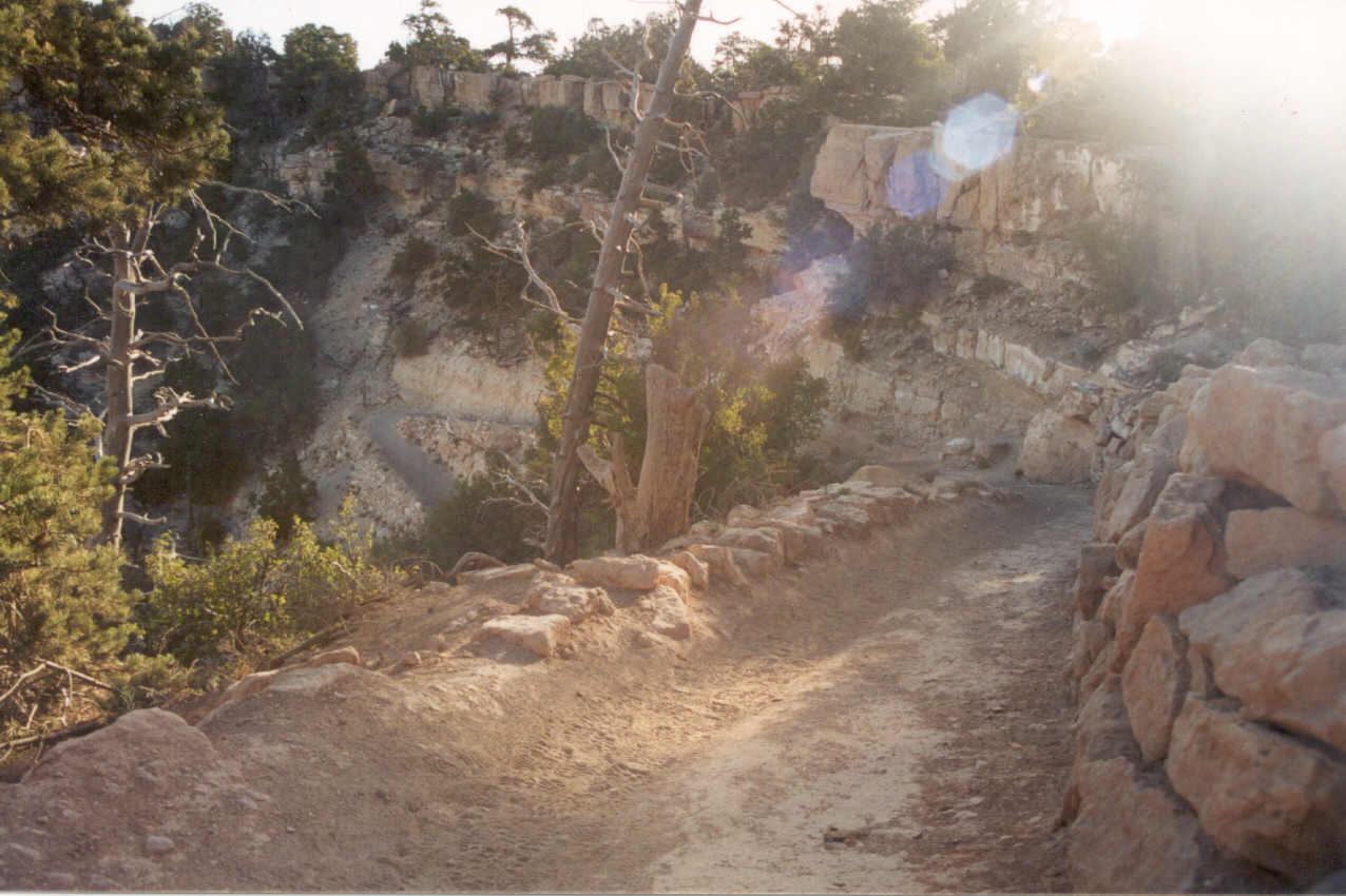
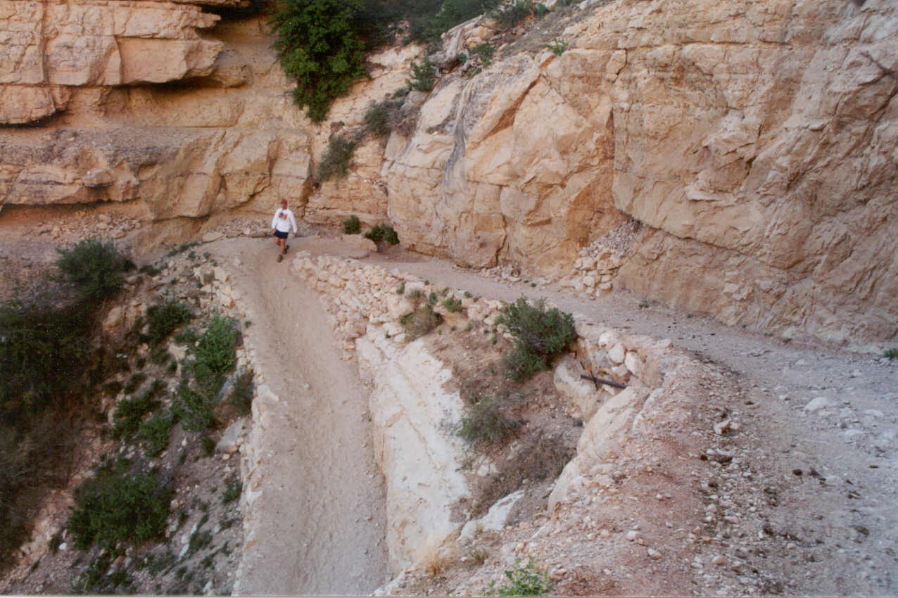
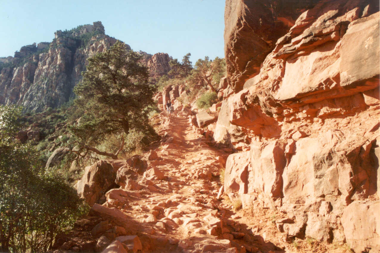
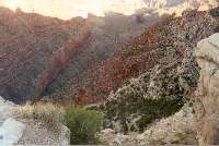
path to the smell of mule dung that mined the path. These are very tight
switchbacks (at least a dozen of them) which hug the canyon wall because
the drop is so vertical. But they end very quickly (as does most of the
mule dropping) and the trail straightens out as it follows the canyon wall
of limestone. In retrospect it this part of the trail was very odd in that
we passed only two hikers so it seemed like we had the whole trail to ourselves.
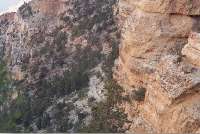
Being shielded by a tall wall of limestone to the east, the first section
of the trail was entirely shaded. It would be in the sun during our return.
Immediately I started thinking about which parts of the trail were familiar
and which seemed totally new. This would continue for the entire descent.
The trail descends over 6 miles to the river which is a lot of trail to
remember. I was determined to not have to depend on memory in the future
which is why I had a camera and enough film for over 100 pictures. After
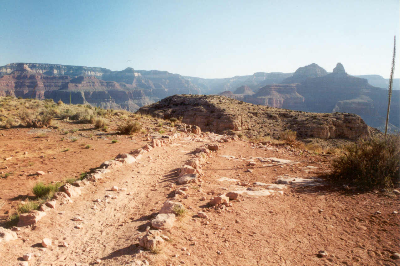
only ten minutes we could see the Cedar Ridge clearing which marks the spot
where they advise all hikers to stop if they're doing a day hike. It seemed
like a long way to get there, but as soon as you can see it, it's not long
before you actually arrive.
When the initial euphoria of starting the hike had ended, I realized
that the temperature was not cold but in fact comfortable. This was not
a good sign. I was really hoping (and expecting noting the weather reports)
that it would be chilly up until we reached Cedar Ridge. I had decided to
go with a single water bottle because the double water holder was too awkward
with the camera. I experimented getting the camera out before the trip and
found it extremely difficult to get it out and put it back. The single holder
was much easier. But in practice even this didn't work. I was taking so
many pictures I just held the camera almost all the time! I could have used
the pouch to hold the extra water bottle. But the decision to use the 35mm
SLR camera over the digital, however, was the correct one. The big problem
with my digital is that it is slow to cycle. It takes 10-12 seconds for
it to get ready after you turn it on or it goes into its energy saving mode.
The 35mm is ready instantly.

Was Ron having a good time? At one point he said, "I can't believe
I've lived here all these years and haven't done this. This is the one of
the best trails in the world and it's right in our backyard!" I remember
vividly looking at the grandeur of the scenery right after he made the comment
and thinking how inadequate a camera is at capturing the experience. But
even the visual does not register the size of the canyon. You can only get
that by actually going into the canyon. I was thinking what a privilege
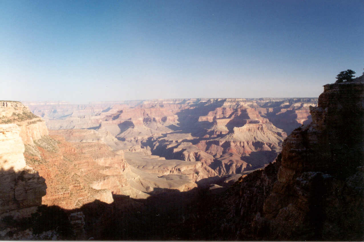
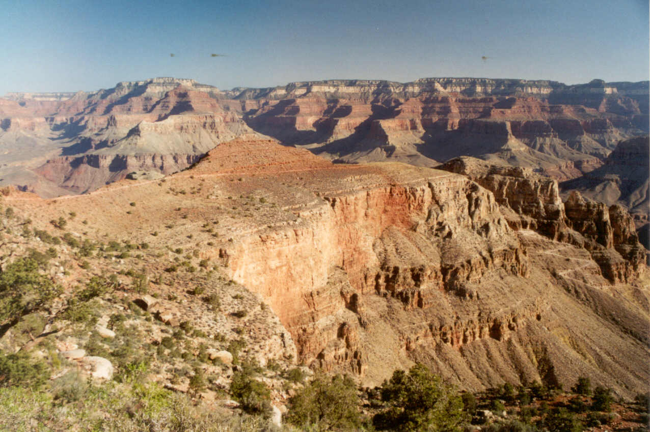
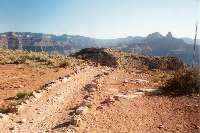
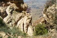
it was that we could do this. The Grand Canyon is a geological marvel. The
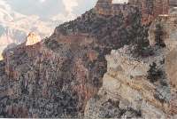
beauty of the canyon is simply the artwork of God. On the Kaibab, when the
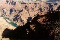
trail breaks from the limestone wall with Yaki Point above, suddenly the
whole canyon is visible. They aptly call this location the Ooh-Aah Point.

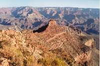

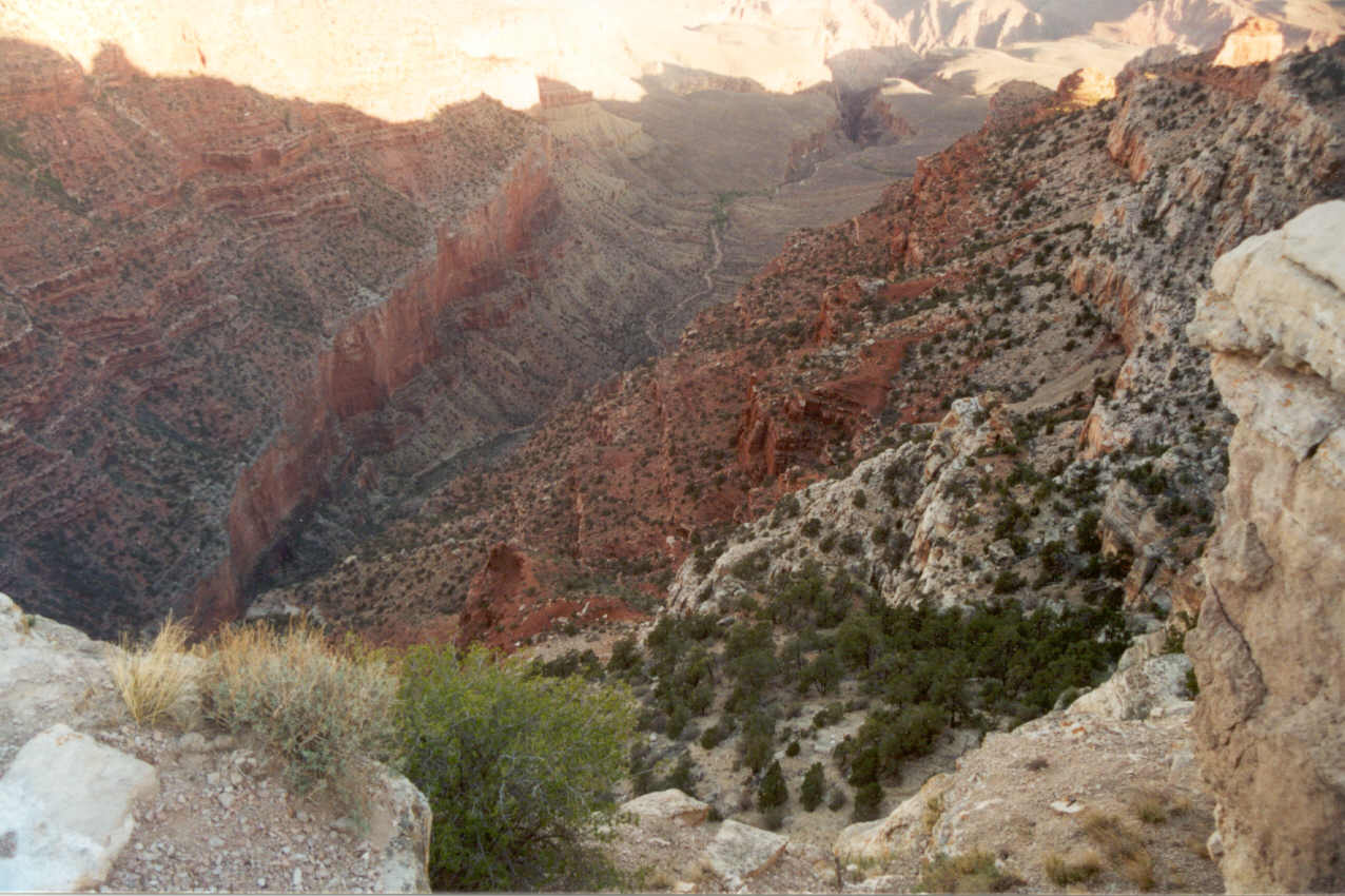
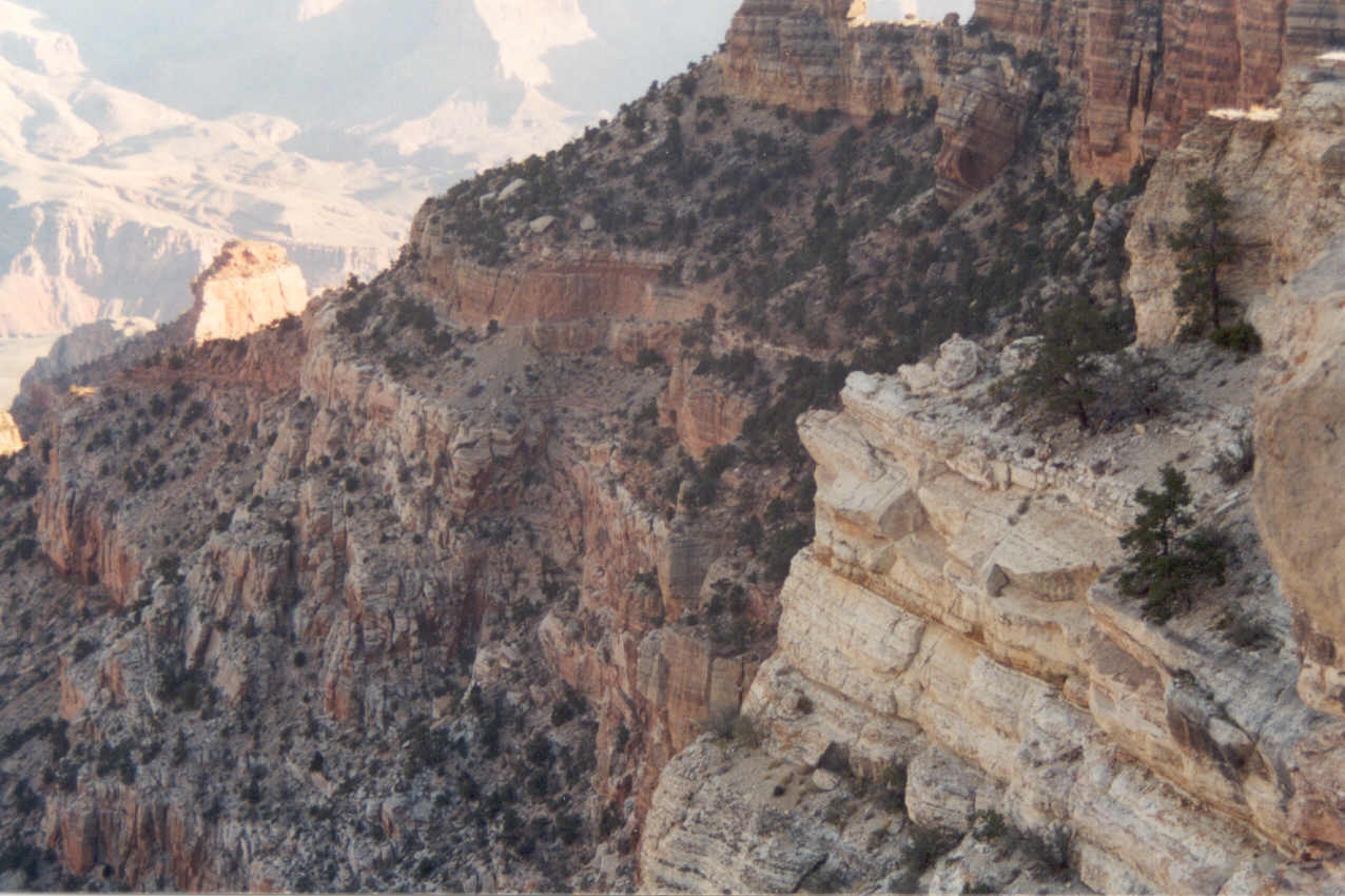
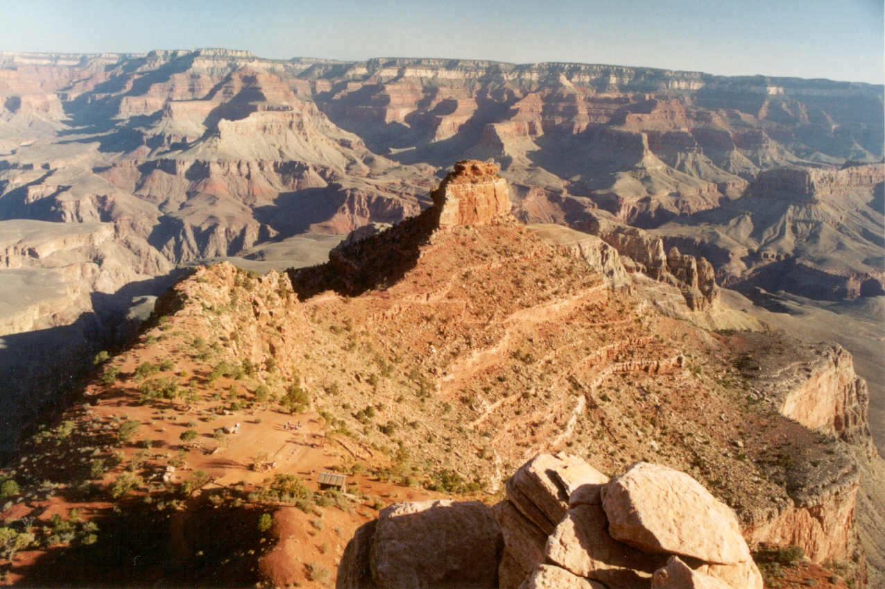
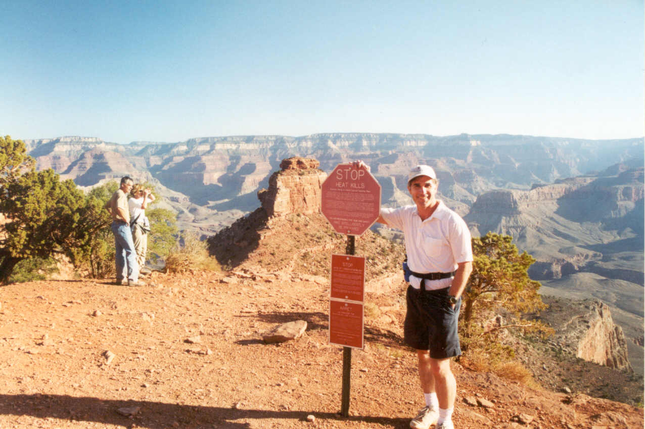
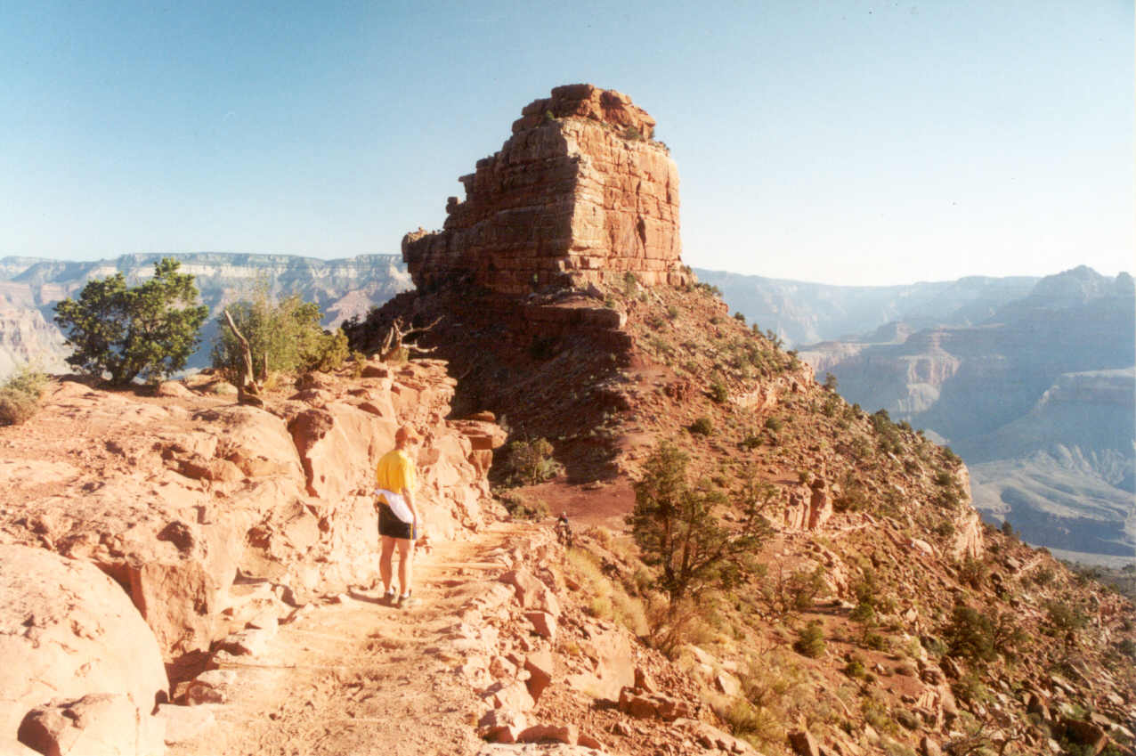
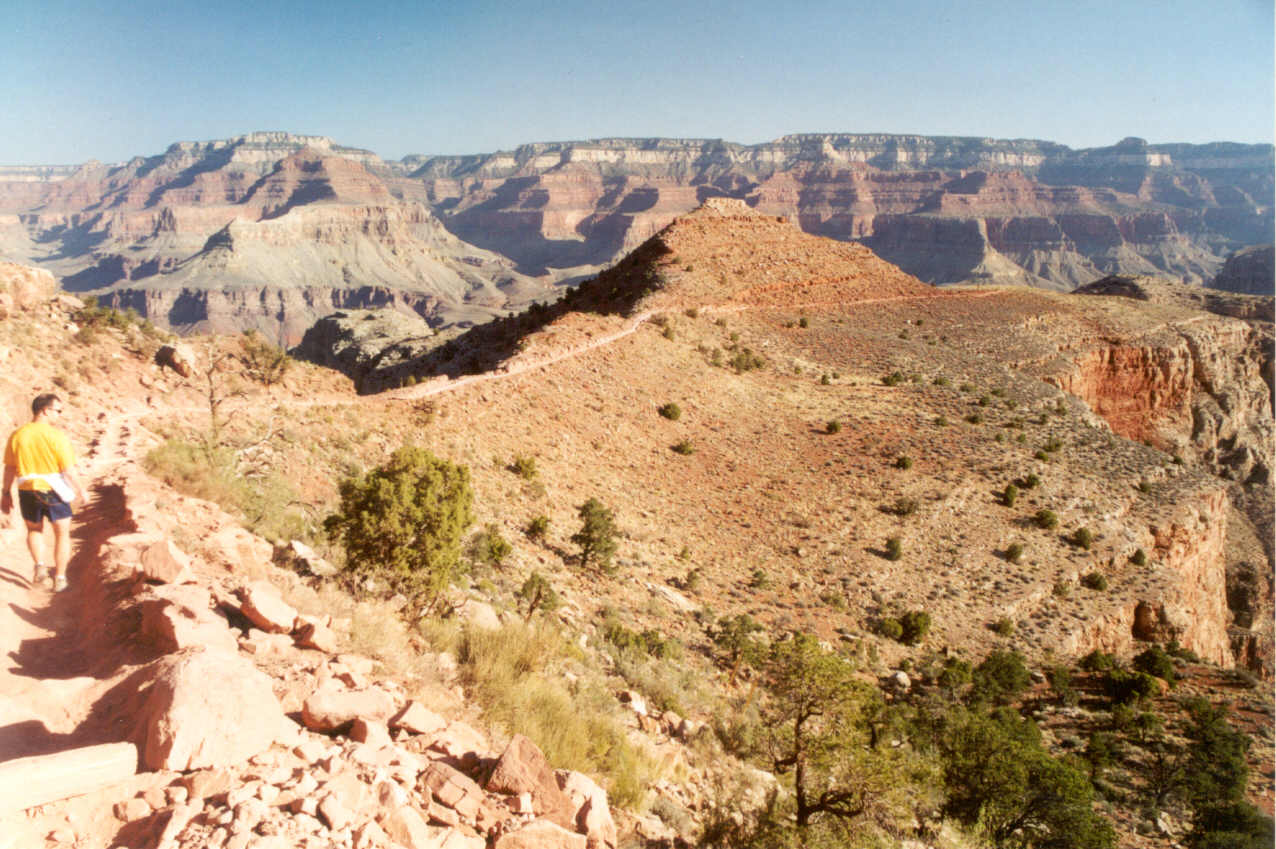
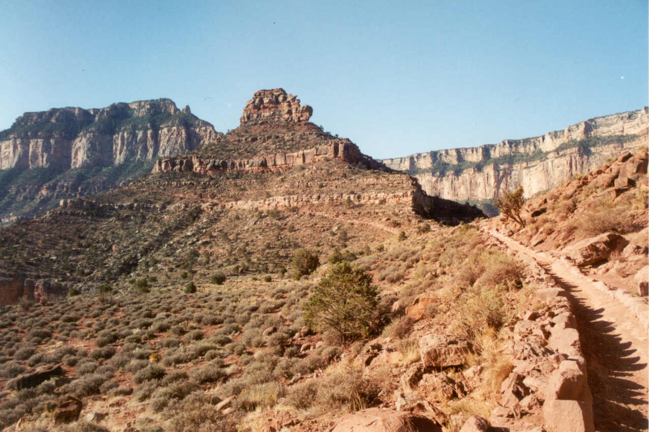
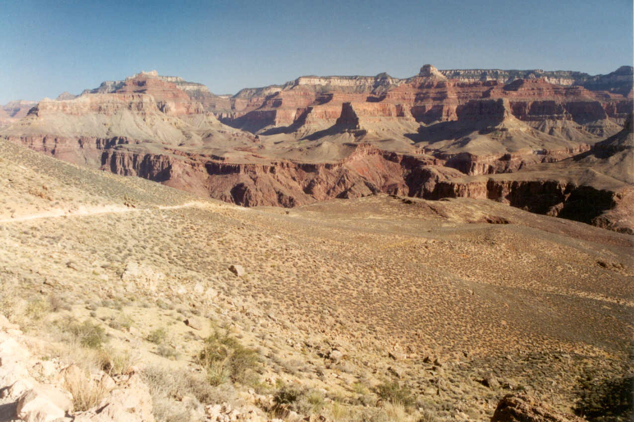
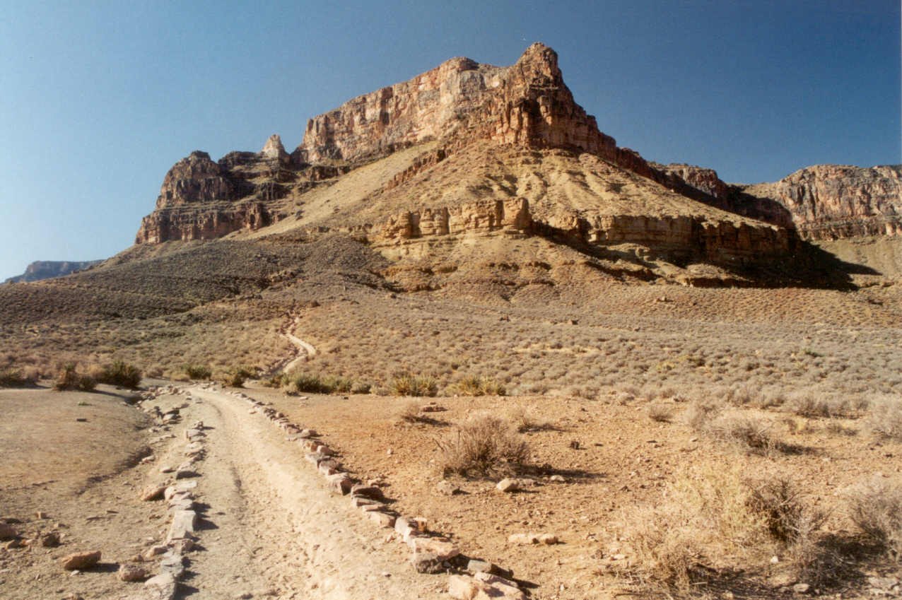
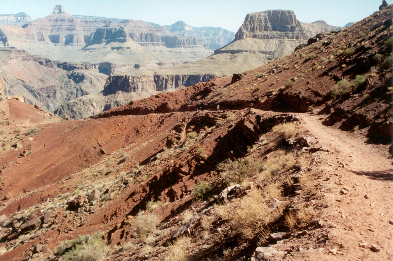
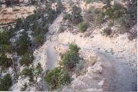
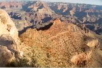
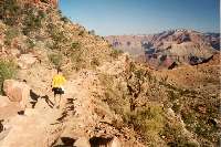
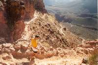
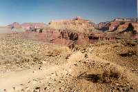
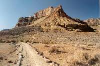
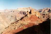
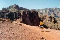
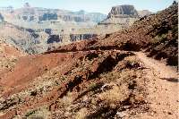
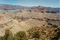
With Cedar Ridge in sight, O'Neill Butte was now in full view. This large
landmark would be visible for almost two-thirds of the trip and would allow
us (if we're paying attention) to give us a reference where we were at during
the hike. On one of the photo stops above Cedar Ridge I pointed out how
you could see the trail wrap around O'Neill Butte and see the lower switchbacks.
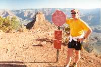
Minutes later we arrived at this stopping point and both posed in front
of the "Heat Kills" sign. I did not need to be convinced of this.
I was thinking in my mind that this location might be a very welcome sight
on the way up. They recommend Cedar Ridge as the stopping point for anyone
doing a day hike into the canyon. It is only 1000 feet of descent (out of
4800 if you go to the river) and only 1.5 miles which is less than a fourth
of the distance.
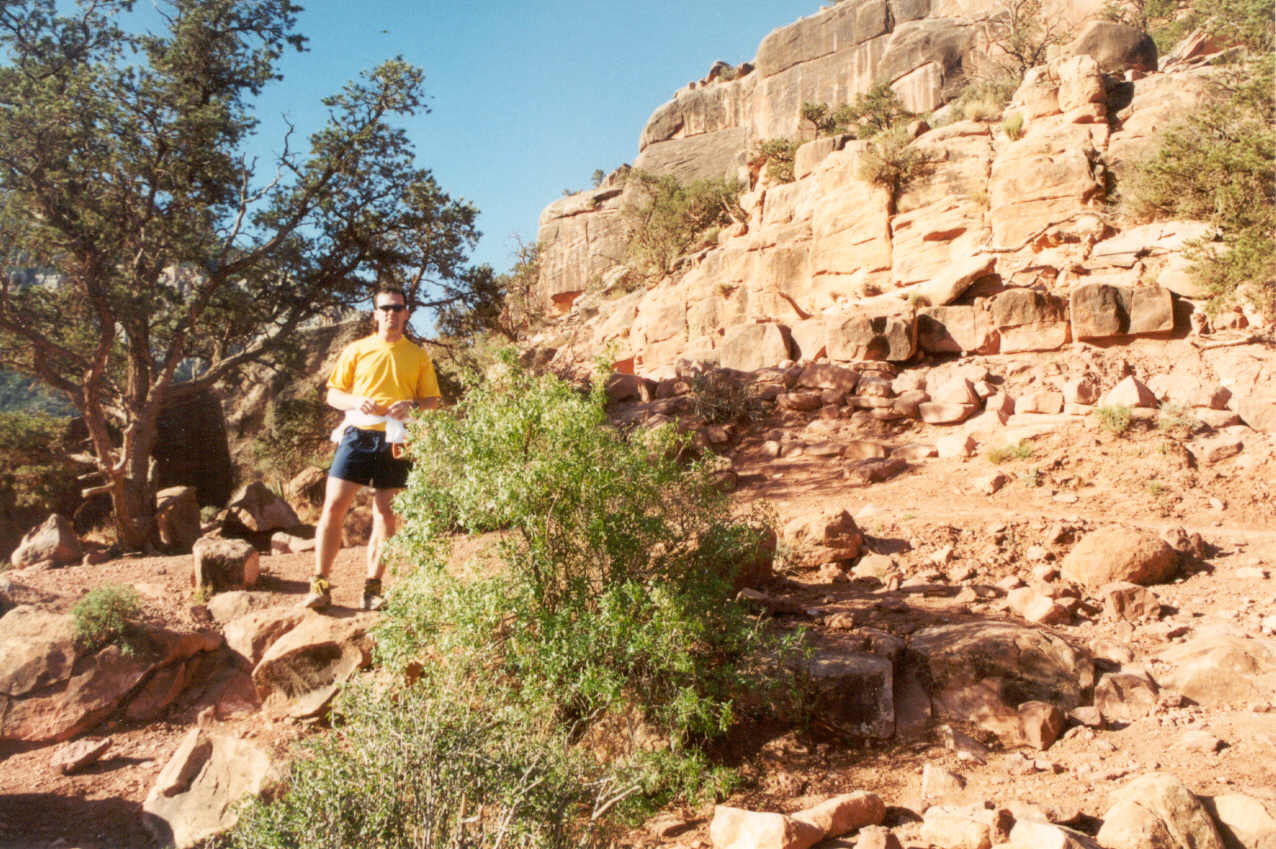
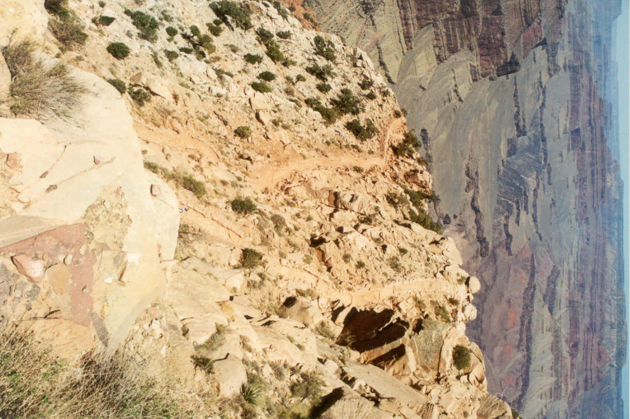
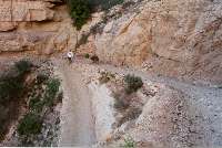
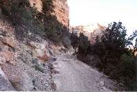
 The trail below Cedar Ridge
is long and relatively straight with only a few curves as it wraps around
O'Neill Butte. This is where the trail for me becomes somewhat surreal.
Ron said later this was where he started to realize how far this trail was.
We had already gone so far and we weren't even a third of the way there.
From the top of the trail to Cedar Ridge we seemed to have the canyon to
ourselves. But from here on out I was surprised by the number of people.
I would estimate we passed two to three times the number I'd encountered
in my previous three hikes. Almost without exception the hikers were very
friendly. Everyone could see me and Ron were moving fast and they parted
the waters for us. The only exception to this was a middle aged lady on
her way out who was obviously very tired because she was breathing
hard and really concentrating on the trail.
The trail below Cedar Ridge
is long and relatively straight with only a few curves as it wraps around
O'Neill Butte. This is where the trail for me becomes somewhat surreal.
Ron said later this was where he started to realize how far this trail was.
We had already gone so far and we weren't even a third of the way there.
From the top of the trail to Cedar Ridge we seemed to have the canyon to
ourselves. But from here on out I was surprised by the number of people.
I would estimate we passed two to three times the number I'd encountered
in my previous three hikes. Almost without exception the hikers were very
friendly. Everyone could see me and Ron were moving fast and they parted
the waters for us. The only exception to this was a middle aged lady on
her way out who was obviously very tired because she was breathing
hard and really concentrating on the trail.

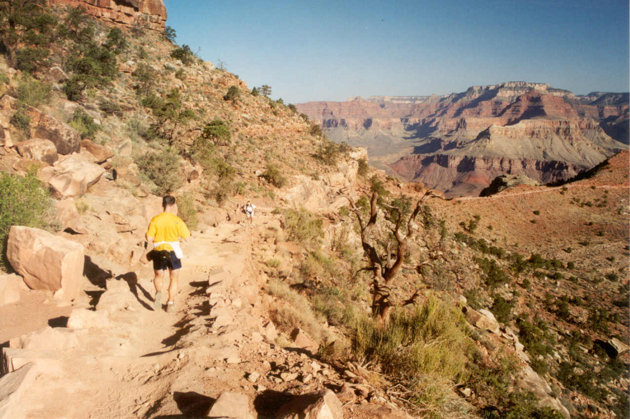
As we moved down the trail I took frequent looks behind to see if there
were good pictures to be taken and to form an image of the trail on our
return. We kept a very brisk pace that Ron said felt like eight minutes
per mile, but was probably closer to 10 minutes. On my previous hike I arrived
at the bridge in 70 minutes which meant I did an 11 minute pace. It felt
like we were going faster than that. For a good way we could spot the small
restroom house at Cedar Ridge and with this landmark we would know exactly
where it was for our return trip.

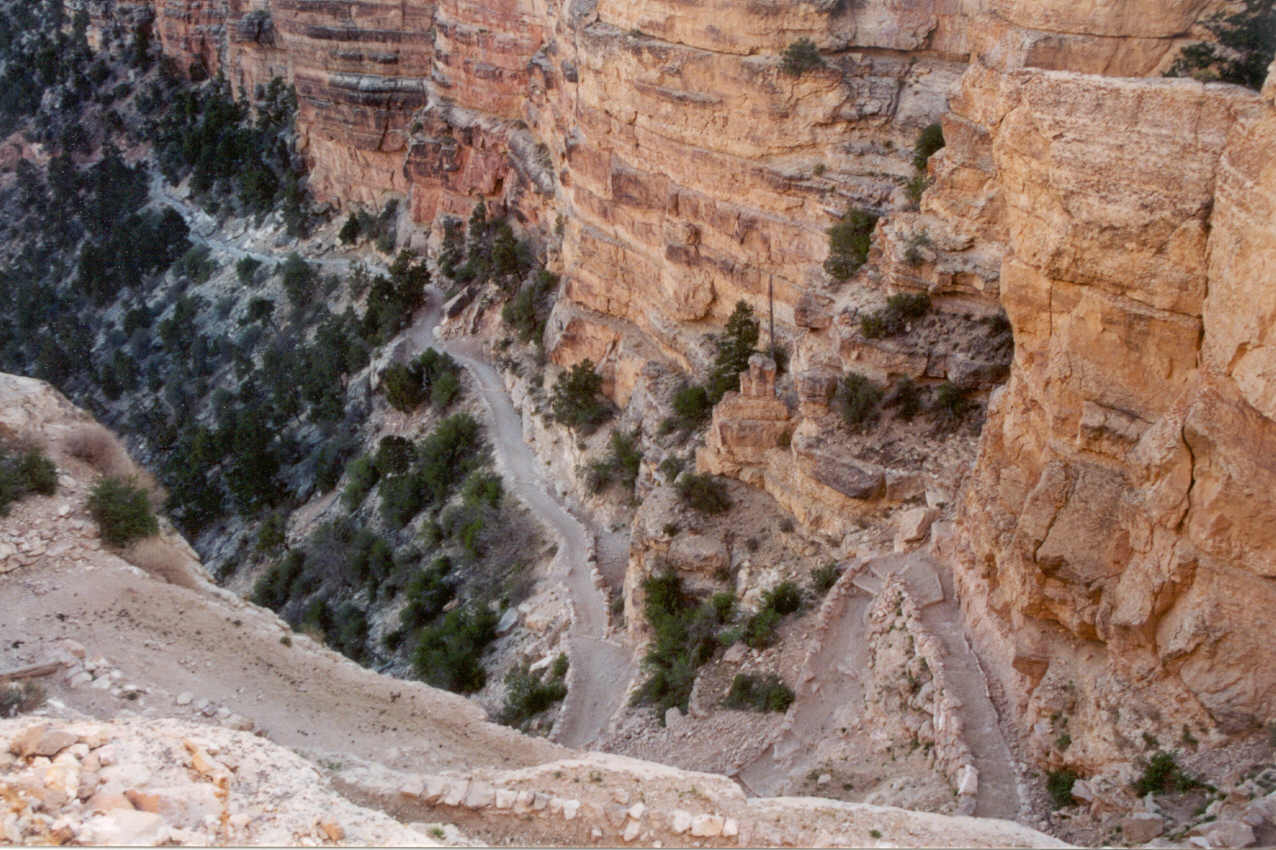
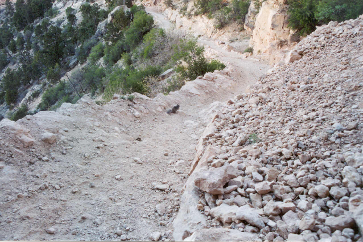
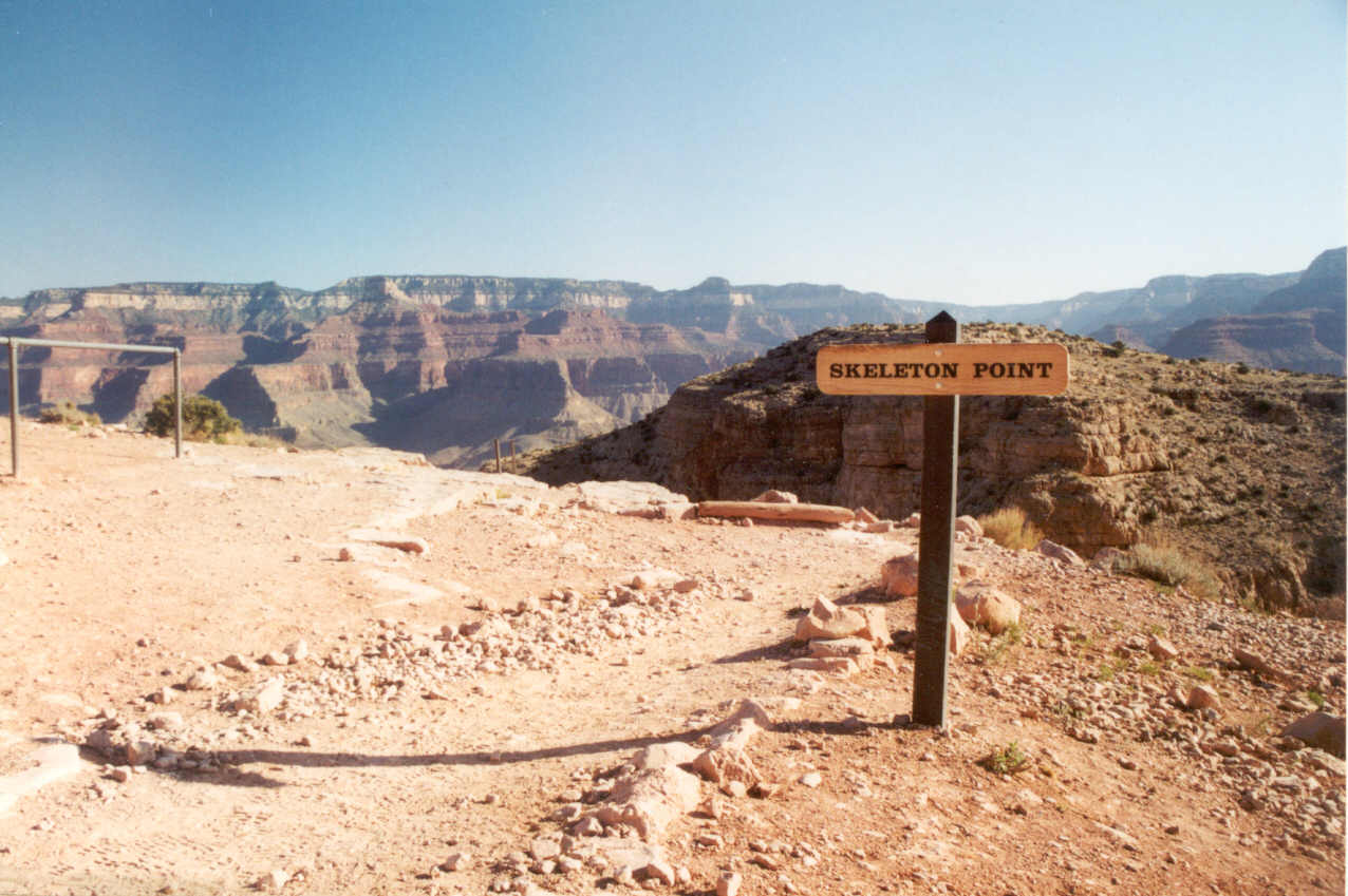
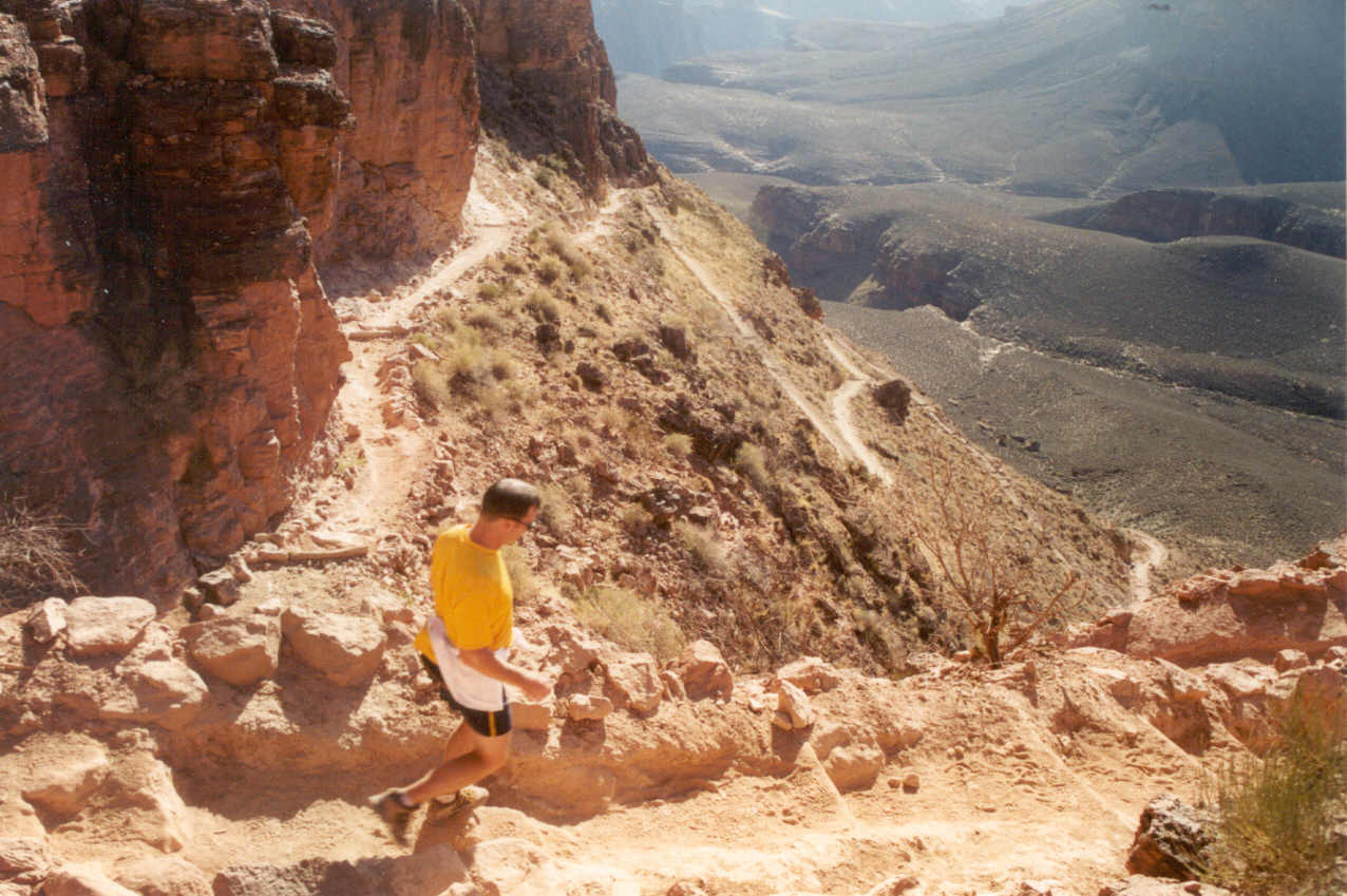
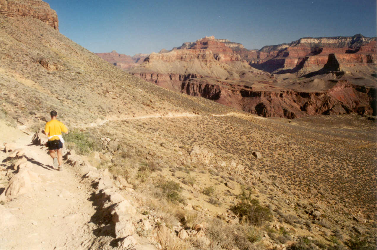
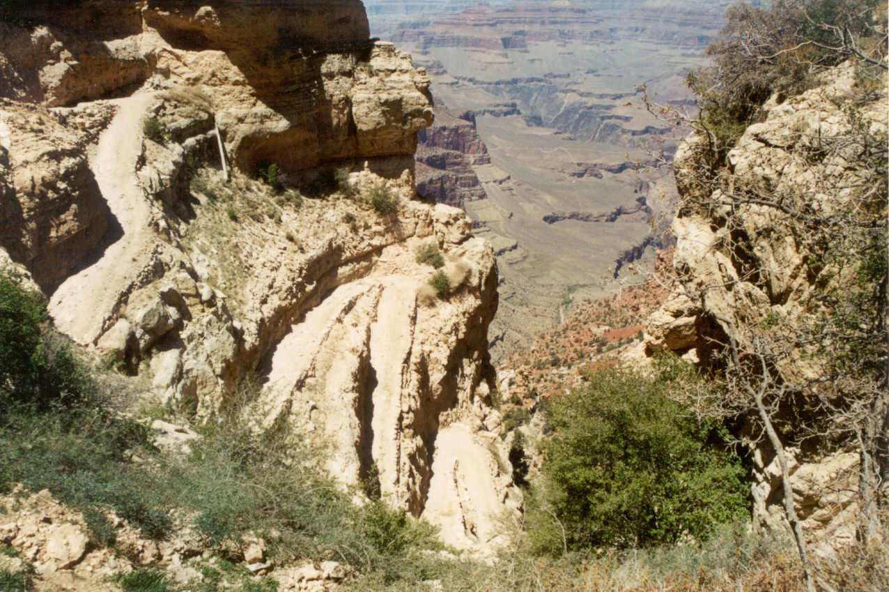
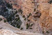
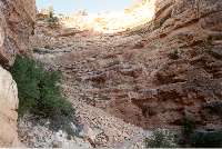
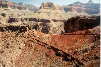
Just below O'Neill Butte was a long relatively flat section that I simply
could not remember from my previous hikes. This ended at a point in the
trail marked with a sign, "Skeleton Point." I have no idea why
it is called that (I personally didn't see a single bone), but consider
this: it is the absolute farthest point for a so-called day hike (like the
one we're doing) because to go further is putting yourself at considerable
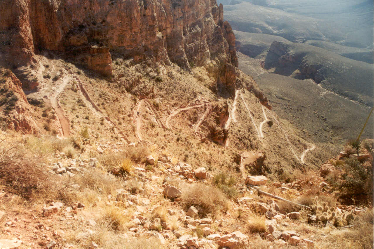
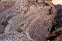
risk. Directly below this is one of the toughest parts of the trail on the
return trip. I call it the long switchbacks. On the return trip getting
past these without being tired is the goal. Looking down at these switchbacks
is an awesome sight and the only comment I remember Ron saying was, "Wow!"
We didn't savor the moments for long, however, as we jogged quickly down
this part only stopping for a couple of pictures. I had forgotten how long
this section was and in my mind I was thinking this might be a very difficult
part on the way out.

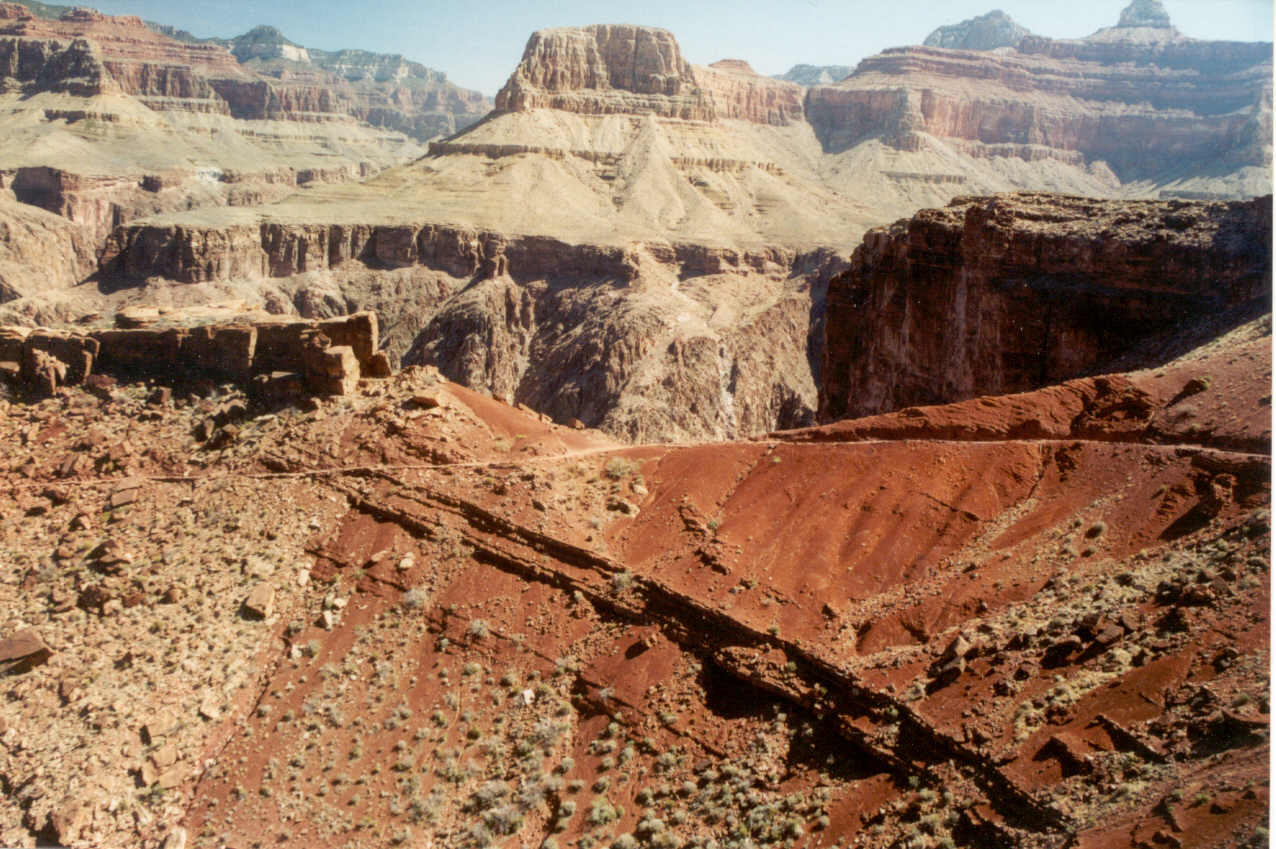
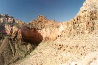
At the end of the switchbacks we've arrived at the Tonto Plateau. This
is the longest relatively flat section of the trail and ends at a point
called The Tipoff where there is another small restroom house. It
is called The Tipoff because after this you enter the inner gorge. We met
a threesome at this point heading down with a very elderly gentlemen who
had just celebrated his 76th birthday! They were planning on a rim to rim,
rim to rim hike taking six days. I asked them if they had an email address
(thinking it would be nice to send them some pictures and hearing how it
all ended up), but they all said they did not.
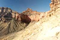

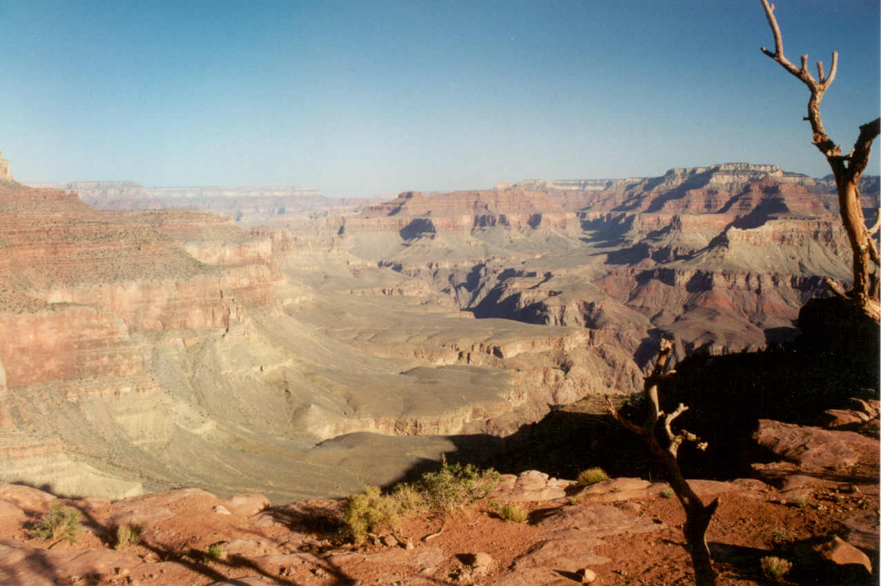
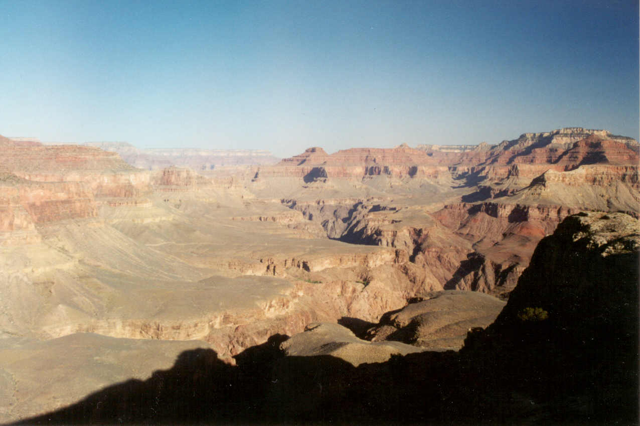
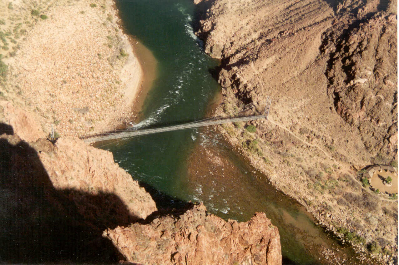
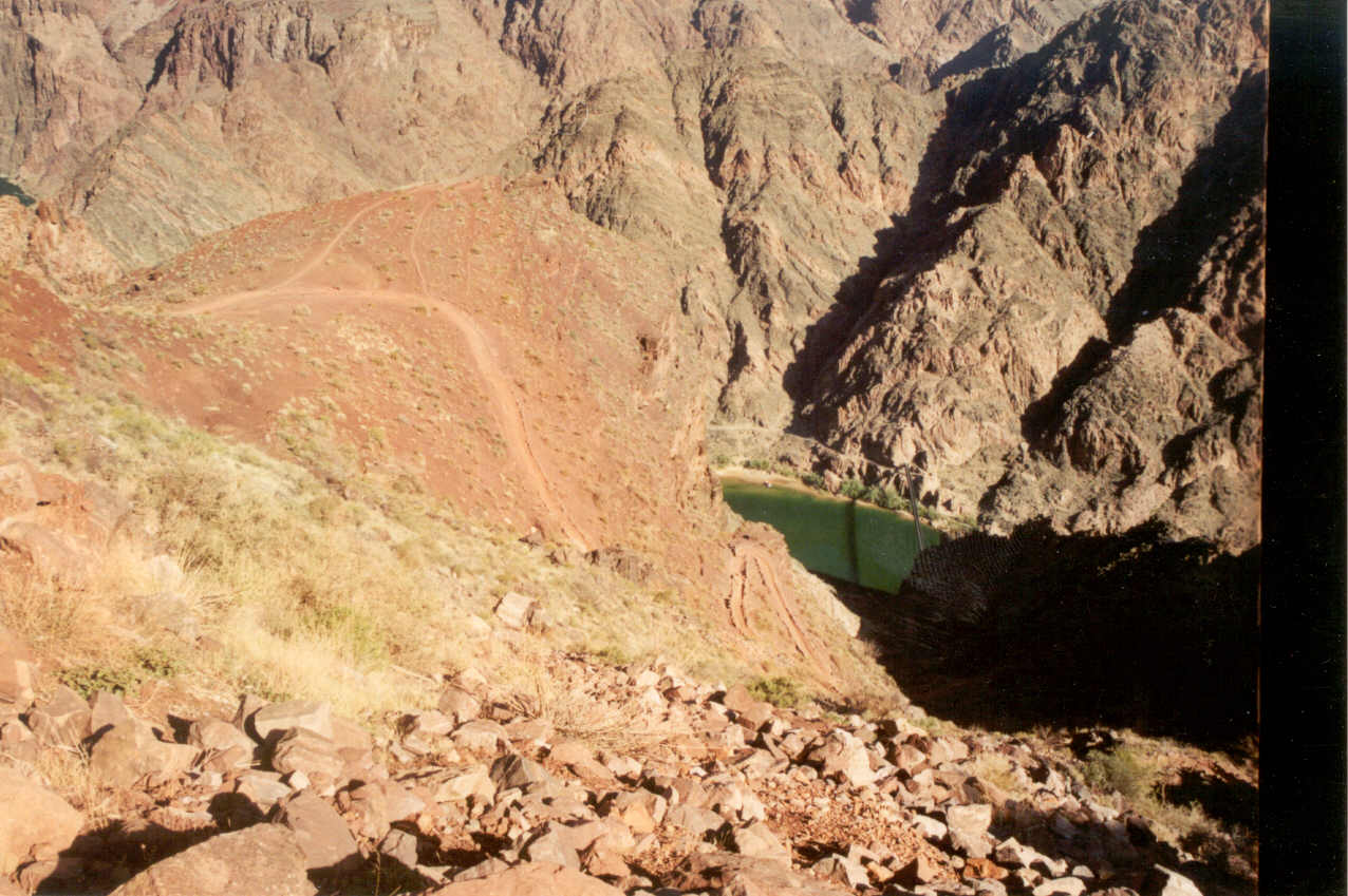
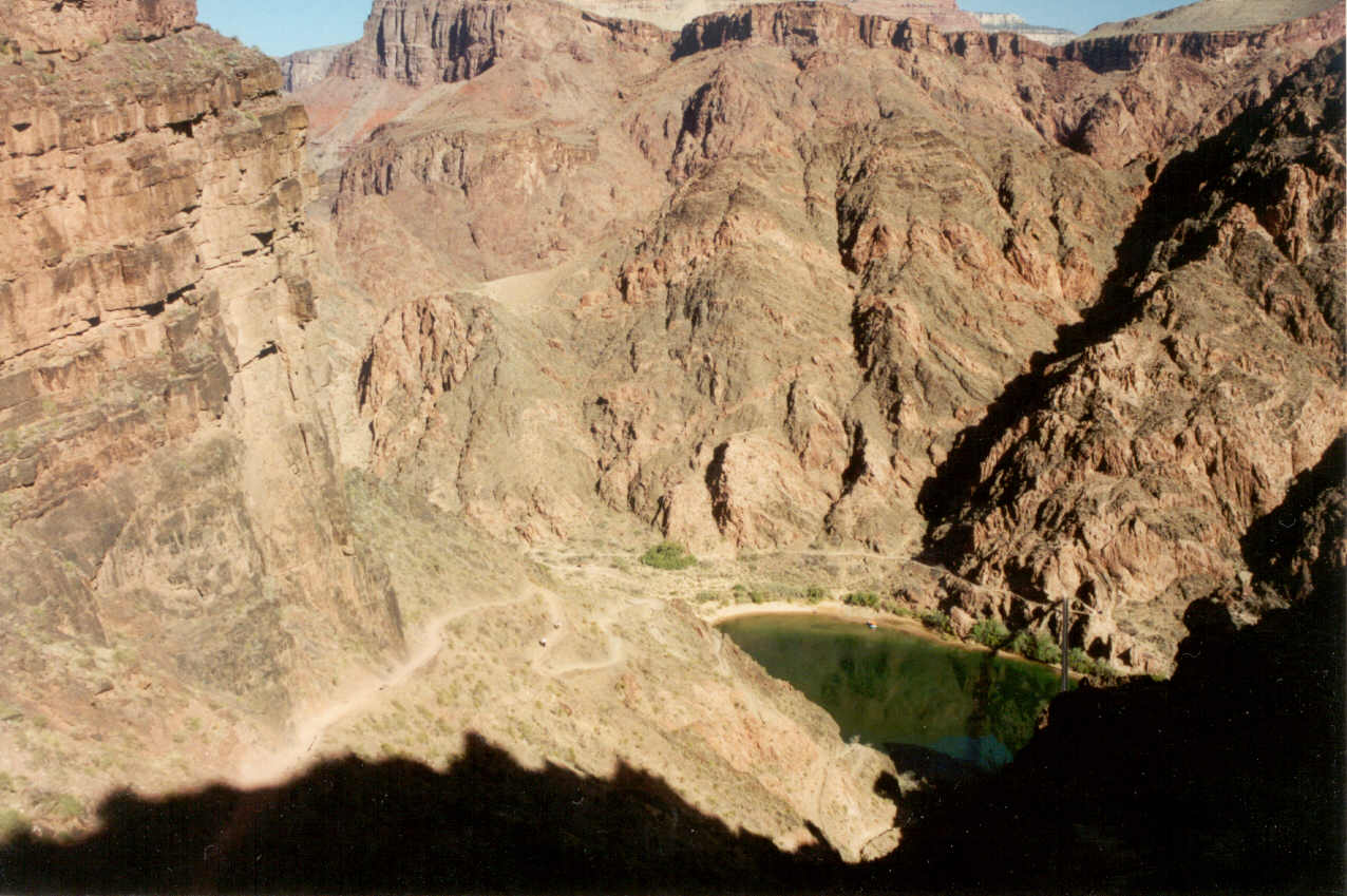
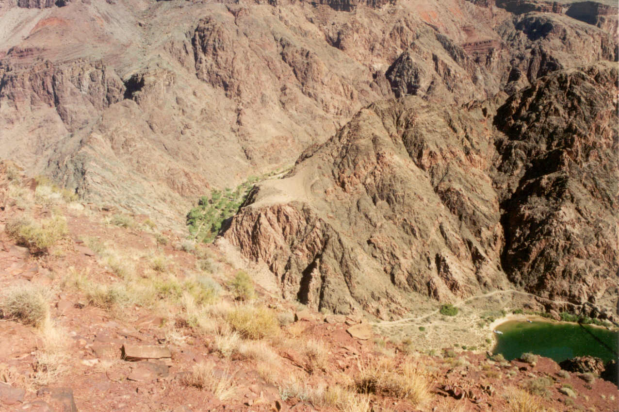
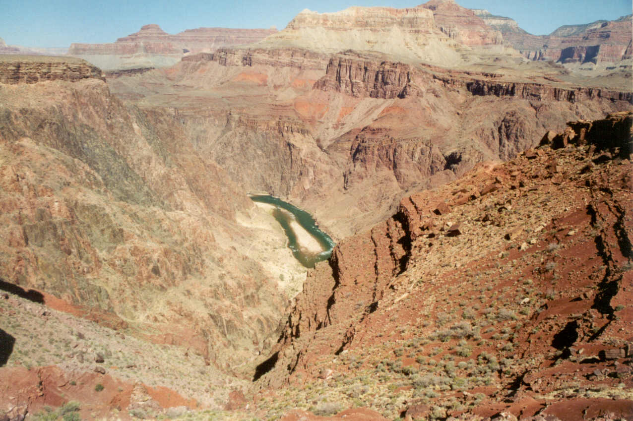
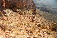
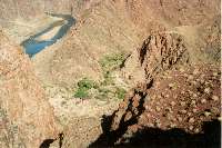
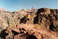
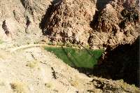
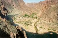
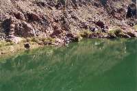
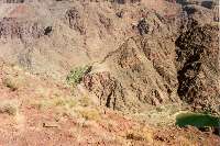
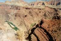
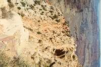
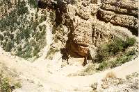
As we entered the inner gorge I was greeted with a sight I was not expecting.
The usual muddy Colorado river that becomes visible at this point in the
trail was an emerald green! I recognized a part of the trail from a photo
I'd seen on the internet and knew I would have a view of Phantom Ranch.
There it was still in the shadows since it was still very early in the morning.
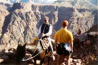
Ahead on the trail at least 500 feet away we finally saw our first mule
train taking passengers out of the canyon. Within seconds as we turned a
corner we were suddenly face to face with the mule train! I wondered how
we could have covered so much ground so quickly, but I soon discovered this
was not the same mule train. They were another 300 feet back.


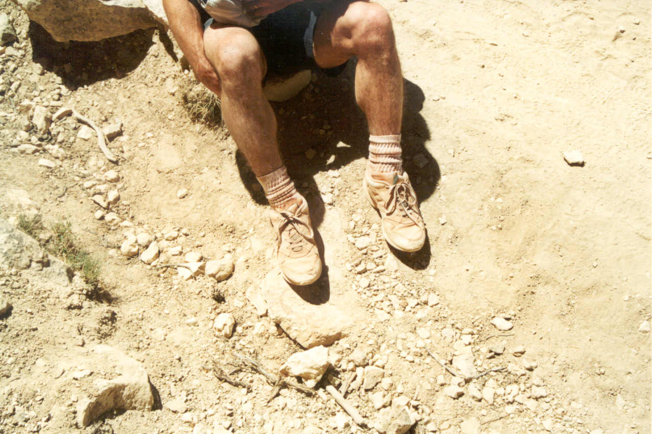
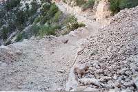
The trail in the inner gorge descends rather quickly and has the dustiest
sections. As I looked down I noticed my shoes and socks were covered with
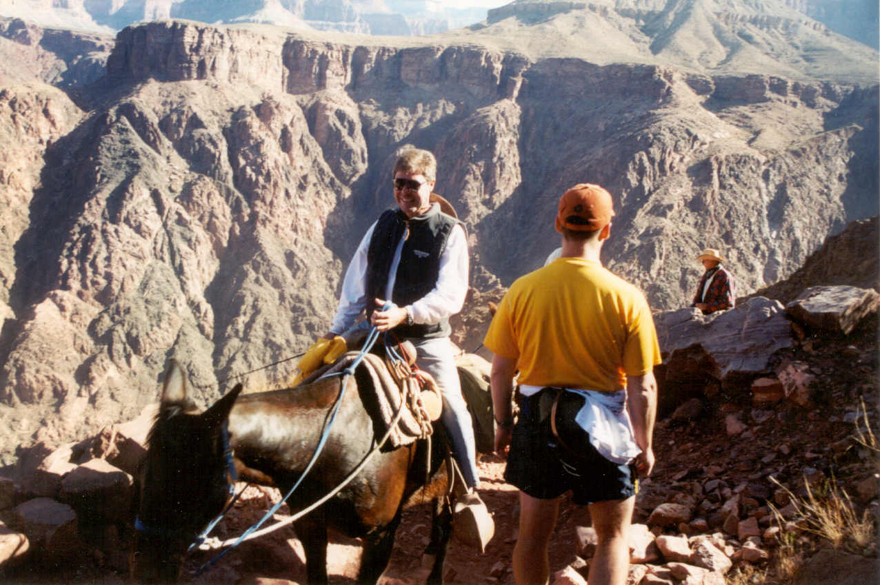
red dust. This dust is a problem to the tourists riding the mules up and
down the trail. Each one it seemed were outfitted with a red or blue handkerchief
that they could use to filter the dust. With many of these riders actually
wearing them I couldn't help but thinking this was a Wells Fargo stickup.
I raised my hands to the riders saying, "Why do I feel like I need
to do this?" The riders seem to come in two flavors. Some are smiling
and really enjoying the mule trip while the others can hardly acknowledge
you because they are focusing so much on their mule and staying on the trail.
(I think the later would be me if I were on a mule in the canyon!)
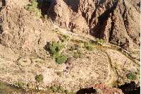

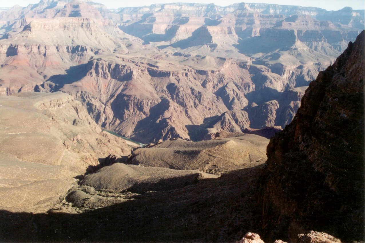
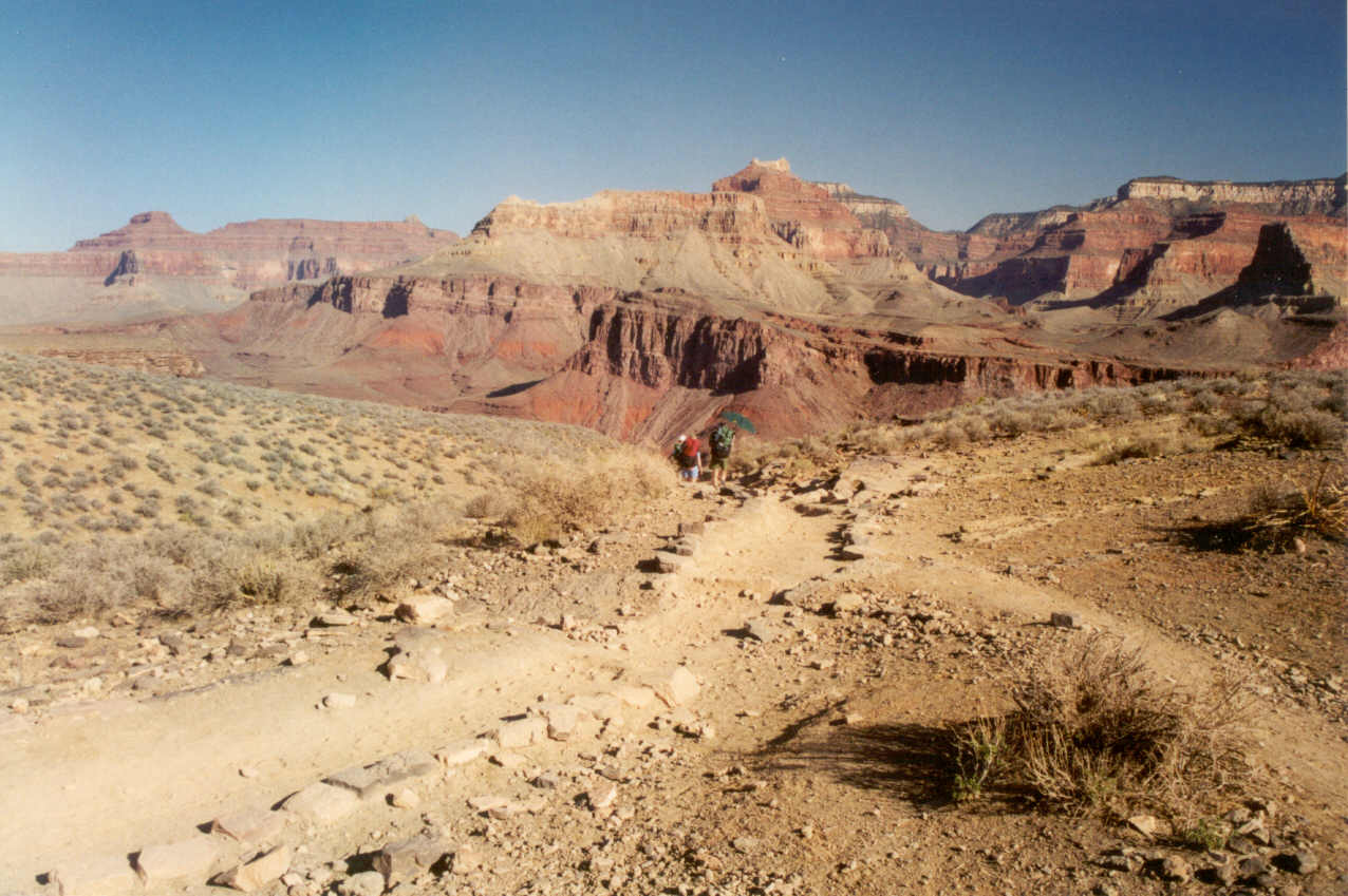
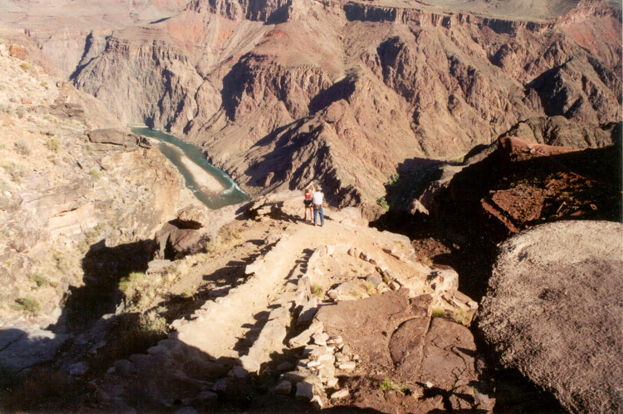
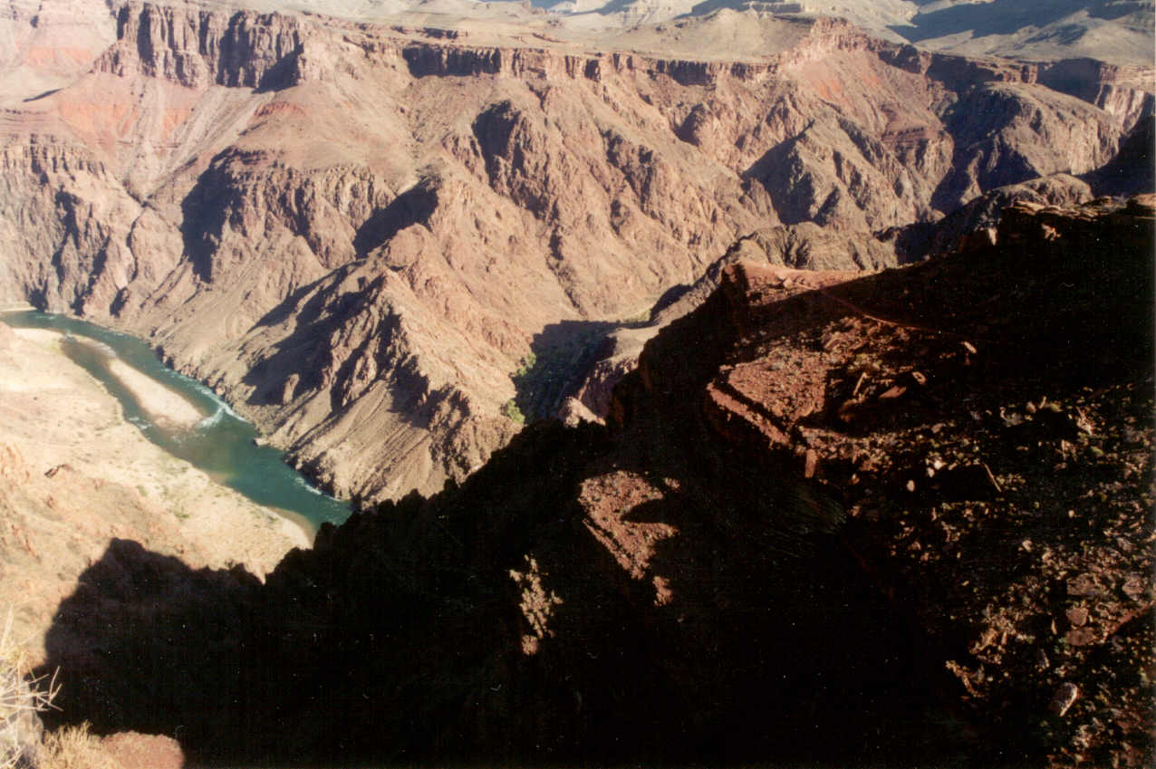
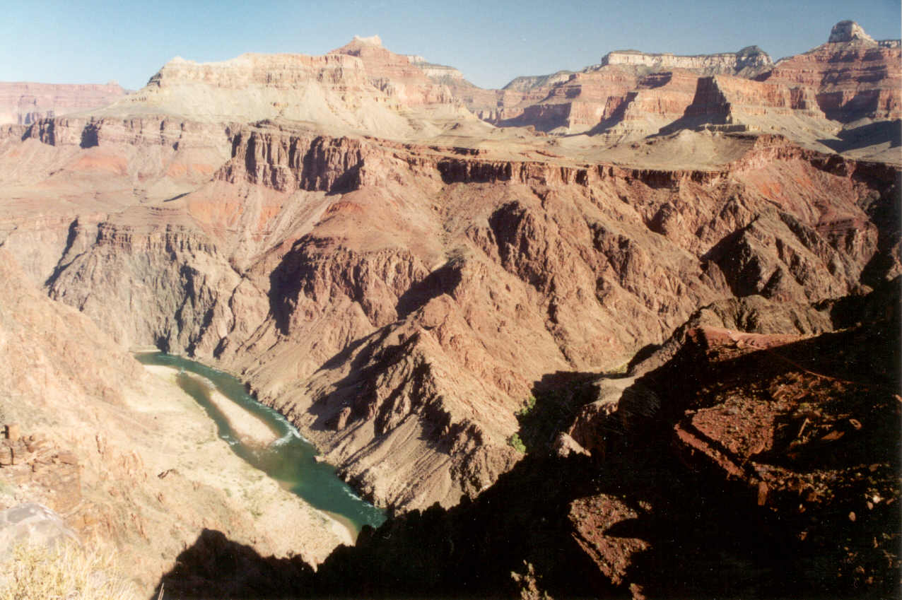
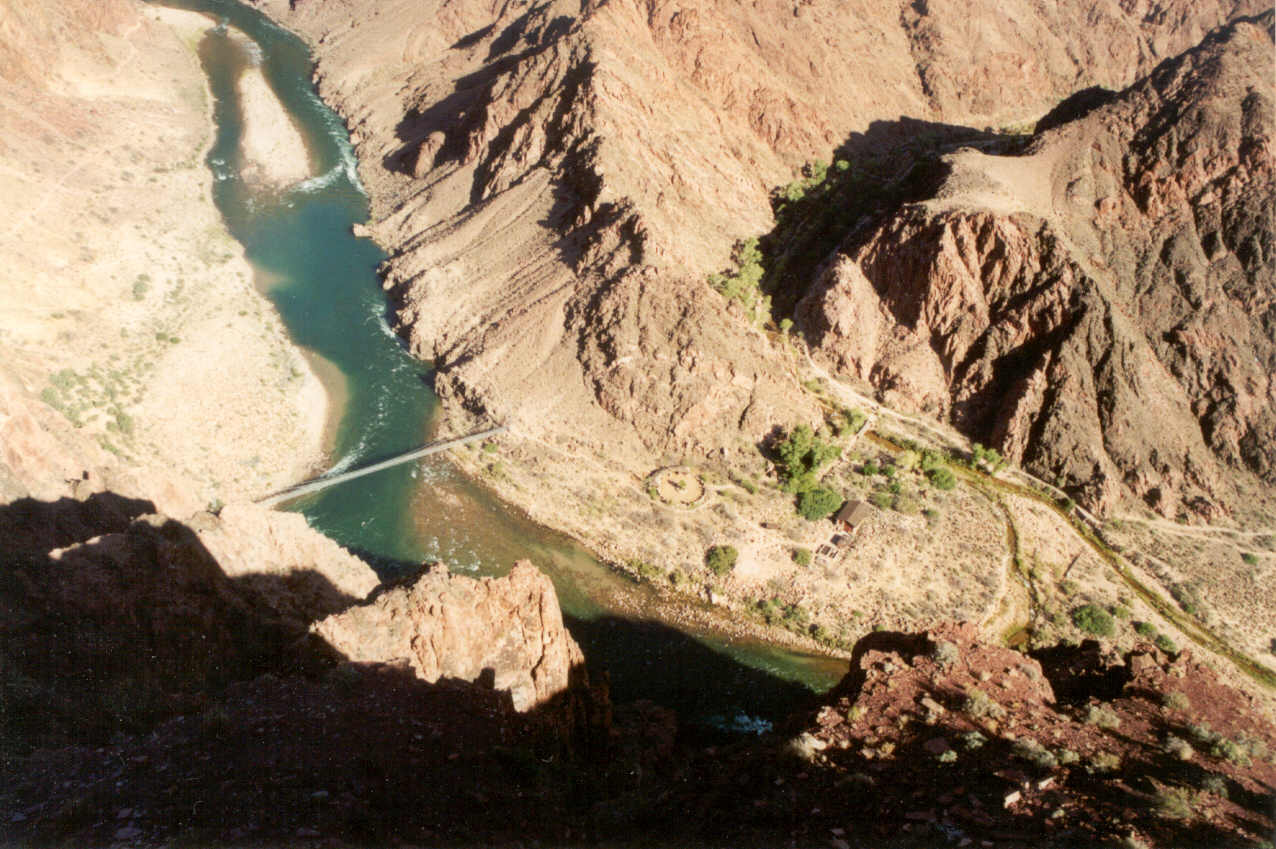
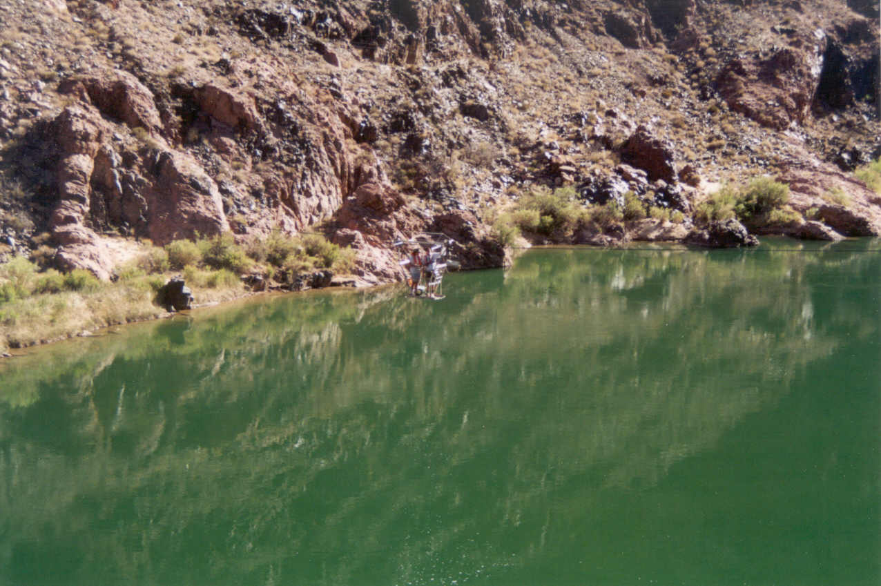
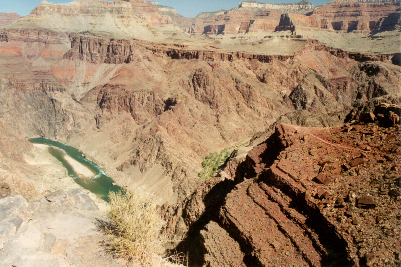
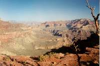
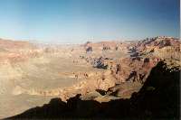
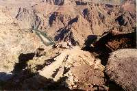
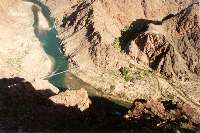
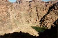
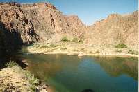
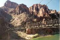
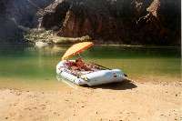
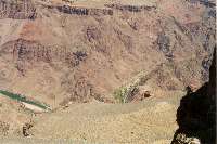
Several points we stopped to admire the view of the river, one of them
being known as Panorama Point, but don't ask me which one it was since there
were several candidates to choose from. At one point it seemed like we were
nearly on top of the river which shows in the photos above. At the left
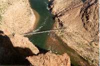
we could see the Bright Angel Bridge and at the right was our first view
of the Kaibab Bridge though it was partially in the shadows. Between the
bridges (over a quarter mile) there were a couple of buildings fairly close
to the water and a circle of dirt which had an "H" which indicated
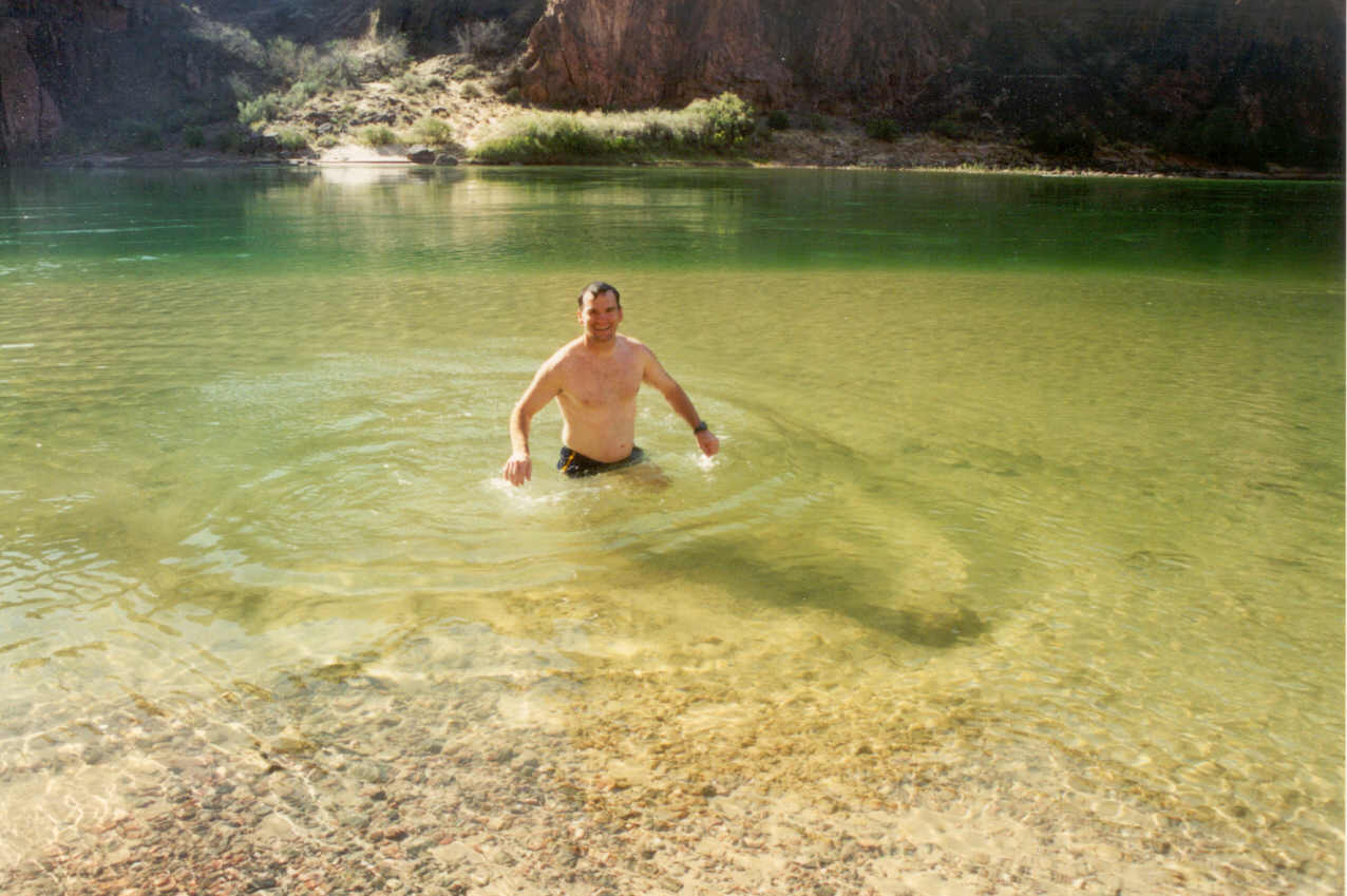
it was a helipad. At this point Ron announced he must go in the river. My
first reaction was I didn't think this was a good idea. However, as I jogged
down the trail I soon thought how many times do you go down the GC? And
how many times can you go down and have the river this clear? The closer
we got the better I thought of the idea.
 We also continued to encounter
a lot of other hikers. I was also starting to think how warm it felt and
I was thinking I was perspiring too much. I remember the very strong feeling
of being alone at this part of the trail in my previous hikes, but there
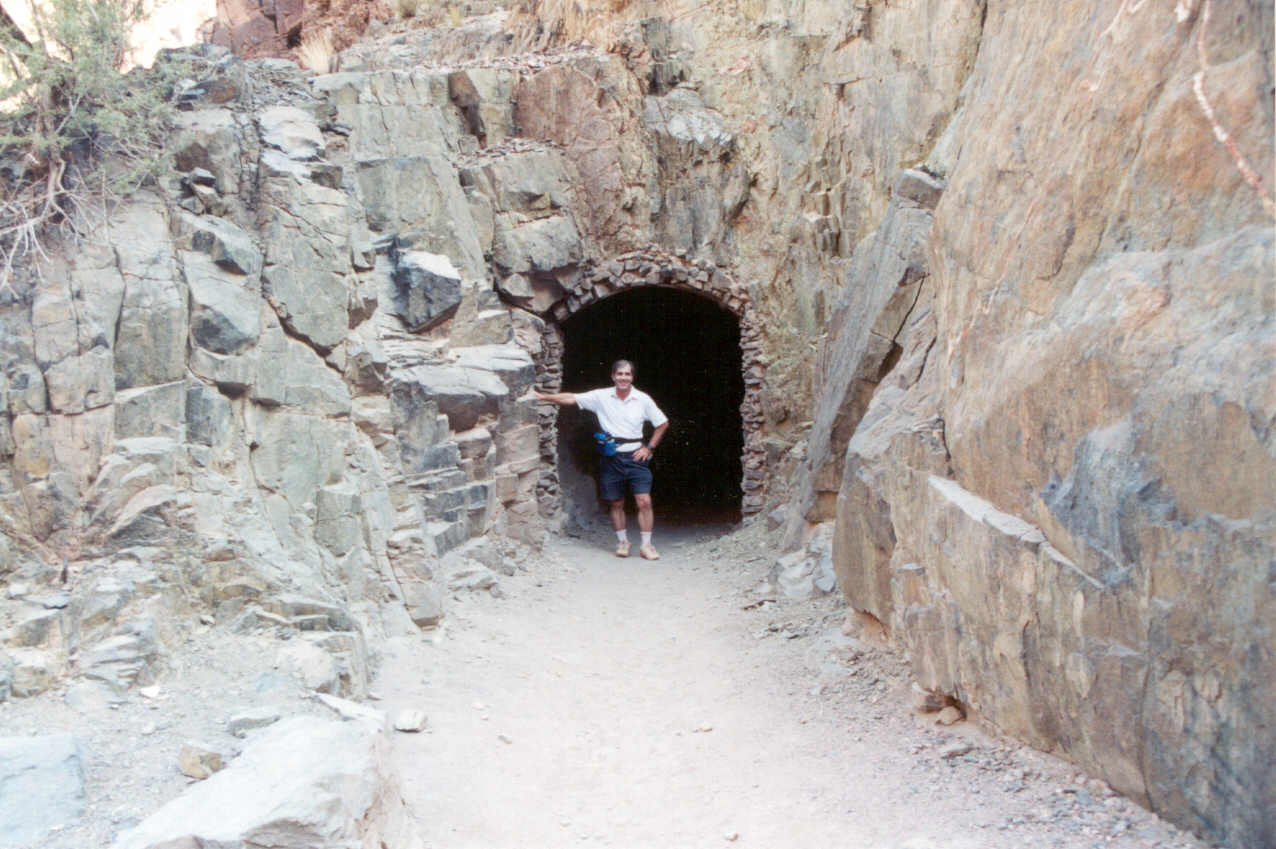
wasn't a hint of that this time. When I could see the tunnel which leads
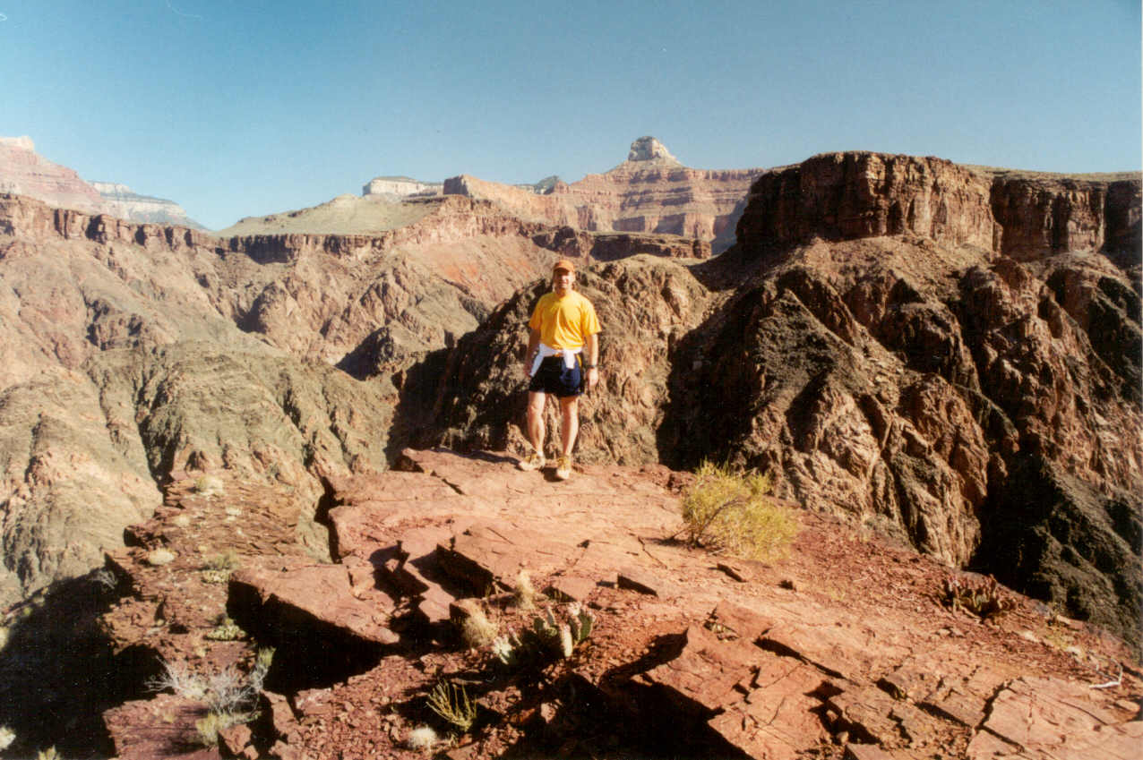
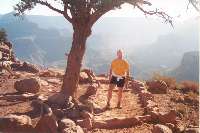
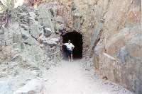
onto the bridge I knew we were only minutes away. I had Ron take a picture
of me at the tunnel entrance because for me this really marks the end of
the descent.
We also continued to encounter
a lot of other hikers. I was also starting to think how warm it felt and
I was thinking I was perspiring too much. I remember the very strong feeling
of being alone at this part of the trail in my previous hikes, but there
wasn't a hint of that this time. When I could see the tunnel which leads
onto the bridge I knew we were only minutes away. I had Ron take a picture
of me at the tunnel entrance because for me this really marks the end of
the descent.
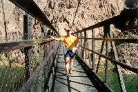
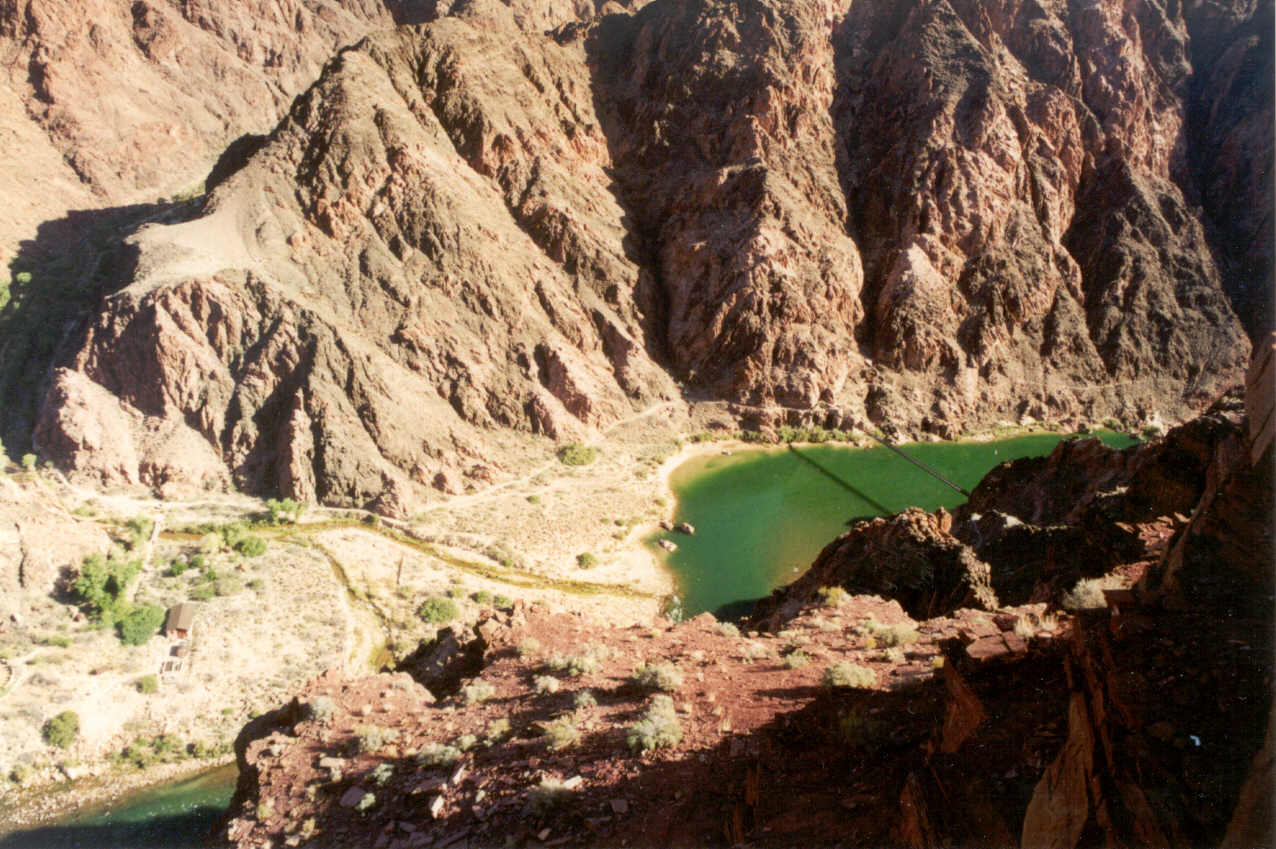
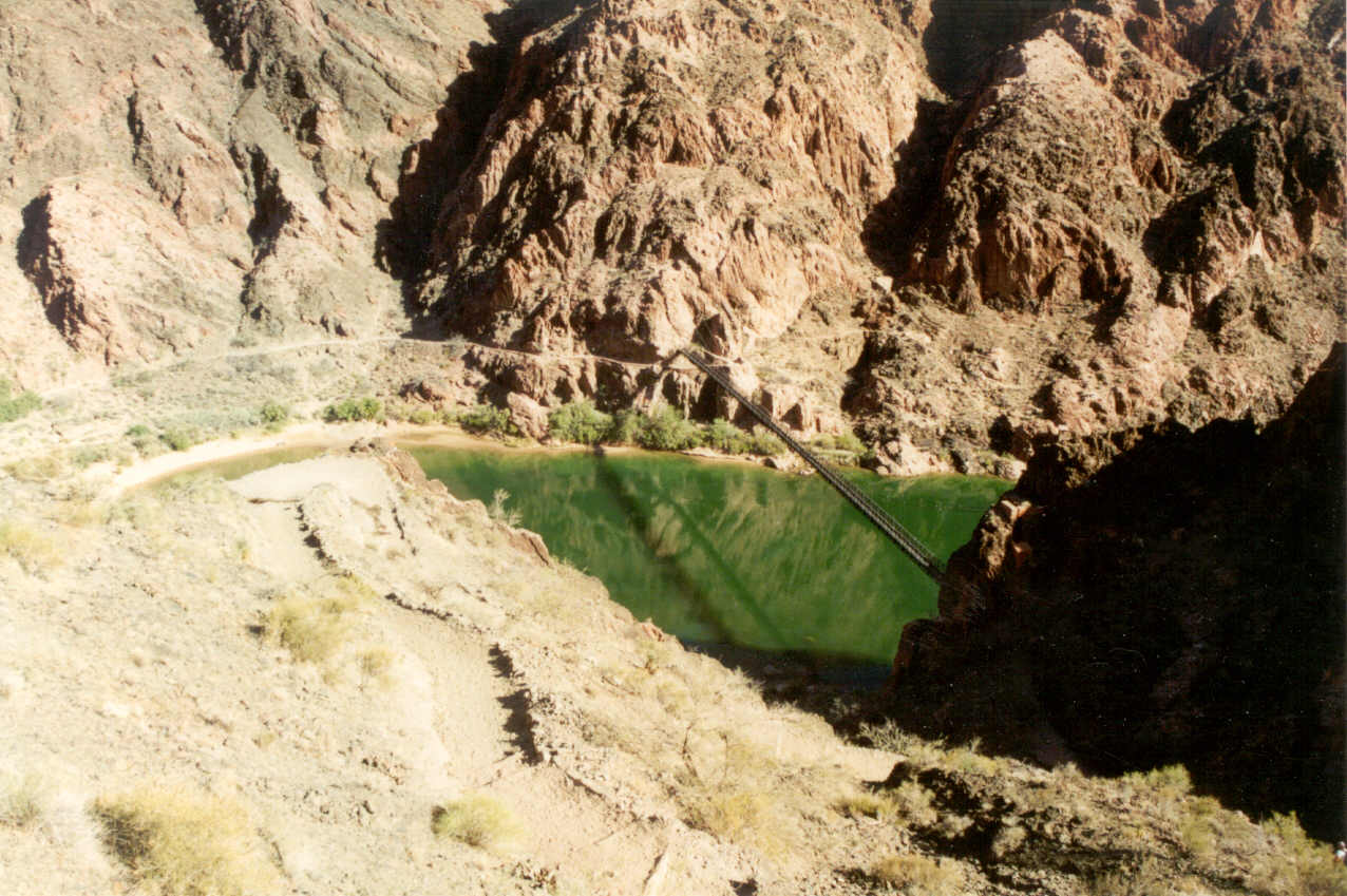
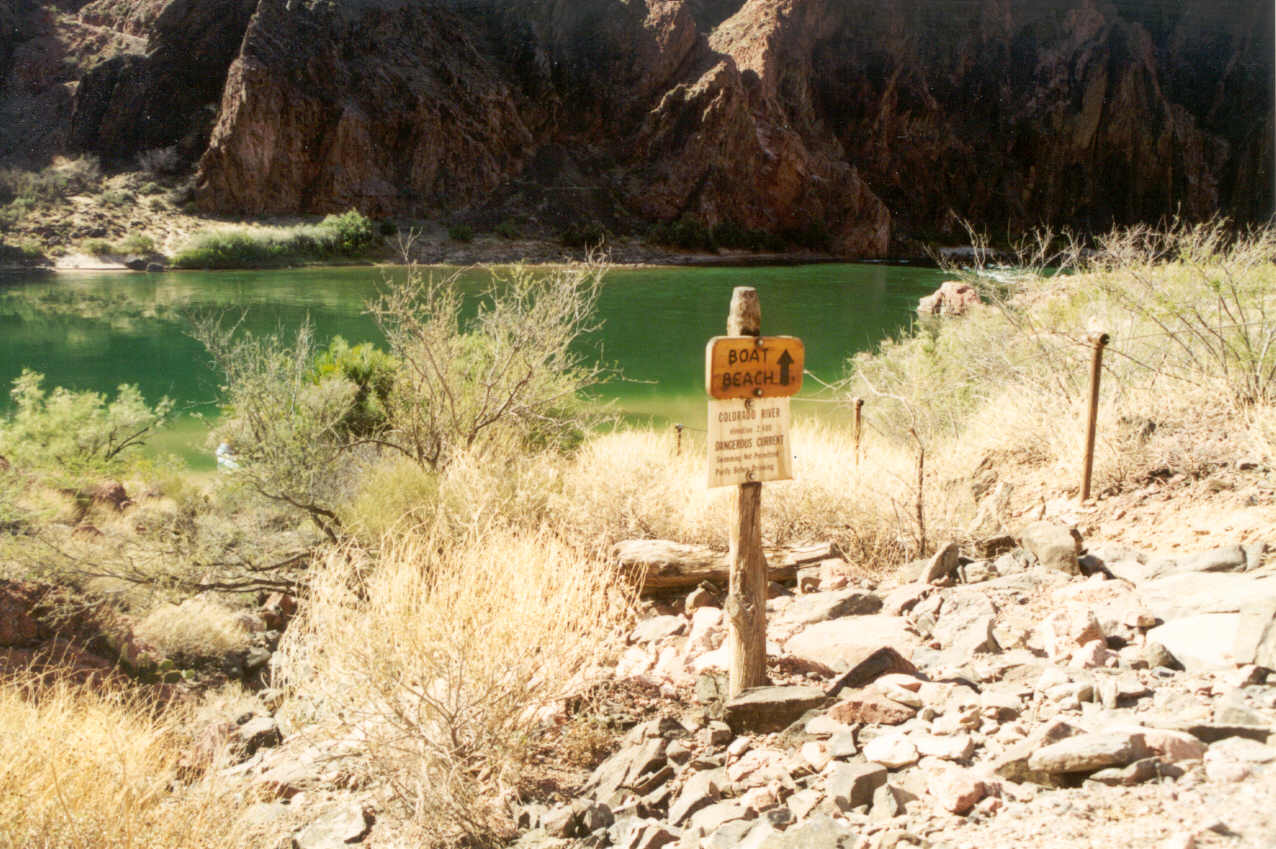
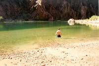
The river was simply beautiful. The water upstream was slow moving, almost
calm. Downstream there were rapids which filled the air with its sound;
a very pleasant white noise. We crossed the bridge and headed toward a short
side path to take us to the beach where a raft was parked. The sign on this
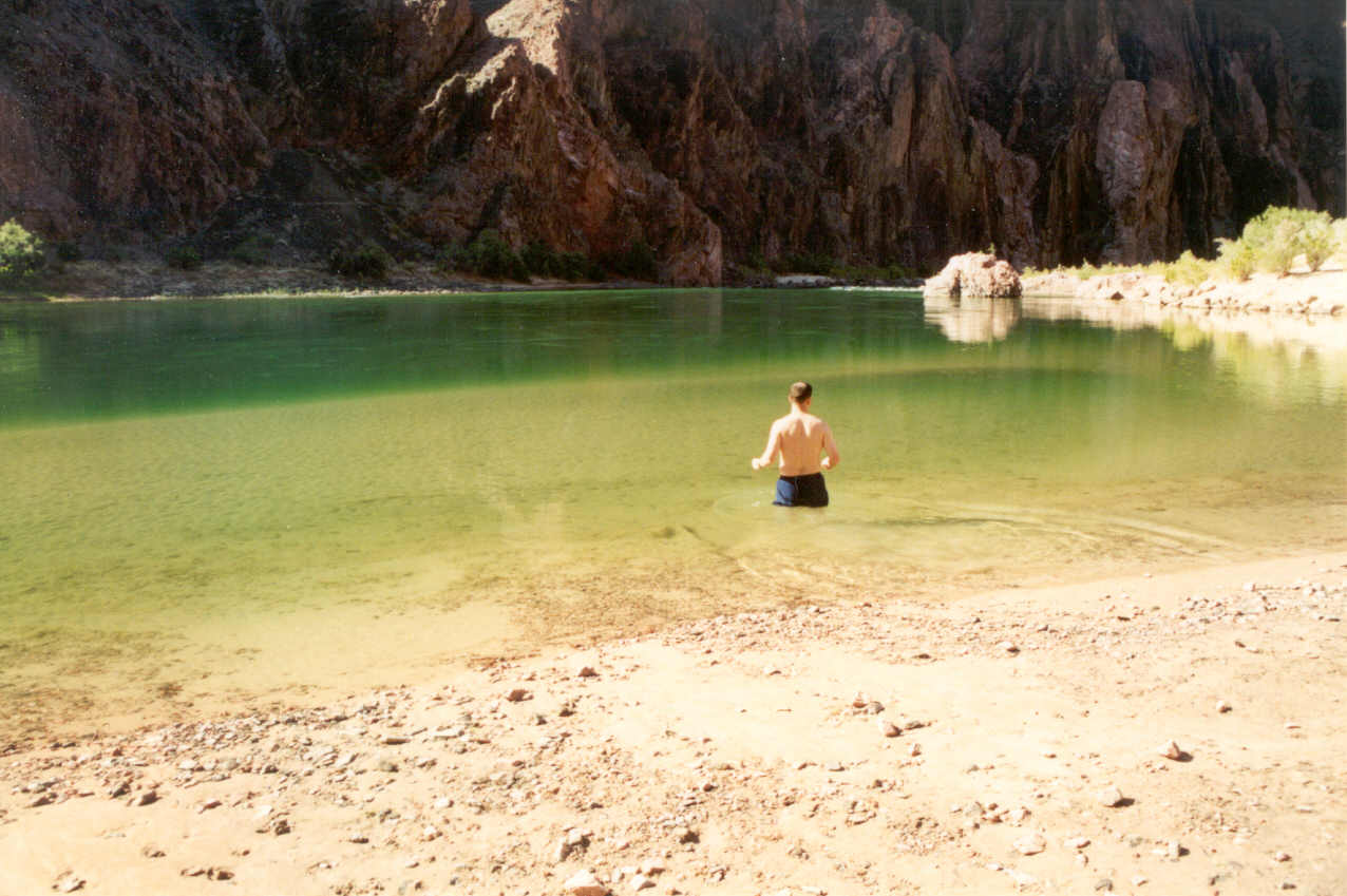
path stated "Swimming is Prohibited" and Ron was clearly disappointed.
We walked onto a beach which by any description was an oasis. Seconds ago
we were in a desert. He asked the female raft guide (who was lounging on
the raft under a large umbrella) about it and she said that it was okay
as long as you didn't go out into the current which was maybe 80 feet away.
She added that the problem is not so much the current, but people can get
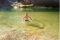
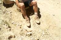
hypothermia trying to swim across it. Ron soon afterward stripped to his
shorts and personally discovered how cold the water was. As he did this
I splashed water on my face and legs.
We struck up a small conversation with the raft guide who was in the
middle of a 12-day trip. She had been doing it for eight years and I confirmed
it was a job you had to love. In the off-season she was a massage
therapist, a fact she conceals to her rafting party for obvious reasons.
She also revealed that the clientele can be divided into those who were
a pleasure to serve and those who she advises, "You don't need a life
jacket."
 She offered us a beverage
and told us that they had water installed just ahead on the trail. My bottle
was filled at this point and I wasn't really thirsty. But before we left
she offered us some apples which we did not refuse.
She offered us a beverage
and told us that they had water installed just ahead on the trail. My bottle
was filled at this point and I wasn't really thirsty. But before we left
she offered us some apples which we did not refuse.
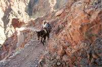
As we left the beach area to get back on the trail for our return trip,
we were late by less than a minute. A mule team was there and we were behind
them. There are two kinds of mules that travel in the canyon day after day.
The difference between mules is easy to spot when they're on the trail because
of the presence or absence of a human rider. These particular mules were
not carrying passengers, but instead, carried supplies into the canyon and
refuge out. I had read about this. These are the mules which are not tame
or safe enough to carry passengers. You don't want to be too close to them.
Ron was ahead of me and thought nothing of getting right next to the last
mule in the team. In my mind I was screaming, "Get away from that mule!"
but vocally I calmly told him to move away and told him the story behind
these mules. I knew what Ron was thinking; how do we get around them?
 As we started up the trail we knew immediately we didn't
want to be behind these mules as they kicked up a lot of dust and had an
aroma that reminded me of every farm I've ever visited. When we got close
I protected my half eaten apple as much as possible. But they moved at a
very good pace (a bit faster than us) and I was relieved that it looked
like to me that they could get far enough ahead of us in no time. However,
they have to stop frequently for up to a minute at a time so we would catch
up to them and have to wait. Worse than the dust and smell were the flash
floods of urine. At one point we were held up and the mule guide was close
by because he was on the switchback ahead. I was almost 10 feet away from
the last mule (the same mule Ron had stood next to) and the guide warned
me that I was standing too close! I confirmed with him that I understood
these were the mules that weren't yet ready for passengers. He said if we
could wait about five minutes we would let us pass, and on queue we carefully
passed the train.
As we started up the trail we knew immediately we didn't
want to be behind these mules as they kicked up a lot of dust and had an
aroma that reminded me of every farm I've ever visited. When we got close
I protected my half eaten apple as much as possible. But they moved at a
very good pace (a bit faster than us) and I was relieved that it looked
like to me that they could get far enough ahead of us in no time. However,
they have to stop frequently for up to a minute at a time so we would catch
up to them and have to wait. Worse than the dust and smell were the flash
floods of urine. At one point we were held up and the mule guide was close
by because he was on the switchback ahead. I was almost 10 feet away from
the last mule (the same mule Ron had stood next to) and the guide warned
me that I was standing too close! I confirmed with him that I understood
these were the mules that weren't yet ready for passengers. He said if we
could wait about five minutes we would let us pass, and on queue we carefully
passed the train.
 Passing
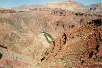 the mules was a mixed blessing. It was great to be away
from them, but since we were allowed to pass, we now felt obligated to really
stay ahead of them. I could feel I was moving too quick on this lower and
relatively steep part of the trail and it was the mistake I made on my very
first hike. We were moving much faster. At this part of the trail one by
one we went by the hikers we passed on the way down. One told us they expected
to see us on the Discovery Channel. We knew what they meant and Ron said,
"Eco Challenge!" I'm not entirely sure this was a compliment because
when I've seen the Eco Challenge my thought has been, "These people
are nuts!"
the mules was a mixed blessing. It was great to be away
from them, but since we were allowed to pass, we now felt obligated to really
stay ahead of them. I could feel I was moving too quick on this lower and
relatively steep part of the trail and it was the mistake I made on my very
first hike. We were moving much faster. At this part of the trail one by
one we went by the hikers we passed on the way down. One told us they expected
to see us on the Discovery Channel. We knew what they meant and Ron said,
"Eco Challenge!" I'm not entirely sure this was a compliment because
when I've seen the Eco Challenge my thought has been, "These people
are nuts!"
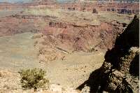
We emerged from the inner gorge and were on the Tonto Plateau. It was
good to be out and we had put more than a quarter mile between us and the
mules. This was the first point I felt very hot and a little drained. As
we headed up the gentle slope toward the big switchbacks I was beginning
to think, "It shouldn't be this difficult. I shouldn't be this tired
at this point." I was not relieved when we arrived at the base of the
big switchbacks. In my mind I was thinking how difficult this was going
to be and soon after as we started up I was actually feeling a little sick.
Was it the apple that wasn't sitting well, or was I just plain tired? As
I was suddenly finding it difficult to move a terrible thought began to
form in my mind: I might not make it out! I felt my water bottle which added
to the sudden anxiety. "I don't think I have enough water. Why didn't
I bring two bottles and hide one on the way?"
 Once again my training at Squaw Peak came to the rescue.
I knew what I had to do and within minutes the anxiety was gone and replaced
with a mild anger. "This is going to worse than my first hike on this
trail!" The anger was knowing that it was going to be tough going and
not fun. At the top of the switchbacks Ron found a large rock that provided
us with some shade. The rock was very cool and the wind was blowing making
it very comfortable. He had me drink a little of his gatorade. He looked
very fresh and that was a relief to me. Most of the sickness I had seemed
to go away and I felt much better as we continued. But it was slow going.
Only afterward did I find out how concerned Ron was. Later he said, "I've
never seen you move that slow!" He lead for most of the way after this
and would pick out places to rest were we could find shade.
Once again my training at Squaw Peak came to the rescue.
I knew what I had to do and within minutes the anxiety was gone and replaced
with a mild anger. "This is going to worse than my first hike on this
trail!" The anger was knowing that it was going to be tough going and
not fun. At the top of the switchbacks Ron found a large rock that provided
us with some shade. The rock was very cool and the wind was blowing making
it very comfortable. He had me drink a little of his gatorade. He looked
very fresh and that was a relief to me. Most of the sickness I had seemed
to go away and I felt much better as we continued. But it was slow going.
Only afterward did I find out how concerned Ron was. Later he said, "I've
never seen you move that slow!" He lead for most of the way after this
and would pick out places to rest were we could find shade.
 Though
I was very
Though
I was very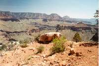 tired the beauty of the canyon
never escaped me because another terrible thought had formed in my mind:
maybe this is my last Grand Canyon hike. I looked back often though I didn't
take a lot of pictures since I was now running low on film. I could see
the mules catching up to us and finally as we took a long rest they passed.
We caught up them as they took their next regular stop, but that was the
last time. They would gain increasing distance on us for the rest of the
hike. Unlike previous trips I knew exactly where we were in relation to
Cedar Ridge. I was mentally rationing my water to last until we got to this
landmark. Just like my first hike the arrival at Cedar Ridge was cause for
a brief celebration. I drank the last drops of water in my bottle.
tired the beauty of the canyon
never escaped me because another terrible thought had formed in my mind:
maybe this is my last Grand Canyon hike. I looked back often though I didn't
take a lot of pictures since I was now running low on film. I could see
the mules catching up to us and finally as we took a long rest they passed.
We caught up them as they took their next regular stop, but that was the
last time. They would gain increasing distance on us for the rest of the
hike. Unlike previous trips I knew exactly where we were in relation to
Cedar Ridge. I was mentally rationing my water to last until we got to this
landmark. Just like my first hike the arrival at Cedar Ridge was cause for
a brief celebration. I drank the last drops of water in my bottle.
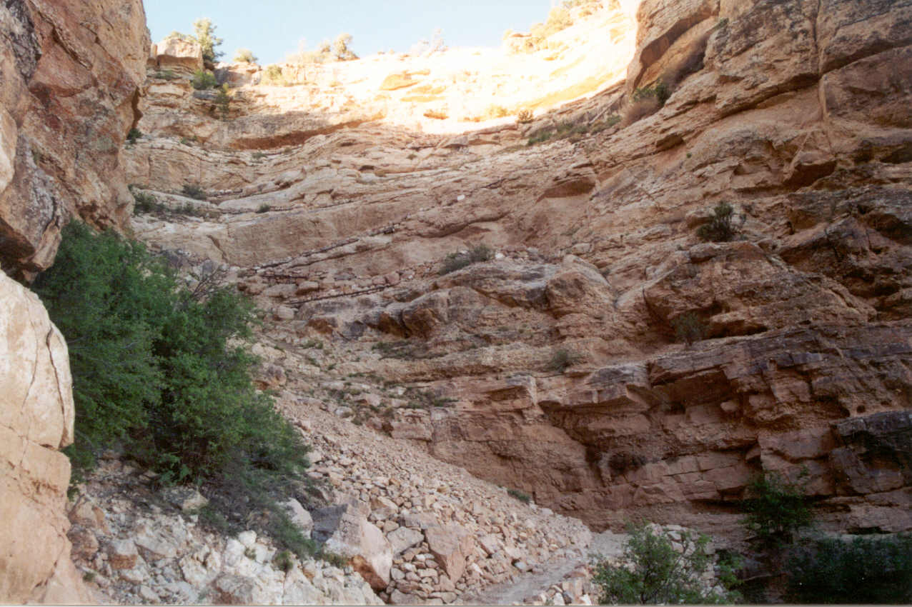
I have no idea how long it took to reach the top after Cedar Ridge. I
remember seeing the mules way up ahead on the tight switchbacks thinking
it would be nice to be at that point in the trail because you would be nearly
done. My watch has a built in altimeter and I checked it from time to time
to see how close we were. When we finally arrived at the base of the cliff
wall switchbacks Ron asked me if I was okay because he wanted to jog the
rest of the way. One of the lasting memories I'll have of this hike is seeing
Ron take off jogging the last several hundred feet. To me it was his way
of celebrating the end of the journey. I just put one foot in front of the
other. I stopped to take a couple of pictures because this section (which
included Pipe Creek Canyon) was completely shaded on our way down. Now it
was in full sunlight and I savored the view. There were only a couple hundred
feet to go and the ordeal of the last two hours was over.
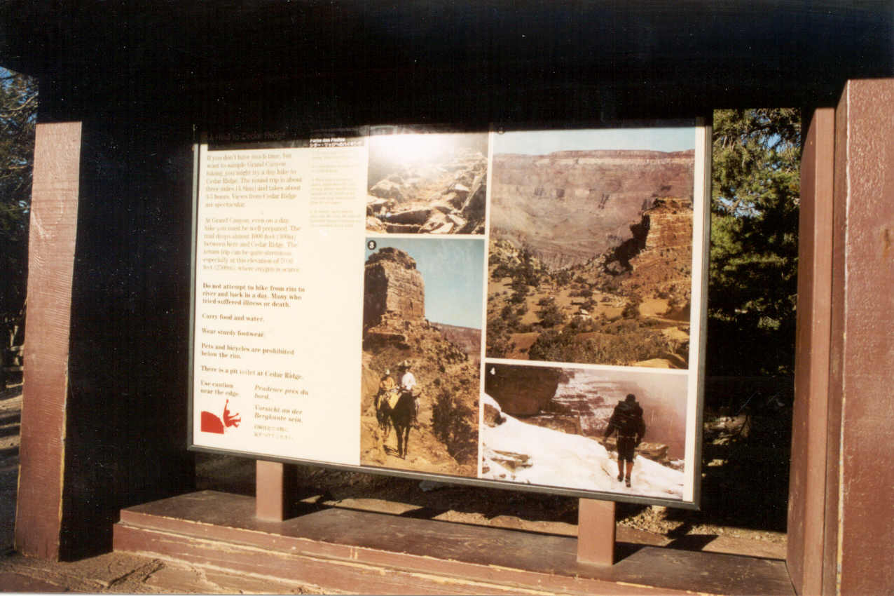
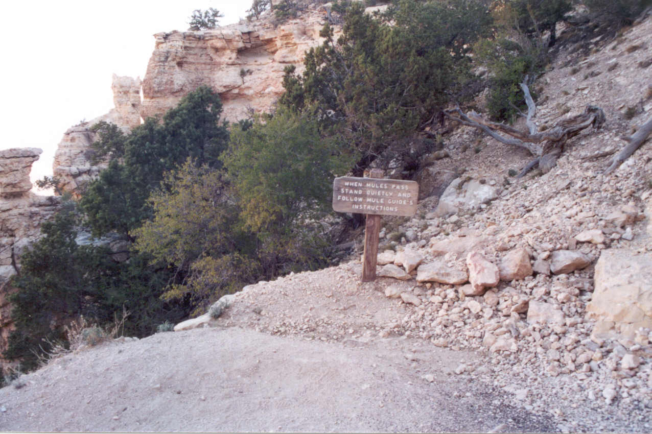
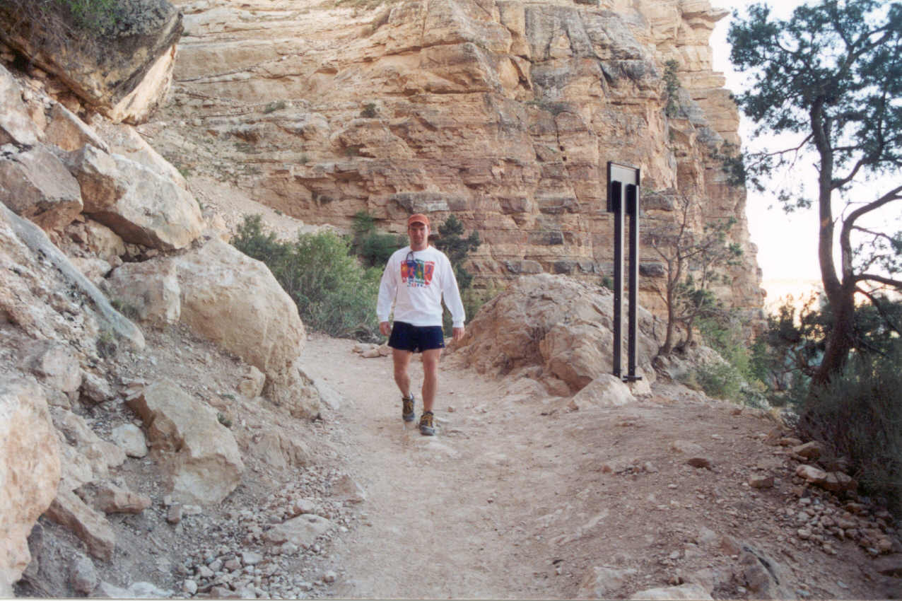
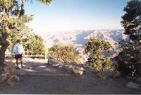
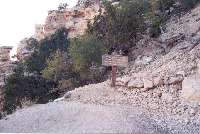
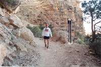
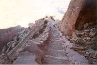
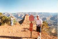
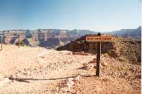
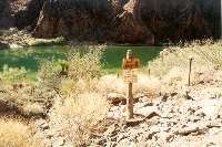
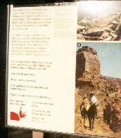 At
the top of
trail a couple of hikers offered us their remaining water. We were sitting
on the ledge of the sign you see to the right (the enlargement is on the
left) as it had a canopy that offered shade as we now had to wait for the
next bus. One of the warnings on the sign is, "Do not attempt to hike
from rim to river and back in one day. Many who tried suffered illness or
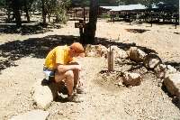
death." However, we soon discovered that there was a water supply nearby.
We used it to clean ourselves, but I also determined it was the best tasting
water I think I've ever had. As we arrived back at our car for the return
trip to Phoenix, I felt generally okay, but very quickly started feeling
ill. It was a replay of my first hike. This time there was no doubt in my
mind that dehydration was a factor, although I felt immediately better when
we stopped at a gas station to use its facilities. By Flagstaff all was
well where we stopped for a late lunch. I know I was feeling good after
this because I began thinking of the next hike.
At
the top of
trail a couple of hikers offered us their remaining water. We were sitting
on the ledge of the sign you see to the right (the enlargement is on the
left) as it had a canopy that offered shade as we now had to wait for the
next bus. One of the warnings on the sign is, "Do not attempt to hike
from rim to river and back in one day. Many who tried suffered illness or
death." However, we soon discovered that there was a water supply nearby.
We used it to clean ourselves, but I also determined it was the best tasting
water I think I've ever had. As we arrived back at our car for the return
trip to Phoenix, I felt generally okay, but very quickly started feeling
ill. It was a replay of my first hike. This time there was no doubt in my
mind that dehydration was a factor, although I felt immediately better when
we stopped at a gas station to use its facilities. By Flagstaff all was
well where we stopped for a late lunch. I know I was feeling good after
this because I began thinking of the next hike.
Fate was not on my side for an early return to the trail as the temperatures
continued to shoot up in the following days. I had hoped to do the safer
down South Kaibab and up Bright
Angel route within two weeks, but with temperatures reaching over 100
degrees, even an early morning hike could prove hazardous. This will have
to be postponed until at least October. I
didn't end up going until the following February.
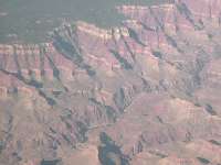 As an interesting postscript, I got to see the trails
less than two weeks later on an airplane flight to Seattle. It is amazing
that even at 30,000 feet part of the South Kaibab and Bright Angel trails
were visible (if you knew where to look.)
As an interesting postscript, I got to see the trails
less than two weeks later on an airplane flight to Seattle. It is amazing
that even at 30,000 feet part of the South Kaibab and Bright Angel trails
were visible (if you knew where to look.)
Return to Home Page
...... Virtual Hike/South Kaibab, Bright
Angel Trails
 Before
hitting Flagstaff there were signs warning of Elk. The first sign said Watch
for Elk, 25 miles. The next, 20 miles, then 15 miles, and so forth. But
before the 10 mile mark there was a temporary light sign (the kind they
usually use to warn drivers of construction ahead) warning about the elk.
With this sign I took the warnings very seriously, but we made it to Flagstaff
without seeing a single one. I joked to Ron that this was all false advertising.
"I was promised 25 miles of elk and there weren't any!" It was
too early in the morning so the Flagstaff Chamber of Commerce was probably
not open so we couldn't drop in the file a complaint. ;) But outside of
Flagstaff heading north to the canyon things were bit more serious. Every
half mile it seemed there were one or two elk along the side of the road
or crossing! Ron was driving at this point and he drove with considerable
care as it was only twilight at this point without great visibility. Interestingly,
there were no signs on the road warning about the elk!
Before
hitting Flagstaff there were signs warning of Elk. The first sign said Watch
for Elk, 25 miles. The next, 20 miles, then 15 miles, and so forth. But
before the 10 mile mark there was a temporary light sign (the kind they
usually use to warn drivers of construction ahead) warning about the elk.
With this sign I took the warnings very seriously, but we made it to Flagstaff
without seeing a single one. I joked to Ron that this was all false advertising.
"I was promised 25 miles of elk and there weren't any!" It was
too early in the morning so the Flagstaff Chamber of Commerce was probably
not open so we couldn't drop in the file a complaint. ;) But outside of
Flagstaff heading north to the canyon things were bit more serious. Every
half mile it seemed there were one or two elk along the side of the road
or crossing! Ron was driving at this point and he drove with considerable
care as it was only twilight at this point without great visibility. Interestingly,
there were no signs on the road warning about the elk!