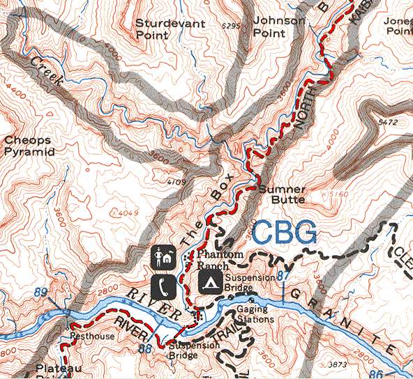
Page 5
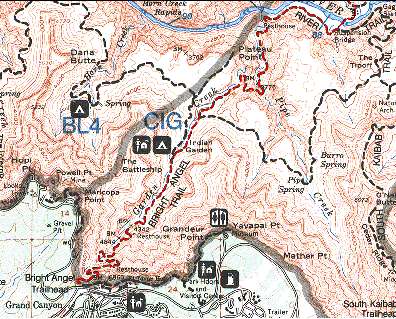 |
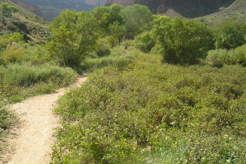
A view of the Bright Angel
Trail from the Silver Bridge crossing all the way to the
trailhead.
After you've hiked this trail even once, you divide it up into
sections with dividing points of the River Resthouse, the Devil's
Corkscrew, Indian Garden, 3 Mile Resthouse and the 1.5 Mile Resthouse. |
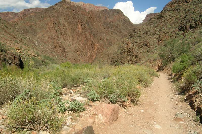
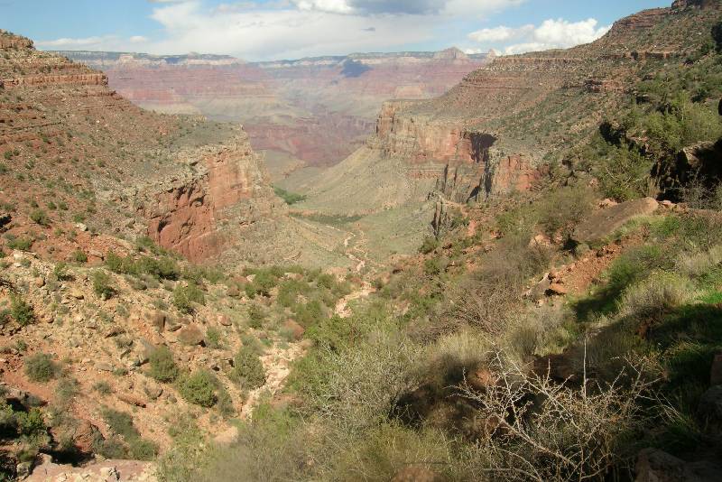
River Trail Junction Mile: 16.4
/ 7.7 Elevation: 2,440
The start of the BA is marked by the River Resthouse. Ron was ahead of me and
was checking out the availability of water. But he found none, even though
various guides say it is available. Luckily, it wasn’t imperative since we’d
just filled a mile and a half back. As we started the grand ascent, I commented
to Ron that I wished we were past the Devil’s Corkscrew, now starting to break
up the trail into smaller sections, each one a mini goal to complete. "I
wish we were almost done!" I wasn’t suffering from that delusion. All I
knew was that there was a lot of work ahead. Every time I put my right leg
forward I had to think about it. If I forget my leg would remind me to pay
attention. All I could do was to minimize the pain. In stretches it wasn’t so
bad; then in others is was.
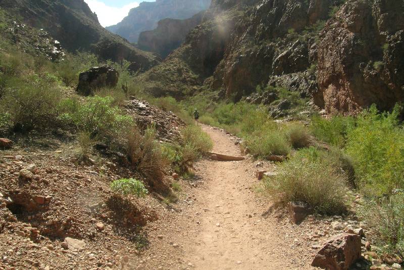
Above the Devil’s Corkscrew I pointed back at it to Ron who was not
impressed one bit. His focus was going forward. For me it was an accomplishment
because it was the first hurdle cleared of several checkpoints I’d mapped in
my mind on the long journey to the rim. We could part of the South Rim, but not
our destination. We were still below the inner gorge but I could see the end to
that coming and knew we had a fairly long flat section coming up approaching the
next checkpoint: Indian Garden. It was warmer than we'd hoped given the time of
year, but I was paying no attention to that or my missing hat.
gc_2004_1173.jpg)
gc_2004_1174.jpg)
gc_2004_1175.jpg)
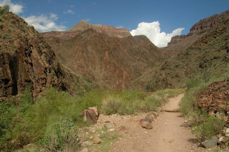
gc_2004_1176.jpg) I didn’t snap a single picture until we were out of the gorge and onto the
flatter section leading to Indian Garden. A highlight which I couldn’t take
advantage of came when Ron, some 50 feet in front of me announces as he’s
pointing to his right, "Rattlesnake! You better come quickly. It's heading away." As I got out my camera I thought to myself, "It’s
probably not a rattlesnake!" As I approached and he indicated where it was,
Ron didn’t wait and walked ahead. I first saw the light brown body, but the
head was unseen. "That’s a gopher snake," I announced before noting
the strange dark brown markings which indicated this is not a gopher snake. Then
at the very tail I would see a six ring rattle! I then announced but Ron didn’t
hear me, "It’s a Mohave Rattlesnake!" I was in no mood to play Steve
Irwin to try to get it out for a better picture and I knew the one I took would
be unsatisfying. It was simply astounding to see one out in the middle of the
day when all rattlesnakes are night feeders.
I didn’t snap a single picture until we were out of the gorge and onto the
flatter section leading to Indian Garden. A highlight which I couldn’t take
advantage of came when Ron, some 50 feet in front of me announces as he’s
pointing to his right, "Rattlesnake! You better come quickly. It's heading away." As I got out my camera I thought to myself, "It’s
probably not a rattlesnake!" As I approached and he indicated where it was,
Ron didn’t wait and walked ahead. I first saw the light brown body, but the
head was unseen. "That’s a gopher snake," I announced before noting
the strange dark brown markings which indicated this is not a gopher snake. Then
at the very tail I would see a six ring rattle! I then announced but Ron didn’t
hear me, "It’s a Mohave Rattlesnake!" I was in no mood to play Steve
Irwin to try to get it out for a better picture and I knew the one I took would
be unsatisfying. It was simply astounding to see one out in the middle of the
day when all rattlesnakes are night feeders.
Indian Garden Mile: 19.5 / 4.6 Elevation: 3,800
gc_2004_1177.jpg)
gc_2004_1178.jpg)
Indian Garden was the next checkpoint. I have really come to love this place.
There is plenty of shade, a nice water outlet, and many other hikers. For
most of your hike you're looking for serenity and few people. But late in
the hike as you're getting dog tired, the company become very welcome. It is also
the approximate half way point up the trail. Instead of water, I now unpacked my
Gatorade mix. With the heat and without my cap I was surely losing more
electrolytes than I planned. A drank more than half the bottle right there and
then refilled and added more mix. Ron was thinking of going ahead and I
encouraged him. "I’m going to have to take it slower." He was worried
about Cindy. "Won’t Cindy be mad if I leave you?" I wasn’t worried
about that one bit. "She’ll be happy to see either of us and besides I
have the walkie talkie!" Yes, I thought to myself, soon I’d be in contact
with her and I’d let her know that Ron was well in front.
In raw mileage terms, we had completed most of the journey. We’d already
hiked over 19 miles with only 4.5 to go. But I wasn’t kidding myself in the
least. This was going to be a brutal section especially because I was now tiring
significantly and my leg was not doing any better. The drill was now finding a
way to walk that was the least painful.
I wasn’t worried at all. First, there was no doubt I was going to make it.
Slow it would have to be, but I’d make it. Second, you simply have a lot of
company once you’re beyond Indian Garden. Suddenly the trail is loaded with
day hikers going up and coming down.
Then I started to worry. Not all the time because I had to pay attention to
ease the discomfort. My worry was my silent walkie talkie. As 5 hours passed,
our best case scenario, I rationalized that even though the walkie talkie
supposedly has a 5 mile range, it often is limited to 3 and sometimes as little
as 2. So I was still out of range. I started trying ever so often, "Cindy,
are you there?" Every time the result was silence.
3.0 Mile Resthouse Mile: 21.1 /
3.0 Elevation: 4720
gc_2004_1179.jpg) Every switchback in the trail became a victory. But every time I looked up it
was disheartening to see how much higher I had to go. I don’t know why I was
looking. I knew exactly how far I had to go. There is a great visual landmark
you can see to the right from time to time called the Battleship. From the
top you are looking down on this massive butte and here I was still looking
up. Finally, the next hurdle
approached: the Three-Mile Resthouse. I was not happy that it was some 100 feet
off the trail which was added time and effort, but I wanted to top off my bottle
and take a brief rest. I sat in the small ramada with 8 other hikers who were
talking about the Ooh-Aah Point. "They say we have to see the Ooh-Aah
Point. No one seems to know where it is." I was pleased to be able to
answer, even though it required that I perform a little math in my head and the
calculation was now surprisingly difficult. "It’s on the South Kaibab
Trail, about three quarters of a mile from the trailhead. It’s an easy
hike." I wouldn’t have normally told anyone it was easy, but they were at
the Three-Mile Resthouse so this hike was many times more difficult.
Every switchback in the trail became a victory. But every time I looked up it
was disheartening to see how much higher I had to go. I don’t know why I was
looking. I knew exactly how far I had to go. There is a great visual landmark
you can see to the right from time to time called the Battleship. From the
top you are looking down on this massive butte and here I was still looking
up. Finally, the next hurdle
approached: the Three-Mile Resthouse. I was not happy that it was some 100 feet
off the trail which was added time and effort, but I wanted to top off my bottle
and take a brief rest. I sat in the small ramada with 8 other hikers who were
talking about the Ooh-Aah Point. "They say we have to see the Ooh-Aah
Point. No one seems to know where it is." I was pleased to be able to
answer, even though it required that I perform a little math in my head and the
calculation was now surprisingly difficult. "It’s on the South Kaibab
Trail, about three quarters of a mile from the trailhead. It’s an easy
hike." I wouldn’t have normally told anyone it was easy, but they were at
the Three-Mile Resthouse so this hike was many times more difficult.
It was a nice moment. I then topped off my water bottle and started the agony
again. From here on out, mentally things were becoming a blur. As I noted it was
now 5:45, the silent walkie talkie was starting to unnerve me. I checked it from
time to time to be sure it was still on and set to the proper channel.
"Cindy, are you there?" Though there
might still be 2.5 miles left to go along the trail, the straight-line distance
was now well under a mile. I was trying not to consider the inescapable
conclusion: Cindy was not there, yet. What has happened? An accident? Car
trouble? And I’ll bet she’s worried that we’re down with our hike at the
trailhead wondering where she is.
1.5 Mile Resthouse Mile: 22.6 /
1.5 Elevation: 5720
gc_2004_1180.jpg) Every time those thoughts would
pop into my head I’d try the walkie talkie
one more time and when nothing came back, I’d tell myself you have your own
problems, but the pain was beginning to seem trivial. As six hours passed, however, the thoughts were impossible
to dismiss. I then strolled by the One and Half Mile Resthouse without stopping.
I didn’t need any more water and certainly didn’t need any extra weight. My
leg which was holding me up was no longer a factor. I was now just tired. And
the more tired I got, the less the leg seemed to bother me. Every so often it
would remind me, but for the most part the pain had subsided. Maybe it was
because I was so tired. If only that walkie talkie would start talking!
Every time those thoughts would
pop into my head I’d try the walkie talkie
one more time and when nothing came back, I’d tell myself you have your own
problems, but the pain was beginning to seem trivial. As six hours passed, however, the thoughts were impossible
to dismiss. I then strolled by the One and Half Mile Resthouse without stopping.
I didn’t need any more water and certainly didn’t need any extra weight. My
leg which was holding me up was no longer a factor. I was now just tired. And
the more tired I got, the less the leg seemed to bother me. Every so often it
would remind me, but for the most part the pain had subsided. Maybe it was
because I was so tired. If only that walkie talkie would start talking!
I finally decided (read: rationalized) there is a technical problem with
Cindy’s walkie talkie. Perhaps she can hear me, but I simply can’t hear
her. So I started giving a narrative, "In case you can hear me because I
can’t hear you, I’ve just passed the One and a Half Mile Resthouse. Ron is
walking ahead and will finish way ahead of me."
There are two landmarks on this last 1.5 stretch and they are both tunnels.
In the two hikes before I’d gotten very excited when I hit the first having
forgotten there are two of them. The last tunnel is so close to the traihead
that once you’re there you’re essentially done. But the first one is still
well below the rim and there’s maybe 25-30 minutes left to go when you arrive
there. I made it through the first tunnel at 6:15 and now it was just a matter of
putting one foot in front of the other. I was now way overdue, but where and
what happened to Cindy? Carrying this walkie talkie was supposed to be a
salvation and now it was a curse.
At 6:20 the silence was broken and for only the briefest moment I thought I
was in the Twilight Zone. The walkie talkie came to life and the distinctive
voice of Ron was at the other end. "Gene, are you there? This is Ron."
As tired as I was I processed the thought instantaneously. Because we have
our walkie talkies set to a very unusual frequency that Ron couldn't have
possibly guessed, I
knew he was using Cindy’s! "I’m here! It’s good to hear your voice!
Where’s Cindy?" He replied, "She’s getting me a diet coke." I didn’t
have to ask the next question as Ron automatically answered it. "She
accidently put the walkie talkie into emergency mode and was afraid to use
it." I knew immediately what had happened as this same thing happened to me
earlier in the hike. She hit the red emergency button. Now if you make any
transmission, it’s going to be on an emergency channel. In order to set the
walkie talkie back, she had to hit that same red emergency button. She thought
be hitting it she’d be signaling when in fact all it does is toggle modes. Ron
was not afraid to hit all the buttons.
Soon it was Cindy on the box and she said, "Hey, we can see you! Where’s
your hat?" I didn’t get the joke. I responded dryly, "It’s at
Cottonwood Campground!" They really couldn’t see me yet. Ron told her to
ask about the cap. Now I was feeling genuinely good (or was it relief?) and the
hike was nearly over. Finally, Cindy said, "I’m sure I see you. Are you
about to turn." As I was approaching an upcoming switchback, "Yes, I’m
about to turn. I’m making the turn now." I waved as I said that and I
looked up and could see the Colby Studio Building (it looks like a small house)
which is right at the trailhead. I could not see them, but I was really close.
The second tunnel was 50 feet ahead and after that it was another 150 feet and
it was over. My watch read 6 hours and 45 minutes as I joined them.
Bright Angel Trailhead Mile:
24.1 / 0.0
Elevation: 6,860
Only as I arrived did Ron mention the leg. "How’s the leg?"
"Actually it’s only a little sore and isn’t too bad right now."
Cindy then says looking at Ron, "You didn’t say anything about a bad
leg?" "I didn’t want to worry you." I was happy it was obviously not
bad enough for Cindy to notice.
Cindy offered to bring the car around, but I didn’t think that was a good
idea. I knew what was coming. The moment I stopped moving I was going to feel
sick. I’ve been through this drill too many times. So we walked for what
seemed like a mile to get to the car. As we started to change clothes that
familiar feeling in my stomach came right on queue. But as usual it was easy to
deal with it. All I had to do was lie down and it was instant relief.
Every time I do these incredibly long hikes at the canyon I wonder if it
might just be the last, and this one was no exception. I would like to think the
answer is an unequivocal no, but you never know. But I have learned that by
slowing down a bit and carrying some food that it helps a great deal. So
hopefully it won’t be the last.
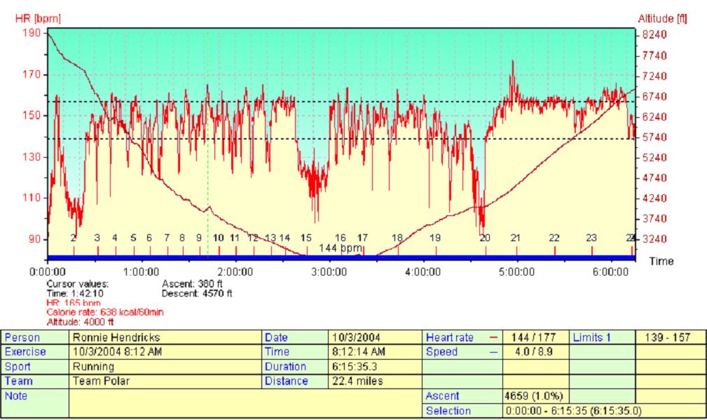
The information in the graph is from the monitor Ron was wearing.
Therefore, the altitude and distance readings are only approximate. For
altitude, he calibrated the barometer at the top of the trail and his reading at
the South Rim 6 hours later was amazingly close. However, at the bottom of
the canyon the reading should be 2400 whereas his reading was about 2800.
What I find totally amazing was how close his distance measurement was, even
though we could accurately say, "He missed by a mile!"
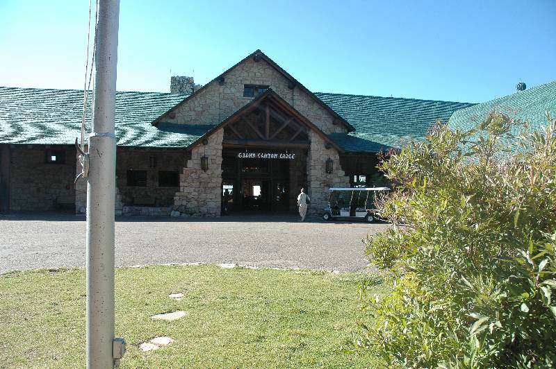
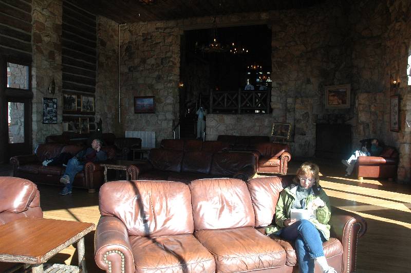
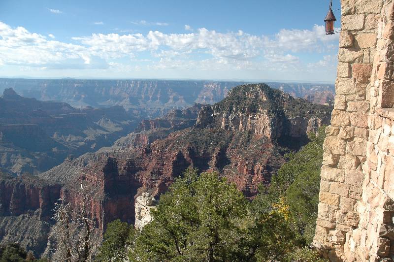
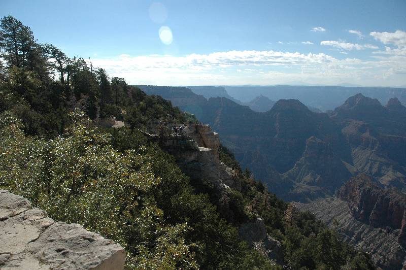
Cindy's Pictures of the Grand Canyon Lodge!
gc_2004_1525.jpg)
gc_2004_1513.jpg)
gc_2004_1514.jpg)
gc_2004_1515.jpg)
gc_2004_1516.jpg)
gc_2004_1517.jpg)
gc_2004_1518.jpg)
gc_2004_1519.jpg)
gc_2004_1520.jpg)
gc_2004_1521.jpg)
gc_2004_1522.jpg)
gc_2004_1600.jpg)
But with Cindy’s enthusiasm for what she saw at the North Rim Lodge, we now
have reservations for late September of 2005! This will be a three night stay
and on one of them I now plan on going down the North Kaibab Trail, but not
necessarily all the way to either Phantom Ranch or the River. A good possibility
is to go only go as far as Ribbon Falls allowing a thorough exploration of some
of the side trails.
<<
1 2 3
4 5 >>
Return to Home Page